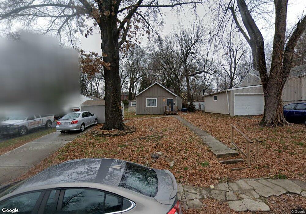
132 W Linden Ave Independence, MO 64050
Heart of Independence NeighborhoodEstimated Value: $216,164 - $230,000
4
Beds
2
Baths
1,550
Sq Ft
$144/Sq Ft
Est. Value
About This Home
This home is located at 132 W Linden Ave, Independence, MO 64050 and is currently estimated at $223,041, approximately $143 per square foot. 132 W Linden Ave is a home located in Jackson County with nearby schools including Santa Fe Trail Elementary School, Bridger Middle School, and Bingham Middle School.
Ownership History
Date
Name
Owned For
Owner Type
Purchase Details
Closed on
Mar 31, 2023
Sold by
T Sauk Sfr Llc
Bought by
High Point Sfr Llc
Current Estimated Value
Home Financials for this Owner
Home Financials are based on the most recent Mortgage that was taken out on this home.
Original Mortgage
$6,807,650
Outstanding Balance
$5,494,661
Interest Rate
6.5%
Mortgage Type
Credit Line Revolving
Estimated Equity
-$5,271,620
Purchase Details
Closed on
Nov 29, 2022
Sold by
Fifth Trust
Bought by
T Sauk Sfr Llc
Purchase Details
Closed on
Jun 3, 2020
Sold by
Wahl Joseph P
Bought by
Grace Pat and Fifth Trusts
Home Financials for this Owner
Home Financials are based on the most recent Mortgage that was taken out on this home.
Original Mortgage
$101,246
Interest Rate
3.3%
Mortgage Type
New Conventional
Purchase Details
Closed on
May 26, 2020
Sold by
Community Invest Llc
Bought by
Wahl Joseph P
Home Financials for this Owner
Home Financials are based on the most recent Mortgage that was taken out on this home.
Original Mortgage
$101,246
Interest Rate
3.3%
Mortgage Type
New Conventional
Purchase Details
Closed on
Jan 31, 2020
Sold by
Heath Carl Vernon
Bought by
Community Invest Llc
Purchase Details
Closed on
Aug 5, 2019
Sold by
Heath Debra Lee and Heath Carl Vernon
Bought by
Heath Carol Vernon
Purchase Details
Closed on
Jun 7, 2005
Sold by
Heater Ann
Bought by
Heater John E and Smith Mary M
Home Financials for this Owner
Home Financials are based on the most recent Mortgage that was taken out on this home.
Original Mortgage
$66,000
Interest Rate
5.79%
Mortgage Type
Fannie Mae Freddie Mac
Purchase Details
Closed on
May 23, 2005
Sold by
Heath Mathea Leann
Bought by
Lee Heath Carl Vernon and Lee Heath Debra
Home Financials for this Owner
Home Financials are based on the most recent Mortgage that was taken out on this home.
Original Mortgage
$66,000
Interest Rate
5.79%
Mortgage Type
Fannie Mae Freddie Mac
Purchase Details
Closed on
Aug 14, 2001
Sold by
Heath Mathea Leann and Heath Carl Vernon
Bought by
Heath Mathea Leann
Home Financials for this Owner
Home Financials are based on the most recent Mortgage that was taken out on this home.
Original Mortgage
$45,000
Interest Rate
7.14%
Mortgage Type
Purchase Money Mortgage
Purchase Details
Closed on
Dec 28, 2000
Sold by
Crowe Don and Crowe Sharon
Bought by
Heath Mathea Leann and Heath Carl Vernon
Create a Home Valuation Report for This Property
The Home Valuation Report is an in-depth analysis detailing your home's value as well as a comparison with similar homes in the area
Home Values in the Area
Average Home Value in this Area
Purchase History
| Date | Buyer | Sale Price | Title Company |
|---|---|---|---|
| High Point Sfr Llc | -- | -- | |
| T Sauk Sfr Llc | -- | -- | |
| Grace Pat | -- | None Available | |
| Wahl Joseph P | -- | None Available | |
| Community Invest Llc | -- | Accurate Title | |
| Heath Carol Vernon | -- | None Available | |
| Heater John E | -- | -- | |
| Lee Heath Carl Vernon | -- | Commonwealth Title | |
| Heath Mathea Leann | -- | Security Land Title Co | |
| Heath Mathea Leann | -- | Guaranty Land Title Ins Inc |
Source: Public Records
Mortgage History
| Date | Status | Borrower | Loan Amount |
|---|---|---|---|
| Open | High Point Sfr Llc | $6,807,650 | |
| Previous Owner | Wahl Joseph P | $101,246 | |
| Previous Owner | Lee Heath Carl Vernon | $66,000 | |
| Previous Owner | Heath Mathea Leann | $45,000 |
Source: Public Records
Tax History Compared to Growth
Tax History
| Year | Tax Paid | Tax Assessment Tax Assessment Total Assessment is a certain percentage of the fair market value that is determined by local assessors to be the total taxable value of land and additions on the property. | Land | Improvement |
|---|---|---|---|---|
| 2025 | $2,212 | $18,343 | $3,819 | $14,524 |
| 2024 | $2,161 | $31,920 | $9,359 | $22,561 |
| 2023 | $2,161 | $31,920 | $3,705 | $28,215 |
| 2022 | $1,025 | $13,870 | $3,705 | $10,165 |
| 2021 | $1,024 | $13,870 | $3,705 | $10,165 |
| 2020 | $1,003 | $13,197 | $3,705 | $9,492 |
| 2019 | $987 | $13,197 | $3,705 | $9,492 |
| 2018 | $1,011 | $12,913 | $2,014 | $10,899 |
| 2017 | $996 | $12,913 | $2,014 | $10,899 |
| 2016 | $996 | $12,589 | $1,761 | $10,828 |
| 2014 | $946 | $12,223 | $1,710 | $10,513 |
Source: Public Records
Map
Nearby Homes
- 203 W Ruby Ave
- 900 S Osage St
- 334 W Sea Ave
- 421 W Sea Ave
- 1106 S Osage St
- 1100 S Noland Rd
- 1122 S Main St
- 229 E Elm St
- 501 W South Ave
- 511 S Pleasant St
- 1215 S Osage St
- 1122 S Pearl St
- 1216 S Osage St
- 1223 S Osage St
- 916 S Hocker Ave
- 908 S Delaware St
- 913 S Hocker Ave
- 514 W Walnut St
- 301 E Fair St
- 1215 S Delaware Ave
- 124 W Linden Ave
- 134 W Linden Ave
- 120 W Linden Ave
- 131 W Linden Ave
- 129 W Linden Ave
- 133 W Linden Ave
- 118 W Linden Ave
- 731 S Liberty St
- 729 S Liberty St
- 119 W Linden Ave
- 727 S Liberty St
- 110 W Linden Ave
- 725 S Liberty St
- 801 S Liberty St
- 117 W Linden Ave
- 811 S Liberty St
- 111 W Linden Ave
- 721 S Liberty St
- 728 S Liberty St
- 132 W Sea Ave