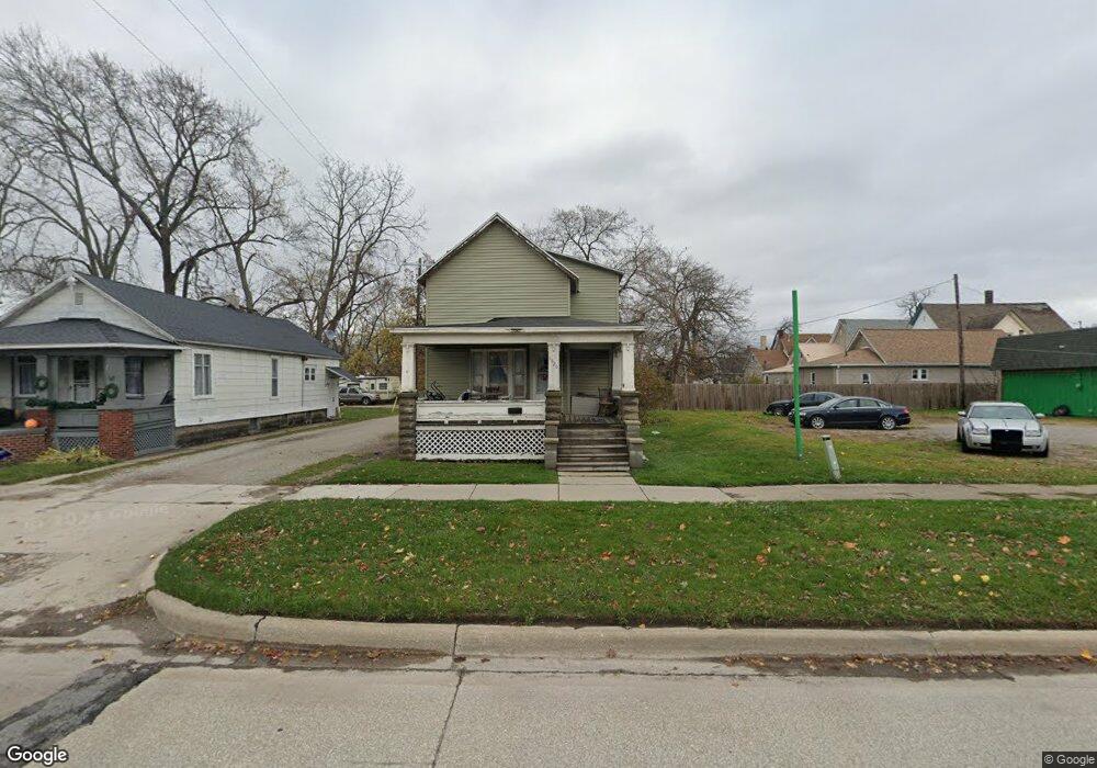
1320 10th St Port Huron, MI 48060
Estimated Value: $90,000 - $136,000
4
Beds
2
Baths
1,070
Sq Ft
$110/Sq Ft
Est. Value
About This Home
This home is located at 1320 10th St, Port Huron, MI 48060 and is currently estimated at $117,299, approximately $109 per square foot. 1320 10th St is a home located in St. Clair County with nearby schools including Woodrow Wilson Elementary School, Holland Woods Middle School, and Port Huron High School.
Create a Home Valuation Report for This Property
The Home Valuation Report is an in-depth analysis detailing your home's value as well as a comparison with similar homes in the area
Home Values in the Area
Average Home Value in this Area
Tax History Compared to Growth
Tax History
| Year | Tax Paid | Tax Assessment Tax Assessment Total Assessment is a certain percentage of the fair market value that is determined by local assessors to be the total taxable value of land and additions on the property. | Land | Improvement |
|---|---|---|---|---|
| 2025 | $1,148 | $46,100 | $0 | $0 |
| 2024 | $917 | $43,700 | $0 | $0 |
| 2023 | $866 | $38,500 | $0 | $0 |
| 2022 | $839 | $31,700 | $0 | $0 |
| 2021 | $797 | $27,400 | $0 | $0 |
| 2020 | $806 | $24,000 | $24,000 | $0 |
| 2019 | $792 | $17,800 | $0 | $0 |
| 2018 | $775 | $17,800 | $0 | $0 |
| 2017 | $693 | $17,200 | $0 | $0 |
| 2016 | $581 | $17,200 | $0 | $0 |
| 2015 | $570 | $16,800 | $16,800 | $0 |
| 2014 | $570 | $15,900 | $15,900 | $0 |
| 2013 | -- | $16,000 | $0 | $0 |
Source: Public Records
Map
Nearby Homes
- 1316 10th St
- 931 Chestnut St
- 1326 10th St
- 1326 10th St
- 929 Chestnut St Unit 931
- 923 Chestnut St Unit 925
- 930 Union St
- 926 Union St
- 927 Chestnut St
- 1331 10th St
- 917 Chestnut St
- 1000 Union St Unit 1029
- 920 Union St
- 1011 Chestnut St
- 1018 Union St
- 916 Union St
- 1300 10th St
- 1300 10th St Unit 1321
- 1300 10th St Unit 1319
- 1300 10th St Unit 1304