Estimated Value: $121,000 - $147,000
2
Beds
2
Baths
1,120
Sq Ft
$119/Sq Ft
Est. Value
About This Home
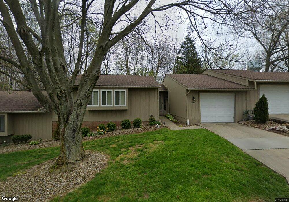
This home is located at 1320 Aarons Way, Kent, OH 44240 and is currently estimated at $132,950, approximately $118 per square foot. 1320 Aarons Way is a home located in Portage County with nearby schools including Brimfield Elementary School, Field Middle School, and Field High School.
Ownership History
Date
Name
Owned For
Owner Type
Purchase Details
Closed on
Mar 17, 1997
Sold by
Kline Anne B
Bought by
Kunar Michael D
Current Estimated Value
Home Financials for this Owner
Home Financials are based on the most recent Mortgage that was taken out on this home.
Original Mortgage
$37,000
Outstanding Balance
$3,810
Interest Rate
6%
Mortgage Type
New Conventional
Estimated Equity
$129,141
Purchase Details
Closed on
Apr 28, 1995
Sold by
Hack Clarice M
Bought by
Kline Anne B
Home Financials for this Owner
Home Financials are based on the most recent Mortgage that was taken out on this home.
Original Mortgage
$37,500
Interest Rate
8.42%
Mortgage Type
New Conventional
Create a Home Valuation Report for This Property
The Home Valuation Report is an in-depth analysis detailing your home's value as well as a comparison with similar homes in the area
Home Values in the Area
Average Home Value in this Area
Purchase History
| Date | Buyer | Sale Price | Title Company |
|---|---|---|---|
| Kunar Michael D | $57,500 | -- | |
| Kline Anne B | $57,500 | -- |
Source: Public Records
Mortgage History
| Date | Status | Borrower | Loan Amount |
|---|---|---|---|
| Open | Kunar Michael D | $37,000 | |
| Previous Owner | Kline Anne B | $37,500 |
Source: Public Records
Tax History Compared to Growth
Tax History
| Year | Tax Paid | Tax Assessment Tax Assessment Total Assessment is a certain percentage of the fair market value that is determined by local assessors to be the total taxable value of land and additions on the property. | Land | Improvement |
|---|---|---|---|---|
| 2024 | $1,807 | $36,370 | $3,500 | $32,870 |
| 2023 | $1,572 | $25,310 | $2,630 | $22,680 |
| 2022 | $1,577 | $25,310 | $2,630 | $22,680 |
| 2021 | $1,527 | $25,310 | $2,630 | $22,680 |
| 2020 | $1,394 | $21,080 | $2,630 | $18,450 |
| 2019 | $1,384 | $21,080 | $2,630 | $18,450 |
| 2018 | $1,025 | $18,480 | $3,500 | $14,980 |
| 2017 | $1,025 | $18,480 | $3,500 | $14,980 |
| 2016 | $1,020 | $18,480 | $3,500 | $14,980 |
| 2015 | $989 | $18,480 | $3,500 | $14,980 |
| 2014 | $1,170 | $22,720 | $3,500 | $19,220 |
| 2013 | $1,144 | $22,720 | $3,500 | $19,220 |
Source: Public Records
Map
Nearby Homes
- 1354 Brimfield Dr
- 4682 State Route 43
- 5044 Sherman Wood Dr
- 847 Lakeview Ct
- 3946 Mctaggart Blvd
- Poplar Plan at Woodland Reserve
- Nassau Cove Plan at Woodland Reserve
- V/L Sherman Rd
- 1088 Irish Rd
- 1523 Queenstown Rd
- 4088 Lynwood Dr
- 4649 Creekside Dr Unit 4649
- 4891 Edson Rd
- 1755 Honeychuck Ln
- 1418 Arcadia Rd
- 0 Meloy Rd Unit 5162435
- 3793 Ranfield Rd
- 3579 Elmhurst Ct
- 3868 Willow Way
- 3672 Elmhurst Ct
- 1318 Aarons Way Unit 31D
- 1322 Aarons Way
- 1326 Aarons Way Unit 27D
- 1316 Aarons Way
- 1324 Aarons Way
- 1314 Aarons Way Unit 33E
- 4437 Sandelwood Blvd
- 1305 Sandlewood Oval
- 1319 Sandlewood Oval Unit 19E
- 1319 Sandlewood Oval Unit Sandelwood
- 1321 Sandelwood Oval
- 1317 Sandlewood Oval Unit 20E
- 1321 Sandlewood Oval
- 1311 Sandelwood Oval
- 1323 Sandlewood Oval Unit 17D
- 1313 Sandlewood Oval Unit 22D
- 1311 Sandlewood Oval Unit 23E
- 1309 Sandlewood Oval
- 1307 Sandlewood Oval
- 1315 Sandlewood Oval Unit 21D