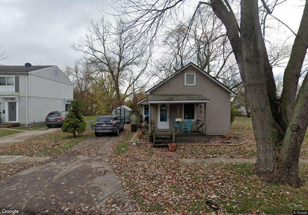
1320 Bancroft St Port Huron, MI 48060
Estimated Value: $94,000 - $124,000
3
Beds
1
Bath
958
Sq Ft
$110/Sq Ft
Est. Value
About This Home
This home is located at 1320 Bancroft St, Port Huron, MI 48060 and is currently estimated at $105,131, approximately $109 per square foot. 1320 Bancroft St is a home located in St. Clair County with nearby schools including Woodrow Wilson Elementary School, Central Middle School, and Port Huron High School.
Ownership History
Date
Name
Owned For
Owner Type
Purchase Details
Closed on
Jul 18, 2022
Sold by
Schieweck Amber
Bought by
Budzyn Scott Michael and Budzyn Lindsay
Current Estimated Value
Home Financials for this Owner
Home Financials are based on the most recent Mortgage that was taken out on this home.
Original Mortgage
$73,641
Interest Rate
5.89%
Mortgage Type
FHA
Purchase Details
Closed on
Mar 19, 2021
Sold by
James A Harris Jr Trust
Bought by
Schieweck Amber
Create a Home Valuation Report for This Property
The Home Valuation Report is an in-depth analysis detailing your home's value as well as a comparison with similar homes in the area
Home Values in the Area
Average Home Value in this Area
Purchase History
| Date | Buyer | Sale Price | Title Company |
|---|---|---|---|
| Budzyn Scott Michael | $75,000 | Liberty Title | |
| Budzyn Scott Michael | $75,000 | Liberty Title | |
| Schieweck Amber | $28,000 | Liberty Title | |
| Schieweck Amber | $28,000 | Liberty Title | |
| Schieweck Amber | -- | Maritime Title Agency |
Source: Public Records
Mortgage History
| Date | Status | Borrower | Loan Amount |
|---|---|---|---|
| Previous Owner | Budzyn Scott Michael | $73,641 |
Source: Public Records
Tax History Compared to Growth
Tax History
| Year | Tax Paid | Tax Assessment Tax Assessment Total Assessment is a certain percentage of the fair market value that is determined by local assessors to be the total taxable value of land and additions on the property. | Land | Improvement |
|---|---|---|---|---|
| 2025 | $1,966 | $44,500 | $0 | $0 |
| 2024 | $1,658 | $42,300 | $0 | $0 |
| 2023 | $1,677 | $37,700 | $0 | $0 |
| 2022 | $1,733 | $27,200 | $0 | $0 |
| 2021 | $1,036 | $29,200 | $0 | $0 |
| 2020 | $1,040 | $25,500 | $25,500 | $0 |
| 2019 | $1,022 | $18,300 | $0 | $0 |
| 2018 | $1,066 | $18,300 | $0 | $0 |
| 2017 | $966 | $17,200 | $0 | $0 |
| 2016 | $807 | $17,200 | $0 | $0 |
| 2015 | $792 | $17,300 | $17,300 | $0 |
| 2014 | $792 | $18,100 | $18,100 | $0 |
| 2013 | -- | $20,200 | $0 | $0 |
Source: Public Records
Map
Nearby Homes
- 1322 Division St
- 1309 Division St
- 1325 Division St
- 1127 Minnie St
- 1112 Minnie St
- 1831 11th St
- 1624 15th St
- 1610 16th St
- 1132 Griswold St
- 1207 White St
- 1413 14th St
- 1103 White St
- 1917 Minnie St
- 831 Bancroft St
- 926 Griswold St
- 1815 Griswold St
- 1426 18th St
- 000 10th St
- 1403 Catherine McAuley Dr
- 738 Bancroft St
- 1302 Bancroft St
- 1300 Bancroft St
- 1307 Bancroft St
- 1322 Bancroft St
- 1301 Bancroft St
- 1321 Bancroft St
- 1313 Bancroft St
- 1232 Bancroft St
- 2000 13th St
- 1319 Bancroft St
- 1334 Bancroft St
- 2025 13th St
- 1307 Cypress St
- 1325 Cypress St
- 1333 Bancroft St
- 1920 13th St
- 1228 Bancroft St
- 1310 Minnie St
- 1314 Minnie St
- 1329 Cypress St