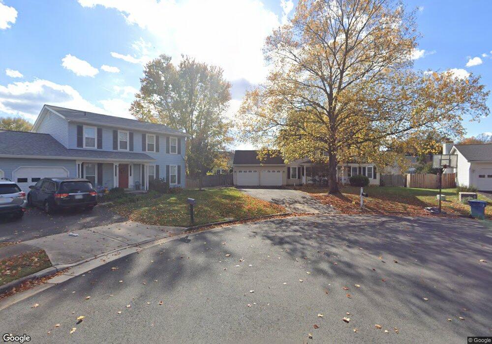
1320 Browns Mill Ct Herndon, VA 20170
Estimated Value: $756,000 - $882,000
4
Beds
4
Baths
2,258
Sq Ft
$371/Sq Ft
Est. Value
About This Home
This home is located at 1320 Browns Mill Ct, Herndon, VA 20170 and is currently estimated at $837,101, approximately $370 per square foot. 1320 Browns Mill Ct is a home located in Fairfax County with nearby schools including Dranesville Elementary, Herndon Middle School, and Herndon High School.
Ownership History
Date
Name
Owned For
Owner Type
Purchase Details
Closed on
Mar 28, 2007
Sold by
Watt Warren L
Bought by
Begg Ian G
Current Estimated Value
Home Financials for this Owner
Home Financials are based on the most recent Mortgage that was taken out on this home.
Original Mortgage
$416,000
Outstanding Balance
$254,005
Interest Rate
6.33%
Mortgage Type
New Conventional
Estimated Equity
$583,096
Create a Home Valuation Report for This Property
The Home Valuation Report is an in-depth analysis detailing your home's value as well as a comparison with similar homes in the area
Home Values in the Area
Average Home Value in this Area
Purchase History
| Date | Buyer | Sale Price | Title Company |
|---|---|---|---|
| Begg Ian G | $521,110 | -- |
Source: Public Records
Mortgage History
| Date | Status | Borrower | Loan Amount |
|---|---|---|---|
| Open | Begg Ian G | $416,000 |
Source: Public Records
Tax History Compared to Growth
Tax History
| Year | Tax Paid | Tax Assessment Tax Assessment Total Assessment is a certain percentage of the fair market value that is determined by local assessors to be the total taxable value of land and additions on the property. | Land | Improvement |
|---|---|---|---|---|
| 2025 | $8,005 | $753,660 | $247,000 | $506,660 |
| 2024 | $8,005 | $691,020 | $247,000 | $444,020 |
| 2023 | $7,480 | $662,810 | $242,000 | $420,810 |
| 2022 | $7,333 | $641,260 | $242,000 | $399,260 |
| 2021 | $6,650 | $566,690 | $207,000 | $359,690 |
| 2020 | $6,505 | $549,640 | $197,000 | $352,640 |
| 2019 | $6,284 | $530,960 | $192,000 | $338,960 |
| 2018 | $5,854 | $509,050 | $187,000 | $322,050 |
| 2017 | $5,850 | $503,840 | $187,000 | $316,840 |
| 2016 | $5,761 | $497,240 | $187,000 | $310,240 |
| 2015 | $5,399 | $483,790 | $187,000 | $296,790 |
| 2014 | $5,419 | $486,690 | $187,000 | $299,690 |
Source: Public Records
Map
Nearby Homes
- 1551 Brownsville Dr
- 400 Gary Ct
- 2007 Jonathan Dr
- 1377 Rock Chapel Rd
- 1402 Bakers Creek Ct
- 1407 Skyhaven Ct
- 12592 Rock Ridge Rd
- 12583 Rock Ridge Rd
- 12535 Misty Water Dr
- 21921 Myrtlewood Square
- 1503 Sadlers Wells Dr
- 21865 Broadleaf Square
- 1314 E Holly Ave
- 1307 E Holly Ave
- 46930 Trumpet Cir
- 46683 Bartlet Square
- 208 Keyes Ct
- 12703 Longleaf Ln
- 12505 Ridgegate Dr
- 814 N Croydon St
- 1318 Browns Mill Ct
- 1430 Powells Tavern Place
- 1322 Browns Mill Ct
- 1428 Powells Tavern Place
- 1311 Mason Mill Ct
- 1309 Mason Mill Ct
- 1432 Powells Tavern Place
- 1426 Powells Tavern Place
- 1316 Browns Mill Ct
- 1301 Mason Mill Ct
- 1323 Browns Mill Ct
- 1424 Powells Tavern Place
- 1321 Browns Mill Ct
- 1317 Browns Mill Ct
- 1297 Mason Mill Ct
- 1427 Powells Tavern Place
- 1429 Powells Tavern Place
- 1314 Browns Mill Ct
- 1312 Mason Mill Ct
- 1317 Mason Mill Ct