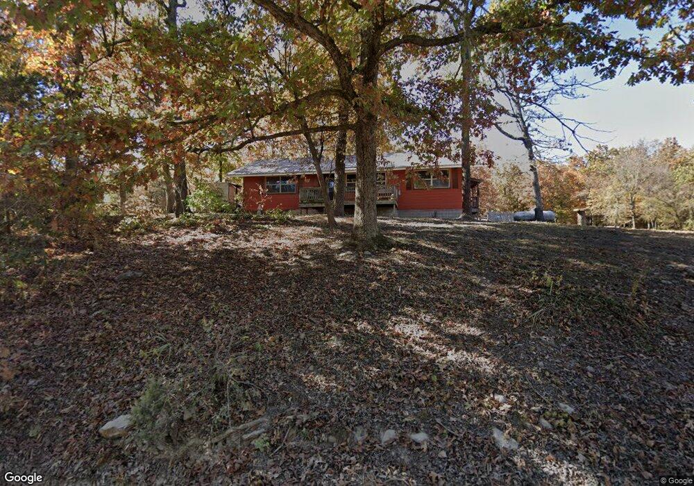
1320 Cedar Rd Harrison, AR 72601
Estimated Value: $151,738 - $304,000
Studio
1
Bath
1,192
Sq Ft
$177/Sq Ft
Est. Value
About This Home
This home is located at 1320 Cedar Rd, Harrison, AR 72601 and is currently estimated at $210,913, approximately $176 per square foot. 1320 Cedar Rd is a home located in Boone County with nearby schools including Alpena Elementary School and Alpena High School.
Ownership History
Date
Name
Owned For
Owner Type
Purchase Details
Closed on
Jun 1, 2011
Sold by
Scott Jackie Lorraine and Scott Lorraine
Bought by
Berry Donnie R and Berry Lyndsey
Current Estimated Value
Home Financials for this Owner
Home Financials are based on the most recent Mortgage that was taken out on this home.
Original Mortgage
$27,000
Outstanding Balance
$18,738
Interest Rate
4.85%
Mortgage Type
Future Advance Clause Open End Mortgage
Estimated Equity
$192,175
Purchase Details
Closed on
Oct 15, 1999
Bought by
Lorraine and Lorraine Ackie L
Create a Home Valuation Report for This Property
The Home Valuation Report is an in-depth analysis detailing your home's value as well as a comparison with similar homes in the area
Purchase History
| Date | Buyer | Sale Price | Title Company |
|---|---|---|---|
| Berry Donnie R | $20,000 | -- | |
| Lorraine | -- | -- |
Source: Public Records
Mortgage History
| Date | Status | Borrower | Loan Amount |
|---|---|---|---|
| Open | Berry Donnie R | $27,000 |
Source: Public Records
Tax History
| Year | Tax Paid | Tax Assessment Tax Assessment Total Assessment is a certain percentage of the fair market value that is determined by local assessors to be the total taxable value of land and additions on the property. | Land | Improvement |
|---|---|---|---|---|
| 2025 | $539 | $13,750 | $1,710 | $12,040 |
| 2024 | $539 | $13,750 | $1,710 | $12,040 |
| 2023 | $517 | $13,750 | $1,710 | $12,040 |
| 2022 | $166 | $13,750 | $1,710 | $12,040 |
| 2021 | $144 | $13,750 | $1,710 | $12,040 |
| 2020 | $111 | $11,490 | $1,710 | $9,780 |
| 2019 | $129 | $11,490 | $1,710 | $9,780 |
| 2018 | $154 | $11,490 | $1,710 | $9,780 |
| 2017 | $130 | $11,490 | $1,710 | $9,780 |
| 2016 | $130 | $11,320 | $1,710 | $9,610 |
| 2015 | $419 | $10,680 | $1,720 | $8,960 |
| 2014 | $70 | $10,680 | $1,720 | $8,960 |
Source: Public Records
Map
Nearby Homes
- 9513 U S 62
- 8764 U S 62
- 172 Stella Ct
- 160 Stella Ct
- 0 Hwy 392 Unit 1313787
- 0000 Hwy 392
- 1989 Patton Ln
- 11175 Arkansas 392
- 0 Old Capps Rd
- 7226 Estes Rd
- 1567 Goff (Lot 28) Rd
- 1959 Henley (Lot 3) Dr
- 1669 Goff (Lot 27) Rd
- 1739 Goff (Lot 26) Rd
- 350 Devitos Loop
- 5745 Estes Rd
- 6555 Arkansas 392
- 4610 Moonbeam Dr
- 4510 Starlite Dr
- Lot 1 Rains Rd S
- 7651 Valentine Ln
- 7820 Denning Rd
- 7820 Denning Rd
- 7740 Valentine Ln
- 7697 Valentine Ln
- 7857 Denning Rd
- 1612 Cedar Rd
- 7748 Denning Rd
- 1613 Cedar Rd
- 974 Cedar Rd
- 000 Cedar Rd
- 7807 Valentine Ln
- 7859 Valentine Ln W
- 0 Cedar Rd
- 7910 Valentine Ln
- 840 Cedar Rd
- 7918 Valentine Ln W
- 18.86 ac Cedar Rd
- 788 Cedar Rd
- 7915 Valentine Ln
Your Personal Tour Guide
Ask me questions while you tour the home.