Estimated Value: $410,000 - $457,000
5
Beds
3
Baths
2,547
Sq Ft
$169/Sq Ft
Est. Value
About This Home
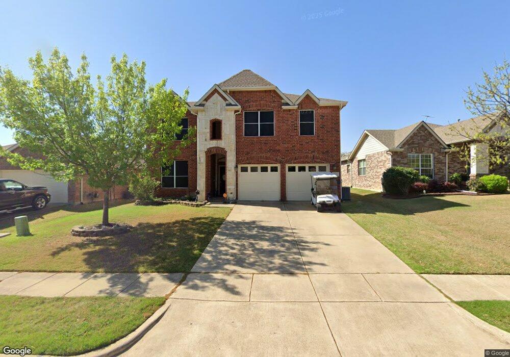
This home is located at 1320 Chestnut Hill Dr, Wylie, TX 75098 and is currently estimated at $430,609, approximately $169 per square foot. 1320 Chestnut Hill Dr is a home located in Collin County with nearby schools including Wally Watkins Elementary School, AB Harrison Intermediate School, and Grady Burnett J High School.
Ownership History
Date
Name
Owned For
Owner Type
Purchase Details
Closed on
Aug 29, 2007
Sold by
Wells Fargo Bank Na
Bought by
Dorsey Wesley E and Dorsey Carol F
Current Estimated Value
Home Financials for this Owner
Home Financials are based on the most recent Mortgage that was taken out on this home.
Original Mortgage
$155,500
Outstanding Balance
$99,206
Interest Rate
6.72%
Mortgage Type
Purchase Money Mortgage
Estimated Equity
$331,403
Purchase Details
Closed on
Jun 5, 2007
Sold by
Scott Bobby E and Scott Sandra R
Bought by
Wells Fargo Bank Na and Option One Mortgage Loan Trust 2005-5 As
Purchase Details
Closed on
Aug 23, 2005
Sold by
First Mortgage Of America Ltd
Bought by
Scott Bobby E and Scott Sandra R
Home Financials for this Owner
Home Financials are based on the most recent Mortgage that was taken out on this home.
Original Mortgage
$147,868
Interest Rate
5.81%
Mortgage Type
Fannie Mae Freddie Mac
Create a Home Valuation Report for This Property
The Home Valuation Report is an in-depth analysis detailing your home's value as well as a comparison with similar homes in the area
Home Values in the Area
Average Home Value in this Area
Purchase History
| Date | Buyer | Sale Price | Title Company |
|---|---|---|---|
| Dorsey Wesley E | -- | None Available | |
| Wells Fargo Bank Na | $164,387 | None Available | |
| Scott Bobby E | -- | Atc |
Source: Public Records
Mortgage History
| Date | Status | Borrower | Loan Amount |
|---|---|---|---|
| Open | Dorsey Wesley E | $155,500 | |
| Previous Owner | Scott Bobby E | $147,868 | |
| Closed | Scott Bobby E | $36,966 |
Source: Public Records
Tax History Compared to Growth
Tax History
| Year | Tax Paid | Tax Assessment Tax Assessment Total Assessment is a certain percentage of the fair market value that is determined by local assessors to be the total taxable value of land and additions on the property. | Land | Improvement |
|---|---|---|---|---|
| 2025 | $6,395 | $420,138 | $105,000 | $315,138 |
| 2024 | $6,395 | $390,041 | $105,000 | $310,278 |
| 2023 | $6,395 | $354,583 | $95,000 | $295,000 |
| 2022 | $7,072 | $322,348 | $95,000 | $277,363 |
| 2021 | $6,895 | $293,044 | $70,000 | $223,044 |
| 2020 | $7,053 | $284,032 | $60,000 | $224,032 |
| 2019 | $7,314 | $278,308 | $60,000 | $218,308 |
| 2018 | $7,167 | $266,135 | $60,000 | $210,040 |
| 2017 | $6,516 | $253,141 | $50,000 | $203,141 |
| 2016 | $6,111 | $229,815 | $40,000 | $189,815 |
| 2015 | $4,887 | $207,296 | $40,000 | $167,296 |
Source: Public Records
Map
Nearby Homes
- 1318 Chestnut Hill Dr
- 1321 Iron Horse St
- 1320 Cedar Branch Dr
- 1210 Iron Horse St
- 1323 Canyon Creek Rd
- 1316 Taren Trail
- 1330 Canyon Creek Rd
- 1318 Taren Trail
- 1201 E Stone Rd
- 1503 E Collins Blvd
- 407 Sparrow Dr
- 1210 Troy Rd
- 1613 Saddle Ridge Dr
- 312 Maltese Cir
- 306 Foxwood Ct
- 1605 Roberts Ravine Rd
- 1115 Nighthawk Dr
- 1725 Crescent Oak St
- 1209 Surrey Cir
- 1610 Deer Field Ln
- 1322 Chestnut Hill Dr
- 1316 Chestnut Hill Dr
- 1324 Chestnut Hill Dr
- 1317 Iron Horse St
- 1319 Iron Horse St
- 1315 Iron Horse St
- 1314 Chestnut Hill Dr
- 1325 Chestnut Hill Dr
- 1327 Chestnut Hill Dr
- 1329 Chestnut Hill Dr
- 1323 Chestnut Hill Dr
- 1313 Iron Horse St
- 1312 Chestnut Hill Dr
- 1321 Chestnut Hill Dr
- 1319 Chestnut Hill Dr
- 1311 Iron Horse St
- 1317 Chestnut Hill Dr
- 1310R Iron Horse St
- 1318 Cedar Branch Dr
- 1312 Iron Horse St