Estimated Value: $364,000 - $383,000
4
Beds
2
Baths
1,321
Sq Ft
$280/Sq Ft
Est. Value
About This Home
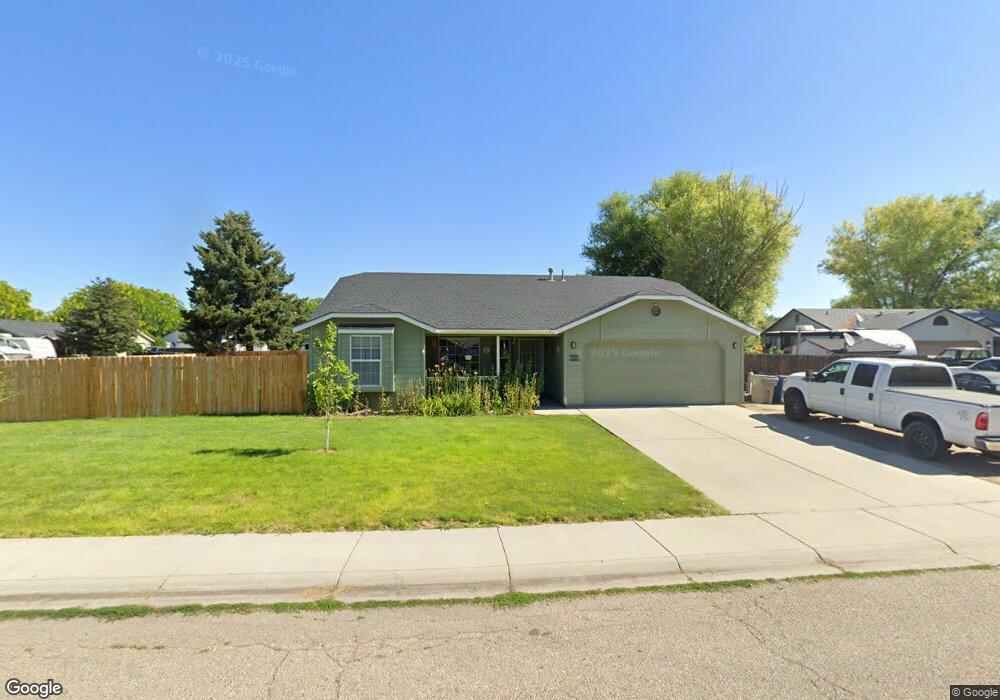
This home is located at 1320 Goldenrod Place, Nampa, ID 83686 and is currently estimated at $370,103, approximately $280 per square foot. 1320 Goldenrod Place is a home located in Canyon County with nearby schools including Greenhurst Elementary School, South Middle School, and Columbia High School.
Ownership History
Date
Name
Owned For
Owner Type
Purchase Details
Closed on
Jul 14, 2021
Sold by
Desmond John and Desmond Evelyn
Bought by
Desmond John and Desmond Evelyn
Current Estimated Value
Home Financials for this Owner
Home Financials are based on the most recent Mortgage that was taken out on this home.
Original Mortgage
$151,100
Interest Rate
3%
Mortgage Type
New Conventional
Purchase Details
Closed on
Dec 2, 2005
Sold by
Desmond John P and Desmond Evelyn H
Bought by
Desmond John P and Desmond Evelyn H
Home Financials for this Owner
Home Financials are based on the most recent Mortgage that was taken out on this home.
Original Mortgage
$22,500
Interest Rate
6.14%
Mortgage Type
Credit Line Revolving
Create a Home Valuation Report for This Property
The Home Valuation Report is an in-depth analysis detailing your home's value as well as a comparison with similar homes in the area
Home Values in the Area
Average Home Value in this Area
Purchase History
| Date | Buyer | Sale Price | Title Company |
|---|---|---|---|
| Desmond John | -- | Alliance Title Boise Product | |
| Desmond John P | -- | Title One |
Source: Public Records
Mortgage History
| Date | Status | Borrower | Loan Amount |
|---|---|---|---|
| Closed | Desmond John | $151,100 | |
| Closed | Desmond John P | $22,500 | |
| Closed | Desmond John P | $120,000 |
Source: Public Records
Tax History Compared to Growth
Tax History
| Year | Tax Paid | Tax Assessment Tax Assessment Total Assessment is a certain percentage of the fair market value that is determined by local assessors to be the total taxable value of land and additions on the property. | Land | Improvement |
|---|---|---|---|---|
| 2025 | $1,379 | $352,700 | $106,700 | $246,000 |
| 2024 | $1,379 | $347,700 | $106,700 | $241,000 |
| 2023 | $1,284 | $341,100 | $106,700 | $234,400 |
| 2022 | $1,694 | $354,500 | $106,700 | $247,800 |
| 2021 | $1,496 | $252,000 | $56,000 | $196,000 |
| 2020 | $1,443 | $211,400 | $46,500 | $164,900 |
| 2019 | $1,503 | $187,300 | $40,000 | $147,300 |
| 2018 | $1,466 | $0 | $0 | $0 |
| 2017 | $1,356 | $0 | $0 | $0 |
| 2016 | $1,265 | $0 | $0 | $0 |
| 2015 | $1,132 | $0 | $0 | $0 |
| 2014 | $1,027 | $105,400 | $20,000 | $85,400 |
Source: Public Records
Map
Nearby Homes
- 1403 Sunflower Ct
- 1426 Chicago St
- 1009 Poppy Dr
- 2308 E Elm Grove Dr
- 2912 E Iowa Ave
- 2019 Kentucky Dr
- 1047 S 20th St
- 3411 Wilson Ln
- 1801 E Iowa Ave
- 1835 E Kentucky Ave
- 545 Knights Cir
- 618 Dufur St
- 2225 Lexi's Ln
- 1157 S Powerline Rd
- 3302 E Princess Amy Ct
- 641 S Bangor Way
- 678 S Queens Dr
- 1810 E Sherman Ave
- 1426 E Sharons Loop
- 2622 Boulder Ave
- 1312 Goldenrod Dr
- 1324 Goldenrod Place
- 1323 Goldenrod Dr
- 1323 Goldenrod Dr
- 1404 Goldenrod Place
- 1400 Goldenrod Place
- 1317 Goldenrod Dr
- 2617 Wildflower Dr
- 2629 Wildflower Dr
- 1328 Goldenrod Place
- 1329 Goldenrod Dr
- 1309 Goldenrod Dr
- 1332 Goldenrod Place
- 1314 Magnolia Place
- 2705 Wildflower Dr
- 1407 Goldenrod Dr
- 2610 Sunflower Dr
- 1320 Magnolia Place
- 1303 Goldenrod Dr
- 1308 Magnolia Place