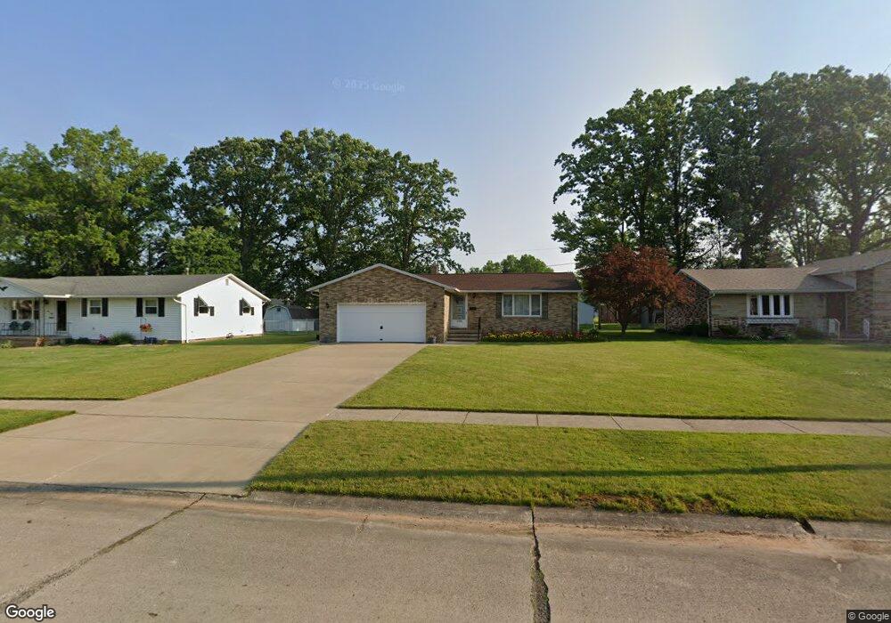
1320 Laura Dr Lorain, OH 44053
Estimated Value: $196,963 - $229,000
3
Beds
2
Baths
1,196
Sq Ft
$176/Sq Ft
Est. Value
About This Home
This home is located at 1320 Laura Dr, Lorain, OH 44053 and is currently estimated at $210,991, approximately $176 per square foot. 1320 Laura Dr is a home located in Lorain County with nearby schools including Toni Wofford Morrison Elementary School, Gen. Johnnie Wilson Middle School, and Lorain High School.
Ownership History
Date
Name
Owned For
Owner Type
Purchase Details
Closed on
Dec 3, 2018
Sold by
Bustamante Chrismon Olga and Chrismon Alan C
Bought by
Bustamante Chrismon Olga
Current Estimated Value
Purchase Details
Closed on
Sep 3, 2010
Sold by
Coteff Christ
Bought by
Chrismon Alan C and Bustamante Chrismon Olga
Purchase Details
Closed on
Apr 4, 2002
Sold by
Coteff Victoria
Bought by
Coteff Victoria and The Coteff Family Trust
Create a Home Valuation Report for This Property
The Home Valuation Report is an in-depth analysis detailing your home's value as well as a comparison with similar homes in the area
Home Values in the Area
Average Home Value in this Area
Purchase History
| Date | Buyer | Sale Price | Title Company |
|---|---|---|---|
| Bustamante Chrismon Olga | -- | None Available | |
| Chrismon Alan C | $105,000 | None Available | |
| Coteff Victoria | -- | -- |
Source: Public Records
Tax History
| Year | Tax Paid | Tax Assessment Tax Assessment Total Assessment is a certain percentage of the fair market value that is determined by local assessors to be the total taxable value of land and additions on the property. | Land | Improvement |
|---|---|---|---|---|
| 2024 | $2,219 | $63,609 | $11,057 | $52,553 |
| 2023 | $1,950 | $47,033 | $13,349 | $33,684 |
| 2022 | $1,954 | $47,033 | $13,349 | $33,684 |
| 2021 | $1,954 | $47,033 | $13,349 | $33,684 |
| 2020 | $1,839 | $40,030 | $11,360 | $28,670 |
| 2019 | $1,828 | $40,030 | $11,360 | $28,670 |
| 2018 | $1,680 | $40,030 | $11,360 | $28,670 |
| 2017 | $1,532 | $33,460 | $11,230 | $22,230 |
| 2016 | $1,520 | $33,460 | $11,230 | $22,230 |
| 2015 | $1,434 | $33,460 | $11,230 | $22,230 |
| 2014 | $1,714 | $38,370 | $12,880 | $25,490 |
| 2013 | $1,701 | $38,370 | $12,880 | $25,490 |
Source: Public Records
Map
Nearby Homes
- 1321 Westwood Dr
- 4977-4985 Oberlin Ave
- 4859 Oberlin Ave
- 1423 Narragansett Blvd
- 1310 Lindenwood Dr
- 1415 Shaffer Dr
- 1519 Shaffer Dr
- 4623 Queen Anne Ave
- 1203 W 44th St
- 1711 N Nantucket Dr
- 4620 Washington Ave
- 5611 Independence Dr
- 1501 Tower Blvd
- 1210 Tower Blvd
- 1819 W 42nd St
- 1727 W 41st St
- 4231 Washington Ave
- 1207 W 38th St
- 0 Leavitt Rd Unit 5169364
- 4248 Leavitt Rd
- 1328 Laura Dr
- 1306 Laura Dr
- 1327 Westwood Dr
- 1336 Laura Dr
- 1321 Laura Dr
- 1315 Westwood Dr
- 5401 Wanda Dr
- 1333 Westwood Dr
- 1309 Westwood Dr
- 1331 Laura Dr
- 5403 Wanda Dr
- 5408 Wanda Dr
- 5321 Ashland Ave
- 1339 Westwood Dr
- 1337 Laura Dr
- 5407 Wanda Dr
- 1301 Westwood Dr
- 5416 Wanda Dr
- 1324 Westwood Dr
- 5407 Ashland Ave
Your Personal Tour Guide
Ask me questions while you tour the home.