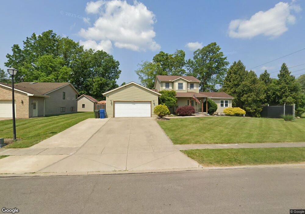
1320 Meadowview Ln Amherst, OH 44001
Estimated Value: $298,000 - $377,703
3
Beds
3
Baths
2,102
Sq Ft
$158/Sq Ft
Est. Value
About This Home
This home is located at 1320 Meadowview Ln, Amherst, OH 44001 and is currently estimated at $331,676, approximately $157 per square foot. 1320 Meadowview Ln is a home located in Lorain County with nearby schools including Powers Elementary School, Walter G. Nord Middle School, and Amherst Junior High School.
Ownership History
Date
Name
Owned For
Owner Type
Purchase Details
Closed on
Apr 12, 2006
Sold by
Harmon John R and Harmon Sandra D
Bought by
Green David M and Green Tracy A
Current Estimated Value
Home Financials for this Owner
Home Financials are based on the most recent Mortgage that was taken out on this home.
Original Mortgage
$174,166
Interest Rate
6.48%
Mortgage Type
Purchase Money Mortgage
Create a Home Valuation Report for This Property
The Home Valuation Report is an in-depth analysis detailing your home's value as well as a comparison with similar homes in the area
Home Values in the Area
Average Home Value in this Area
Purchase History
| Date | Buyer | Sale Price | Title Company |
|---|---|---|---|
| Green David M | $176,900 | Clear Choice Title |
Source: Public Records
Mortgage History
| Date | Status | Borrower | Loan Amount |
|---|---|---|---|
| Closed | Green David M | $174,166 |
Source: Public Records
Tax History Compared to Growth
Tax History
| Year | Tax Paid | Tax Assessment Tax Assessment Total Assessment is a certain percentage of the fair market value that is determined by local assessors to be the total taxable value of land and additions on the property. | Land | Improvement |
|---|---|---|---|---|
| 2024 | $5,048 | $124,751 | $17,640 | $107,111 |
| 2023 | $4,591 | $95,606 | $13,202 | $82,404 |
| 2022 | $4,071 | $88,487 | $13,202 | $75,285 |
| 2021 | $4,082 | $88,487 | $13,202 | $75,285 |
| 2020 | $4,001 | $77,010 | $11,490 | $65,520 |
| 2019 | $3,601 | $70,810 | $11,490 | $59,320 |
| 2018 | $3,633 | $70,050 | $11,490 | $58,560 |
| 2017 | $3,687 | $67,720 | $10,110 | $57,610 |
| 2016 | $3,717 | $67,720 | $10,110 | $57,610 |
| 2015 | $3,696 | $67,720 | $10,110 | $57,610 |
| 2014 | $3,336 | $63,290 | $9,450 | $53,840 |
| 2013 | $3,292 | $59,840 | $9,450 | $50,390 |
Source: Public Records
Map
Nearby Homes
- 3489 Coopers Trail
- 110 Habant Dr
- 0 Cooper Foster Park Rd Unit 5129838
- 1250 N Main St
- 1011 N Main St
- 4510 Weathervane Dr
- 4872 Leavitt Rd
- 922 Sharondale Dr
- 4680 Boulder Ln
- 0 Rosecliff Dr
- 357 Pebble Creek Ct
- 3794 Freedom Place
- 3788 Freedom Place
- 3784 Freedom Place
- 3774 Freedom Place Unit A
- 3772 Freedom Place Unit B
- 3770 Freedom Place Unit C
- 117 Fall Lake Ln
- 3741 Freedom Place Unit 5-A
- 3924 Winger Dr
- 1310 Meadowview Ln
- 1331 Beverly Dr
- 1300 Meadowview Ln
- 1325 Meadowview Ln
- 1315 Beverly Dr
- 1315 Meadowview Ln
- 1280 Meadowview Ln
- 1305 Meadowview Ln
- 1301 Beverly Dr
- 3544 Coopers Trail
- 1285 Meadowview Ln
- 3550 Coopers Trail
- 1270 Meadowview Ln
- 1320 Beverly Dr
- 275 Habant Dr
- 3560 Coopers Trail
- 3538 Coopers Trail
- 1285 Beverly Dr
- 1275 Meadowview Ln
- 3570 Coopers Trail