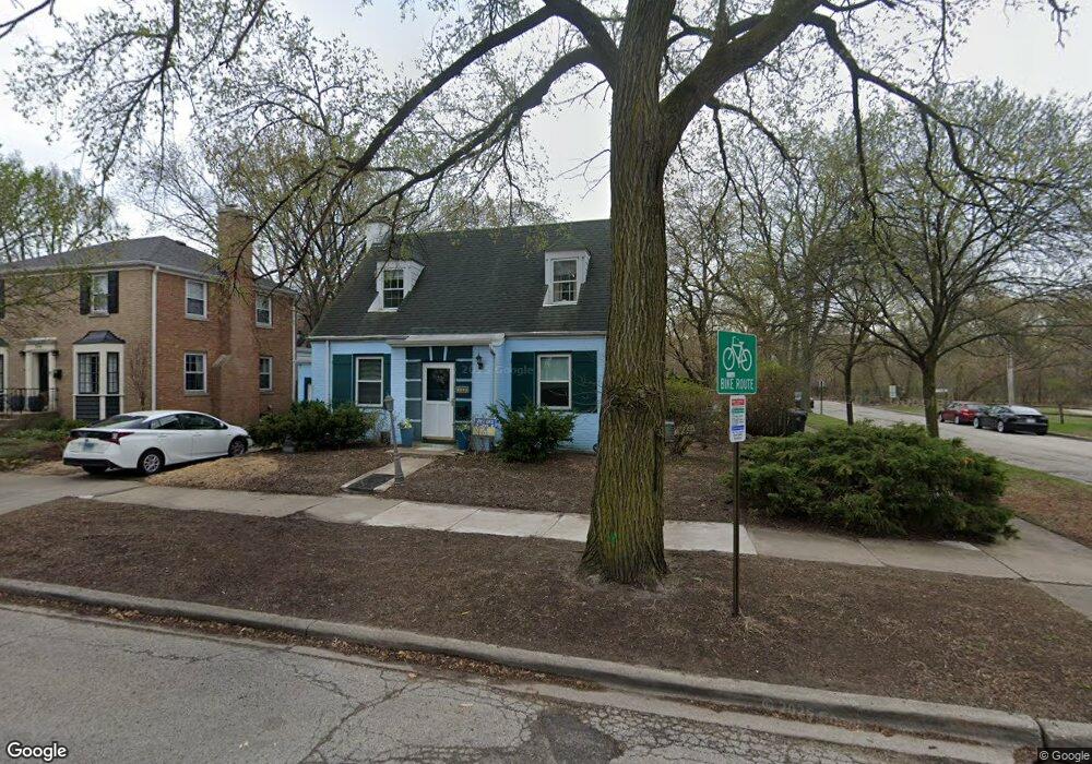
1320 Mulford St Evanston, IL 60202
Estimated Value: $516,000 - $594,000
4
Beds
2
Baths
1,456
Sq Ft
$379/Sq Ft
Est. Value
About This Home
This home is located at 1320 Mulford St, Evanston, IL 60202 and is currently estimated at $552,158, approximately $379 per square foot. 1320 Mulford St is a home located in Cook County with nearby schools including Dawes Elementary School, Chute Middle School, and Evanston Township High School.
Ownership History
Date
Name
Owned For
Owner Type
Purchase Details
Closed on
Feb 26, 2003
Sold by
Lasalle Bank Na
Bought by
Mckearnan Daniel R and Mckearnan Therese
Current Estimated Value
Home Financials for this Owner
Home Financials are based on the most recent Mortgage that was taken out on this home.
Original Mortgage
$250,000
Outstanding Balance
$108,964
Interest Rate
6.07%
Estimated Equity
$443,194
Create a Home Valuation Report for This Property
The Home Valuation Report is an in-depth analysis detailing your home's value as well as a comparison with similar homes in the area
Home Values in the Area
Average Home Value in this Area
Purchase History
| Date | Buyer | Sale Price | Title Company |
|---|---|---|---|
| Mckearnan Daniel R | $315,000 | -- |
Source: Public Records
Mortgage History
| Date | Status | Borrower | Loan Amount |
|---|---|---|---|
| Open | Mckearnan Daniel R | $250,000 |
Source: Public Records
Tax History Compared to Growth
Tax History
| Year | Tax Paid | Tax Assessment Tax Assessment Total Assessment is a certain percentage of the fair market value that is determined by local assessors to be the total taxable value of land and additions on the property. | Land | Improvement |
|---|---|---|---|---|
| 2024 | $8,593 | $41,000 | $9,728 | $31,272 |
| 2023 | $8,199 | $41,000 | $9,728 | $31,272 |
| 2022 | $8,199 | $41,000 | $9,728 | $31,272 |
| 2021 | $6,798 | $31,272 | $5,168 | $26,104 |
| 2020 | $6,815 | $31,272 | $5,168 | $26,104 |
| 2019 | $7,470 | $34,902 | $5,168 | $29,734 |
| 2018 | $7,557 | $30,656 | $4,256 | $26,400 |
| 2017 | $7,374 | $30,656 | $4,256 | $26,400 |
| 2016 | $7,218 | $30,656 | $4,256 | $26,400 |
| 2015 | $6,293 | $25,764 | $5,016 | $20,748 |
| 2014 | $7,012 | $28,603 | $5,016 | $23,587 |
| 2013 | $6,834 | $28,603 | $5,016 | $23,587 |
Source: Public Records
Map
Nearby Homes
- 1214 Hull Terrace
- 1217 Hull Terrace Unit 3A
- 408 Asbury Ave
- 1406 Brummel St
- 419 Florence Ave
- 1200 Dobson St
- 401 Dewey Ave
- 400 Ridge Ave Unit 16-2
- 250 Ridge Ave Unit 4L
- 532 Wesley Ave Unit WEST
- 309 Darrow Ave
- 200 Ridge Ave Unit 2C
- 7546 N Oakley Ave
- 1408 Seward St
- 7519 N Claremont Ave Unit 2S
- 553 Barton Ave
- 1021 South Blvd
- 325 Dodge Ave
- 819 Brummel St Unit 3S
- 1726 Dobson St
- 1316 Mulford St
- 233 Wesley Ave
- 805-807 Mulford St
- 229 Wesley Ave
- 1308 Mulford St
- 1325 Mulford St
- 236 Asbury Ave Unit 2361
- 236 Asbury Ave Unit 2363
- 236 Asbury Ave Unit 2362
- 236 Asbury Ave Unit 236G
- 236 Asbury Ave Unit 2
- 236 Asbury Ave Unit G
- 236 Asbury Ave Unit 3
- 1304 Mulford St
- 234 Asbury Ave Unit 2341
- 234 Asbury Ave Unit 2343
- 234 Asbury Ave Unit 2342
- 234 Asbury Ave Unit 2
- 232 Asbury Ave Unit 2322
- 232 Asbury Ave Unit 2323