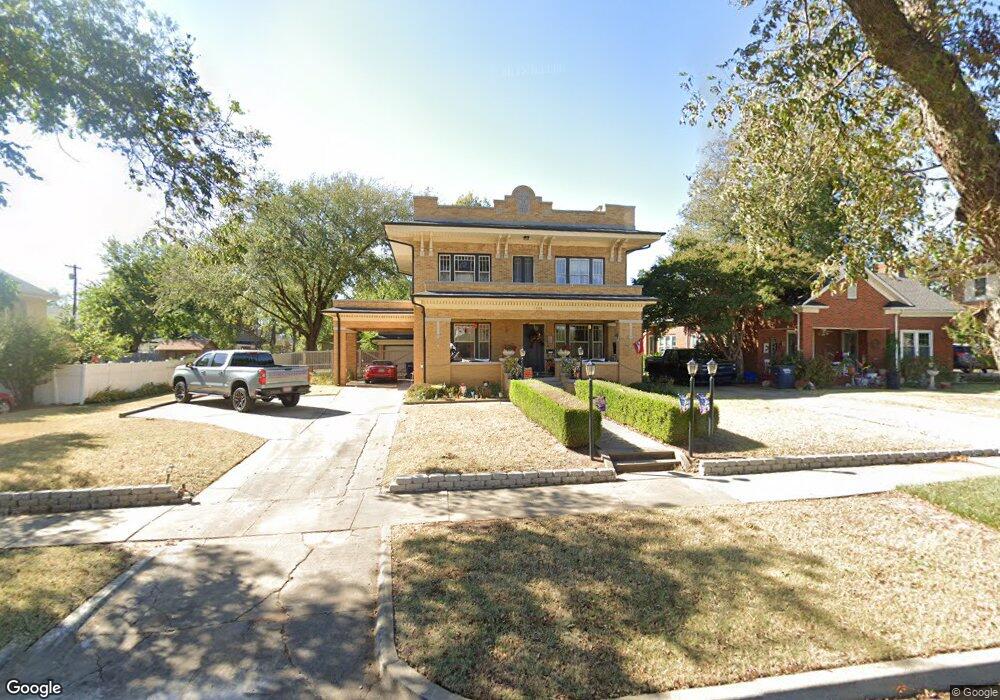
1320 N Bdwy Shawnee, OK 74801
Estimated Value: $148,000 - $344,000
3
Beds
2
Baths
1,486
Sq Ft
$182/Sq Ft
Est. Value
About This Home
This home is located at 1320 N Bdwy, Shawnee, OK 74801 and is currently estimated at $271,006, approximately $182 per square foot. 1320 N Bdwy is a home with nearby schools including Jefferson Elementary School, Shawnee Middle School, and Shawnee High School.
Ownership History
Date
Name
Owned For
Owner Type
Purchase Details
Closed on
Oct 22, 2024
Sold by
Finch Kimberlye E
Bought by
Kimberlye E Finch Living Trust and Finch
Current Estimated Value
Purchase Details
Closed on
May 5, 2017
Sold by
Greg Brown Homes Llc
Bought by
Finch Kimberlye E
Home Financials for this Owner
Home Financials are based on the most recent Mortgage that was taken out on this home.
Original Mortgage
$254,118
Interest Rate
4.1%
Mortgage Type
VA
Create a Home Valuation Report for This Property
The Home Valuation Report is an in-depth analysis detailing your home's value as well as a comparison with similar homes in the area
Home Values in the Area
Average Home Value in this Area
Purchase History
| Date | Buyer | Sale Price | Title Company |
|---|---|---|---|
| Kimberlye E Finch Living Trust | -- | None Listed On Document | |
| Finch Kimberlye E | $246,000 | First American Title |
Source: Public Records
Mortgage History
| Date | Status | Borrower | Loan Amount |
|---|---|---|---|
| Previous Owner | Finch Kimberlye E | $254,118 |
Source: Public Records
Tax History Compared to Growth
Tax History
| Year | Tax Paid | Tax Assessment Tax Assessment Total Assessment is a certain percentage of the fair market value that is determined by local assessors to be the total taxable value of land and additions on the property. | Land | Improvement |
|---|---|---|---|---|
| 2024 | $2,676 | $27,418 | $2,352 | $25,066 |
| 2023 | $2,676 | $26,619 | $2,352 | $24,267 |
| 2022 | $2,629 | $26,619 | $2,352 | $24,267 |
| 2021 | $2,586 | $26,663 | $2,352 | $24,311 |
| 2020 | $2,692 | $27,647 | $2,352 | $25,295 |
| 2019 | $2,834 | $28,144 | $2,352 | $25,792 |
| 2018 | $2,861 | $28,960 | $2,352 | $26,608 |
| 2017 | $1,698 | $16,824 | $1,176 | $15,648 |
| 2016 | $1,653 | $17,358 | $652 | $16,706 |
| 2015 | $1,653 | $16,530 | $602 | $15,928 |
| 2014 | $1,581 | $15,744 | $549 | $15,195 |
Source: Public Records
Map
Nearby Homes
- 1217 N Market Ave
- 1602 N Bdwy
- 1607 N Beard Ave
- 1324 N Park Ave
- 1510 N Union Ave
- 1017 N Bdwy Ave
- 1006 N Market Ave
- 1710 N Park Ave
- 1816 N Bell Ave
- 0 Independence and Minnesota St
- 1817 N Bell Ave
- 824 N Beard Ave
- 1822 N Phil Ave
- 318 W Dill St
- 1901 N Bell Ave
- 1012 N Chapman Ave
- 727 N Beard Ave
- 1712 N Pennsylvania Ave
- 735 N Park Ave
- 434 E Wallace St
- 1324 N Bdwy
- 1320 N Broadway Ave
- 1310 N Bdwy
- 1315 N Beard St
- 1317 N Beard St
- 1313 N Beard St
- 1319 N Beard St
- 1302 N Bdwy
- 1415 N Broadway Ave
- 1309 N Beard St
- 1321 N Bdwy Ave
- 1321 N Beard St
- 1309 N Beard Ave
- 1307 N Beard St
- 1317 N Broadway Ave
- 1335 N Beard St
- 1307 N Beard Ave
- 1420 N Bdwy Ave
- 1404 N Broadway Ave
- 1321 N Broadway Ave