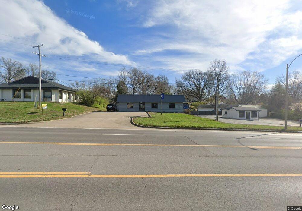
1320 N Kingshighway St Cape Girardeau, MO 63701
Estimated Value: $286,000
--
Bed
--
Bath
1,410
Sq Ft
$203/Sq Ft
Est. Value
About This Home
This home is located at 1320 N Kingshighway St, Cape Girardeau, MO 63701 and is currently estimated at $286,000, approximately $202 per square foot. 1320 N Kingshighway St is a home located in Cape Girardeau County with nearby schools including Alma Schrader Elementary School, Central Middle School, and Central Junior High School.
Ownership History
Date
Name
Owned For
Owner Type
Purchase Details
Closed on
May 6, 2020
Sold by
Gipson Steven M and Gipson Mary Ellen
Bought by
Rogers Larry William
Current Estimated Value
Purchase Details
Closed on
Oct 13, 2016
Sold by
Dame Philip and Dame Ruth
Bought by
Cape Area Properties Llc
Home Financials for this Owner
Home Financials are based on the most recent Mortgage that was taken out on this home.
Original Mortgage
$178,500
Interest Rate
3.5%
Mortgage Type
Commercial
Create a Home Valuation Report for This Property
The Home Valuation Report is an in-depth analysis detailing your home's value as well as a comparison with similar homes in the area
Home Values in the Area
Average Home Value in this Area
Purchase History
| Date | Buyer | Sale Price | Title Company |
|---|---|---|---|
| Rogers Larry William | -- | None Available | |
| Cape Area Properties Llc | -- | Cape Girardeau County Abstra |
Source: Public Records
Mortgage History
| Date | Status | Borrower | Loan Amount |
|---|---|---|---|
| Previous Owner | Cape Area Properties Llc | $178,500 |
Source: Public Records
Tax History Compared to Growth
Tax History
| Year | Tax Paid | Tax Assessment Tax Assessment Total Assessment is a certain percentage of the fair market value that is determined by local assessors to be the total taxable value of land and additions on the property. | Land | Improvement |
|---|---|---|---|---|
| 2025 | $34 | $63,140 | $31,460 | $31,680 |
| 2024 | $34 | $60,130 | $29,960 | $30,170 |
| 2023 | $3,347 | $60,130 | $29,960 | $30,170 |
| 2022 | $3,087 | $55,430 | $27,620 | $27,810 |
| 2021 | $3,087 | $55,430 | $27,620 | $27,810 |
| 2020 | $3,095 | $55,430 | $27,620 | $27,810 |
| 2019 | $3,091 | $55,430 | $0 | $0 |
| 2018 | $3,085 | $55,430 | $0 | $0 |
| 2017 | $3,092 | $55,430 | $0 | $0 |
| 2016 | $2,913 | $52,420 | $0 | $0 |
| 2015 | $2,915 | $52,420 | $0 | $0 |
| 2014 | $2,929 | $52,420 | $0 | $0 |
Source: Public Records
Map
Nearby Homes
- 1246 Marilyn Dr
- 1107 Dorothy St
- 1070 Dorothy St
- 835 Lochinvar Ln
- 2550 Marvin St
- 2629 Hopper Rd
- 2449 Janet Dr
- 2412 Masters Dr
- 3002 Melrose Ave
- 1000 N Mount Auburn Rd
- 1701 Brookwood Dr
- 3269 Hopper Rd
- 769 Cedar Ln
- 1705 Paul Revere Dr
- 2615 Maria Louise Ln
- 2416 Terrie Hill Rd
- 2323 Jean Ann Dr
- 2323 Brookwood Dr
- 3014 Keystone Dr
- 3036 Keystone Dr
- 1318 N Kingshighway St
- 1249 Marilyn Dr
- 1253 Marilyn Dr
- 1257 Marilyn Dr
- 1245 Marilyn Dr
- 1300 Victoria Dr
- 1261 Marilyn Dr
- 1254 Marilyn Dr
- 1241 Marilyn Dr
- 1312 Victoria Dr
- 1260 Marilyn Dr
- 1249 N Kingshighway
- 1237 Marilyn Dr
- 1240 Marilyn Dr
- 1313 Kingsway Dr
- 1316 Victoria Dr
- 1309 Kingsway Dr
- 1305 Kingsway Dr
- 1305 Victoria Dr
- 1281 Kingsway Dr