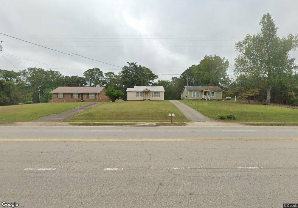
1320 New Franklin Rd Lagrange, GA 30240
Estimated Value: $82,000 - $133,000
2
Beds
1
Bath
869
Sq Ft
$123/Sq Ft
Est. Value
About This Home
This home is located at 1320 New Franklin Rd, Lagrange, GA 30240 and is currently estimated at $107,122, approximately $123 per square foot. 1320 New Franklin Rd is a home located in Troup County with nearby schools including Franklin Forest Elementary School, Hillcrest Elementary School, and Hollis Hand Elementary School.
Ownership History
Date
Name
Owned For
Owner Type
Purchase Details
Closed on
Mar 17, 2022
Sold by
Daniel Larry D
Bought by
Gunter Property Management And Investmen
Current Estimated Value
Home Financials for this Owner
Home Financials are based on the most recent Mortgage that was taken out on this home.
Original Mortgage
$119,000
Outstanding Balance
$37,940
Interest Rate
3.55%
Mortgage Type
Mortgage Modification
Estimated Equity
$69,182
Purchase Details
Closed on
Dec 23, 2008
Sold by
Daniel Larry D
Bought by
Daniel Darden
Purchase Details
Closed on
Aug 26, 1994
Sold by
Blake Hall
Bought by
Grace Alice Daniel
Purchase Details
Closed on
Jan 1, 1959
Sold by
Darden Daniel
Bought by
Blake Hall
Create a Home Valuation Report for This Property
The Home Valuation Report is an in-depth analysis detailing your home's value as well as a comparison with similar homes in the area
Home Values in the Area
Average Home Value in this Area
Purchase History
| Date | Buyer | Sale Price | Title Company |
|---|---|---|---|
| Gunter Property Management And Investmen | $115,000 | -- | |
| Daniel Darden | -- | -- | |
| Grace Alice Daniel | -- | -- | |
| Blake Hall | -- | -- |
Source: Public Records
Mortgage History
| Date | Status | Borrower | Loan Amount |
|---|---|---|---|
| Open | Gunter Property Management And Investmen | $119,000 |
Source: Public Records
Tax History Compared to Growth
Tax History
| Year | Tax Paid | Tax Assessment Tax Assessment Total Assessment is a certain percentage of the fair market value that is determined by local assessors to be the total taxable value of land and additions on the property. | Land | Improvement |
|---|---|---|---|---|
| 2024 | $731 | $26,800 | $6,680 | $20,120 |
| 2023 | $565 | $23,720 | $6,680 | $17,040 |
| 2022 | $634 | $22,720 | $6,680 | $16,040 |
| 2021 | $700 | $23,200 | $6,680 | $16,520 |
| 2020 | $527 | $17,480 | $6,680 | $10,800 |
| 2019 | $525 | $17,400 | $6,680 | $10,720 |
| 2018 | $487 | $16,140 | $6,420 | $9,720 |
| 2017 | $487 | $16,140 | $6,420 | $9,720 |
| 2016 | $477 | $15,828 | $6,420 | $9,408 |
| 2015 | $478 | $15,828 | $6,420 | $9,408 |
| 2014 | $464 | $15,333 | $6,420 | $8,913 |
| 2013 | -- | $16,518 | $6,420 | $10,098 |
Source: Public Records
Map
Nearby Homes
- 89 Chase Rd
- 127 Ashling Dr
- 91 Richmond Dr
- 134 S Page St
- 107 Dixie Creek Dr
- 200 Crestwood Dr
- 127 Oakmont Dr
- 400 S Page St
- 100 Creekside Dr Unit LOT 60A
- 519 Tradition Place
- 517 Tradition Place
- 104 Hidden Branches Ln
- 114 Crestwood Dr
- 1784 New Franklin Rd
- 129 Celebration Blvd
- 114 Briarcliff Rd
- 106 S Chilton Crescent
- 117 Celebration Blvd
- 112 Celebration Blvd
- 105 Ridgeview Dr
- 1320 New Franklin Rd
- 1322 New Franklin Rd
- 1324 New Franklin Rd
- 1326 New Franklin Rd
- 1319 New Franklin Rd
- 1328 New Franklin Rd
- 1336 New Franklin Rd
- 1308 New Franklin Rd
- 1344 New Franklin Rd
- 1306 New Franklin Rd
- 28 Waugh Rd
- 1304 New Franklin Rd
- 74 Waugh Rd
- 1347 New Franklin Rd
- 1347 New Franklin Rd Unit 1347-1351
- 37 Chase Rd
- 1352 New Franklin Rd
- 1357 New Franklin Rd
- 51 Chase Rd
- 47 Waugh Rd