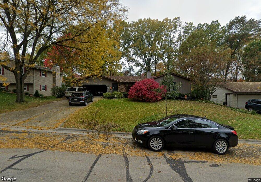
1320 Oasis Dr Green Bay, WI 54313
Westside NeighborhoodEstimated Value: $327,000 - $387,000
--
Bed
--
Bath
--
Sq Ft
0.25
Acres
About This Home
This home is located at 1320 Oasis Dr, Green Bay, WI 54313 and is currently estimated at $348,249. 1320 Oasis Dr is a home located in Brown County with nearby schools including King Elementary School, Lombardi Middle School, and Southwest High School.
Ownership History
Date
Name
Owned For
Owner Type
Purchase Details
Closed on
Aug 8, 2025
Sold by
Schlichting James L and Schlichting Y
Bought by
Schlichting James L and Schlichting James L
Current Estimated Value
Purchase Details
Closed on
Feb 5, 2025
Sold by
Matthies Marie K
Bought by
Schlichting James L
Purchase Details
Closed on
May 31, 2024
Sold by
Matthies Thomas D and Matthies Y
Bought by
Matthies Marie K and Matthies Y
Purchase Details
Closed on
Nov 14, 2007
Sold by
Goffard Jason A and Goffard Kathryn M
Bought by
Matthies Thomas D and Matthies Marie K
Home Financials for this Owner
Home Financials are based on the most recent Mortgage that was taken out on this home.
Original Mortgage
$100,000
Interest Rate
6.45%
Mortgage Type
Unknown
Create a Home Valuation Report for This Property
The Home Valuation Report is an in-depth analysis detailing your home's value as well as a comparison with similar homes in the area
Home Values in the Area
Average Home Value in this Area
Purchase History
| Date | Buyer | Sale Price | Title Company |
|---|---|---|---|
| Schlichting James L | -- | -- | |
| Schlichting James L | $219,900 | Bay Title & Abstract Inc | |
| Matthies Marie K | -- | Bay Title & Abstract Inc | |
| Matthies Thomas D | $173,000 | Bay Title & Abstract Inc |
Source: Public Records
Mortgage History
| Date | Status | Borrower | Loan Amount |
|---|---|---|---|
| Previous Owner | Matthies Thomas D | $100,000 |
Source: Public Records
Tax History Compared to Growth
Tax History
| Year | Tax Paid | Tax Assessment Tax Assessment Total Assessment is a certain percentage of the fair market value that is determined by local assessors to be the total taxable value of land and additions on the property. | Land | Improvement |
|---|---|---|---|---|
| 2024 | $4,177 | $224,400 | $46,600 | $177,800 |
| 2023 | $3,989 | $224,400 | $46,600 | $177,800 |
| 2022 | $3,901 | $224,400 | $46,600 | $177,800 |
| 2021 | $3,263 | $144,000 | $35,400 | $108,600 |
| 2020 | $3,306 | $144,000 | $35,400 | $108,600 |
| 2019 | $3,200 | $144,000 | $35,400 | $108,600 |
| 2018 | $3,127 | $144,000 | $35,400 | $108,600 |
| 2017 | $3,092 | $144,000 | $35,400 | $108,600 |
| 2016 | $3,043 | $144,000 | $35,400 | $108,600 |
| 2015 | $3,143 | $144,000 | $35,400 | $108,600 |
| 2014 | $3,231 | $144,000 | $35,400 | $108,600 |
| 2013 | $3,231 | $144,000 | $35,400 | $108,600 |
Source: Public Records
Map
Nearby Homes
- 3096 S Sandstone Ct
- 3097 S Sandstone Ct
- 1602 W Crusade Ln
- 3023 Crusade Ln
- 3102 Sandstone Ct
- 2993 Fleetwood Dr
- 1000 Rolling Green Dr
- 916 Square Terrace
- 1940 Renaissance Ct
- 618 Night Ct
- 3112 Birdie Ct
- 3833 Hillcrest Dr
- 1433 Baumgart Rd Unit 1435
- 516 Country Club Rd
- 2640 He Nis Ra Ln
- 4179 Hillcrest Dr
- 2768 Independence Dr
- 2550 He Nis Ra Ln
- 1274 S Sedona Cir
- 2060 Wintergreen Ct
- 1316 Oasis Dr
- 1326 Oasis Dr
- 1323 Sandstone Place
- 1327 Sandstone Place
- 1319 Sandstone Place
- 1308 Oasis Dr
- 1330 Oasis Dr
- 1321 Oasis Dr
- 1315 Oasis Dr
- 1325 Oasis Dr
- 1331 Sandstone Place
- 1315 Sandstone Place
- 3095 Sandia Dr
- 1307 Oasis Dr
- 1327 Oasis Dr
- 3105 Sandia Dr
- 1320 Sandstone Place
- 1301 Oasis Dr
- 3107 Sandia Dr
- 1310 Mirage Dr