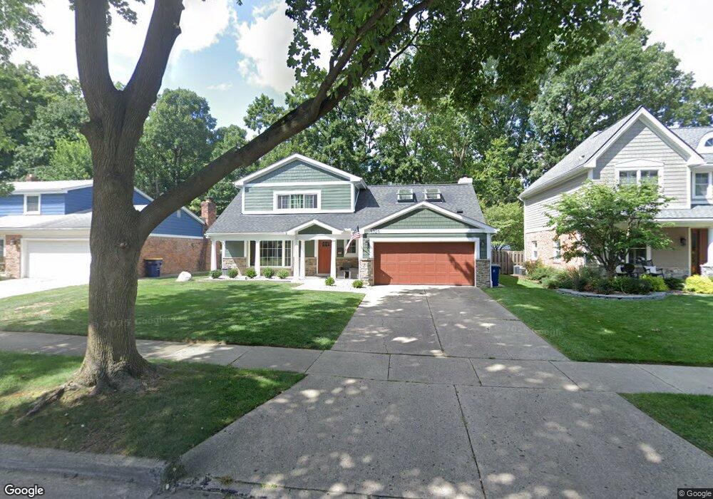
1320 Palmer St Plymouth, MI 48170
Estimated Value: $530,085 - $738,000
4
Beds
3
Baths
1,925
Sq Ft
$321/Sq Ft
Est. Value
About This Home
This home is located at 1320 Palmer St, Plymouth, MI 48170 and is currently estimated at $618,771, approximately $321 per square foot. 1320 Palmer St is a home located in Wayne County with nearby schools including Canton High School, Smith Elementary School, and West Middle School.
Ownership History
Date
Name
Owned For
Owner Type
Purchase Details
Closed on
May 18, 2022
Sold by
James Eglinton Brian and James Elizabeth Natalie
Bought by
Eglinton Brian James and Eglinton Brian James
Current Estimated Value
Purchase Details
Closed on
Nov 17, 2009
Sold by
Reino Brent and Reino Meghan
Bought by
Nicol Natalie
Purchase Details
Closed on
May 31, 2007
Sold by
Merolla Anthony J and Vida Stacy J
Bought by
Reino Brent and Reino Meghan
Purchase Details
Closed on
Apr 26, 2005
Sold by
Lado Derek A and Pankratz Jennifer L
Bought by
Merolla Anthony J and Vida Stacy J
Purchase Details
Closed on
Sep 7, 2001
Sold by
Sidwell Colleen M
Bought by
Lado Derek A
Create a Home Valuation Report for This Property
The Home Valuation Report is an in-depth analysis detailing your home's value as well as a comparison with similar homes in the area
Home Values in the Area
Average Home Value in this Area
Purchase History
| Date | Buyer | Sale Price | Title Company |
|---|---|---|---|
| Eglinton Brian James | -- | None Listed On Document | |
| Eglinton Natalie Elizabeth | -- | None Listed On Document | |
| Nicol Natalie | $205,000 | Nta | |
| Reino Brent | $330,000 | Multiple | |
| Merolla Anthony J | $275,000 | Minnesota Title Agency | |
| Lado Derek A | $291,000 | -- |
Source: Public Records
Tax History Compared to Growth
Tax History
| Year | Tax Paid | Tax Assessment Tax Assessment Total Assessment is a certain percentage of the fair market value that is determined by local assessors to be the total taxable value of land and additions on the property. | Land | Improvement |
|---|---|---|---|---|
| 2025 | $5,489 | $234,900 | $0 | $0 |
| 2024 | $5,489 | $226,100 | $0 | $0 |
| 2023 | $5,347 | $197,200 | $0 | $0 |
| 2022 | $5,667 | $185,100 | $0 | $0 |
| 2021 | $5,492 | $181,000 | $0 | $0 |
| 2020 | $5,478 | $171,400 | $0 | $0 |
| 2019 | $4,822 | $169,700 | $0 | $0 |
| 2018 | $4,643 | $155,000 | $0 | $0 |
| 2017 | $983 | $152,000 | $0 | $0 |
| 2016 | $5,058 | $146,100 | $0 | $0 |
| 2015 | $11,584 | $126,790 | $0 | $0 |
| 2013 | $11,222 | $126,090 | $0 | $0 |
| 2011 | -- | $106,710 | $0 | $0 |
Source: Public Records
Map
Nearby Homes
- 1125 Sutherland St
- 1199 S Sheldon Rd Unit 77
- 1338 S Harvey St
- 638 S Harvey St
- 844 Ross St
- 44571 Clare Blvd
- 553 Jener Place
- 10839 Brookwood Dr
- 44736 Lynn Dr
- 9453 Brookline Ave
- 44750 Erin Dr Unit 40
- 685 Ross St
- 775 Deer Ct Unit 104
- 44703 Erin Dr
- 44872 Lynn Dr
- 9405 Northern Ave
- 801 W Ann Arbor Trail Unit 306
- 44877 Erin Dr Unit 2
- 543 Deer St
- 684 Harding St