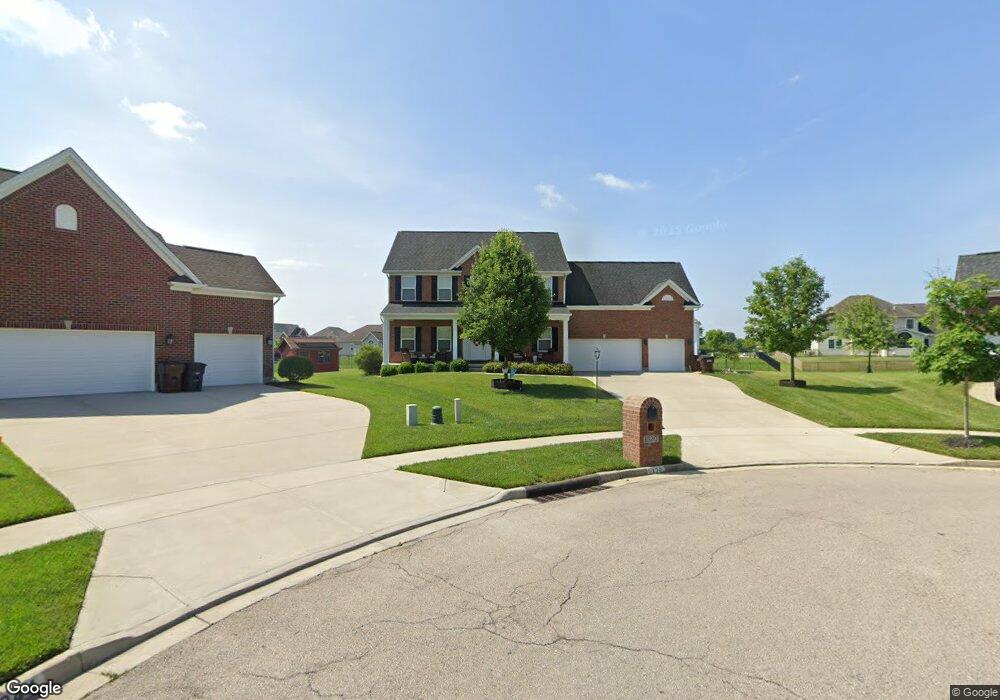
1320 Reagan Ct Beavercreek, OH 45434
Estimated Value: $481,755 - $593,000
4
Beds
4
Baths
2,492
Sq Ft
$217/Sq Ft
Est. Value
About This Home
This home is located at 1320 Reagan Ct, Beavercreek, OH 45434 and is currently estimated at $540,439, approximately $216 per square foot. 1320 Reagan Ct is a home located in Greene County with nearby schools including Trebein Elementary School, Jacob Coy Middle School, and Beavercreek High School.
Ownership History
Date
Name
Owned For
Owner Type
Purchase Details
Closed on
Apr 30, 2019
Sold by
Bugger Eric E and Bugger Tracy A
Bought by
Re Christopher L and Re Christina J
Current Estimated Value
Home Financials for this Owner
Home Financials are based on the most recent Mortgage that was taken out on this home.
Original Mortgage
$379,000
Outstanding Balance
$333,218
Interest Rate
4.2%
Mortgage Type
VA
Estimated Equity
$207,221
Purchase Details
Closed on
Jun 24, 2013
Sold by
M L Huddleston Construction Co Inc
Bought by
Bugger Eric E and Bugger Tracy A
Home Financials for this Owner
Home Financials are based on the most recent Mortgage that was taken out on this home.
Original Mortgage
$321,348
Interest Rate
3.52%
Mortgage Type
New Conventional
Create a Home Valuation Report for This Property
The Home Valuation Report is an in-depth analysis detailing your home's value as well as a comparison with similar homes in the area
Home Values in the Area
Average Home Value in this Area
Purchase History
| Date | Buyer | Sale Price | Title Company |
|---|---|---|---|
| Re Christopher L | $379,000 | Hallmark Title | |
| Bugger Eric E | $238,300 | None Available | |
| M L Huddleston Construction Co Inc | -- | None Available |
Source: Public Records
Mortgage History
| Date | Status | Borrower | Loan Amount |
|---|---|---|---|
| Open | Re Christopher L | $379,000 | |
| Previous Owner | Bugger Eric E | $321,348 |
Source: Public Records
Tax History Compared to Growth
Tax History
| Year | Tax Paid | Tax Assessment Tax Assessment Total Assessment is a certain percentage of the fair market value that is determined by local assessors to be the total taxable value of land and additions on the property. | Land | Improvement |
|---|---|---|---|---|
| 2024 | $7,762 | $138,480 | $30,220 | $108,260 |
| 2023 | $7,762 | $138,480 | $30,220 | $108,260 |
| 2022 | $8,132 | $109,940 | $23,250 | $86,690 |
| 2021 | $7,967 | $109,940 | $23,250 | $86,690 |
| 2020 | $8,027 | $109,940 | $23,250 | $86,690 |
| 2019 | $8,409 | $103,050 | $25,390 | $77,660 |
| 2018 | $7,443 | $103,050 | $25,390 | $77,660 |
| 2017 | $7,319 | $103,050 | $25,390 | $77,660 |
| 2016 | $7,808 | $104,700 | $25,390 | $79,310 |
| 2015 | $7,763 | $104,700 | $25,390 | $79,310 |
| 2014 | $7,651 | $104,700 | $25,390 | $79,310 |
Source: Public Records
Map
Nearby Homes
- 2073 Lincolnshire Dr
- 1360 Backridge Ct
- 1535 Stretch Dr
- 1238 Freedom Point
- 2245 Tourney Trail
- 2154 Sulky Trail
- 1361 Obetz Dr Unit A
- 2162 Sulky Trail
- 2331 Eastwind Dr
- 887 Shady Ln
- 2507 Obetz Dr
- 1156 Westover Rd
- 1210 Lomeda Ln
- 895 Alpha Rd
- 1051 Forest Dr
- 1590 Windham Ln
- 1589 Stonebury Ct
- 1023 Amersham Ave
- 2162 Owen E
- 2418 Owen W
- 1344 Reagan Ct
- 1331 Reagan Ct
- 1346 Reagan Ct
- 1296 Lyndhurst Dr
- 1286 Lyndhurst Dr
- 1299 Patriot Way
- 1343 Reagan Ct
- 1308 Lyndhurst Dr
- 1305 Patriot Way
- 1276 Lyndhurst Dr
- 1318 Lyndhurst Dr
- 1358 Reagan Ct
- 2063 Lincolnshire Dr
- 1332 Lyndhurst Dr
- 1317 Patriot Way
- 2037 Patriot Way
- 1346 Lyndhurst Dr
- 1333 Patriot Way
- 1298 Patriot Way
- 1358 Lyndhurst Dr