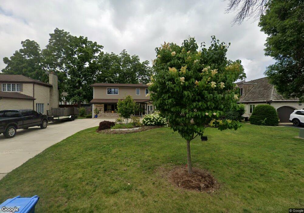
1320 Shagbark Dr Des Plaines, IL 60018
Estimated Value: $525,000 - $650,000
4
Beds
3
Baths
2,970
Sq Ft
$200/Sq Ft
Est. Value
About This Home
This home is located at 1320 Shagbark Dr, Des Plaines, IL 60018 and is currently estimated at $593,240, approximately $199 per square foot. 1320 Shagbark Dr is a home located in Cook County with nearby schools including Central Elementary School, Chippewa Middle School, and Maine West High School.
Ownership History
Date
Name
Owned For
Owner Type
Purchase Details
Closed on
Feb 3, 2016
Sold by
Liv Kostelny Nancy D
Bought by
Lechowski Albin J
Current Estimated Value
Home Financials for this Owner
Home Financials are based on the most recent Mortgage that was taken out on this home.
Original Mortgage
$198,000
Outstanding Balance
$157,460
Interest Rate
4.12%
Mortgage Type
New Conventional
Estimated Equity
$435,780
Purchase Details
Closed on
Aug 20, 2014
Sold by
Kostelny Nancy D
Bought by
Liv Kostelny Nancy D and Nancy D Kostelny Revocable Living Trust
Purchase Details
Closed on
Mar 1, 1996
Sold by
First Bank National Assn
Bought by
Kostelny Nancy
Create a Home Valuation Report for This Property
The Home Valuation Report is an in-depth analysis detailing your home's value as well as a comparison with similar homes in the area
Home Values in the Area
Average Home Value in this Area
Purchase History
| Date | Buyer | Sale Price | Title Company |
|---|---|---|---|
| Lechowski Albin J | $220,000 | Ct | |
| Liv Kostelny Nancy D | -- | None Available | |
| Kostelny Nancy | -- | -- |
Source: Public Records
Mortgage History
| Date | Status | Borrower | Loan Amount |
|---|---|---|---|
| Open | Lechowski Albin J | $198,000 |
Source: Public Records
Tax History
| Year | Tax Paid | Tax Assessment Tax Assessment Total Assessment is a certain percentage of the fair market value that is determined by local assessors to be the total taxable value of land and additions on the property. | Land | Improvement |
|---|---|---|---|---|
| 2025 | $11,609 | $63,000 | $10,863 | $52,137 |
| 2024 | $11,609 | $50,001 | $9,053 | $40,948 |
| 2023 | $11,281 | $50,001 | $9,053 | $40,948 |
| 2022 | $11,281 | $50,001 | $9,053 | $40,948 |
| 2021 | $11,189 | $39,732 | $7,845 | $31,887 |
| 2020 | $11,069 | $39,732 | $7,845 | $31,887 |
| 2019 | $11,091 | $44,643 | $7,845 | $36,798 |
| 2018 | $9,371 | $34,769 | $6,940 | $27,829 |
| 2017 | $11,274 | $41,749 | $6,940 | $34,809 |
| 2016 | $10,907 | $41,749 | $6,940 | $34,809 |
| 2015 | $8,915 | $32,112 | $6,035 | $26,077 |
| 2014 | $8,743 | $32,112 | $6,035 | $26,077 |
| 2013 | $9,125 | $33,961 | $6,035 | $27,926 |
Source: Public Records
Map
Nearby Homes
- 1700 E Forest Ave
- 1990 Berry Ln
- 1640 S River Rd
- 1630 Henry Ave
- 1638 Oakwood Ave
- 1645 Illinois St
- 1649 Ashland Ave Unit 501
- 1509 Center St
- 1524 Oakwood Ave
- 1689 S Elm St
- 1600 E Thacker St Unit 513
- 1721 Prospect Ave
- 1380 Oakwood Ave Unit 306
- 905 Center St Unit B208
- 1445 Everett Ave
- 711 S River Rd Unit 617
- 711 S River Rd Unit 704
- 900 Center St Unit 3A
- 770 Pearson St Unit 808
- 1685 Mill St Unit 409
- 1330 Shagbark Dr
- 1310 Shagbark Dr
- 1305 S River Rd
- 1340 Shagbark Dr
- 1319 Shagbark Dr
- 1322 S River Rd
- 1330 S River Rd
- 1335 Shagbark Dr
- 1314 S River Rd
- 1350 Shagbark Dr
- 1338 S River Rd
- 1309 Shagbark Dr
- 1826 E River Dr
- 1346 S River Rd
- 1850 E River Dr
- 1345 Shagbark Dr
- 1360 Shagbark Dr
- 1360 S River Rd
- 1295 S River Rd
- 1784 Whitcomb Ave
Your Personal Tour Guide
Ask me questions while you tour the home.