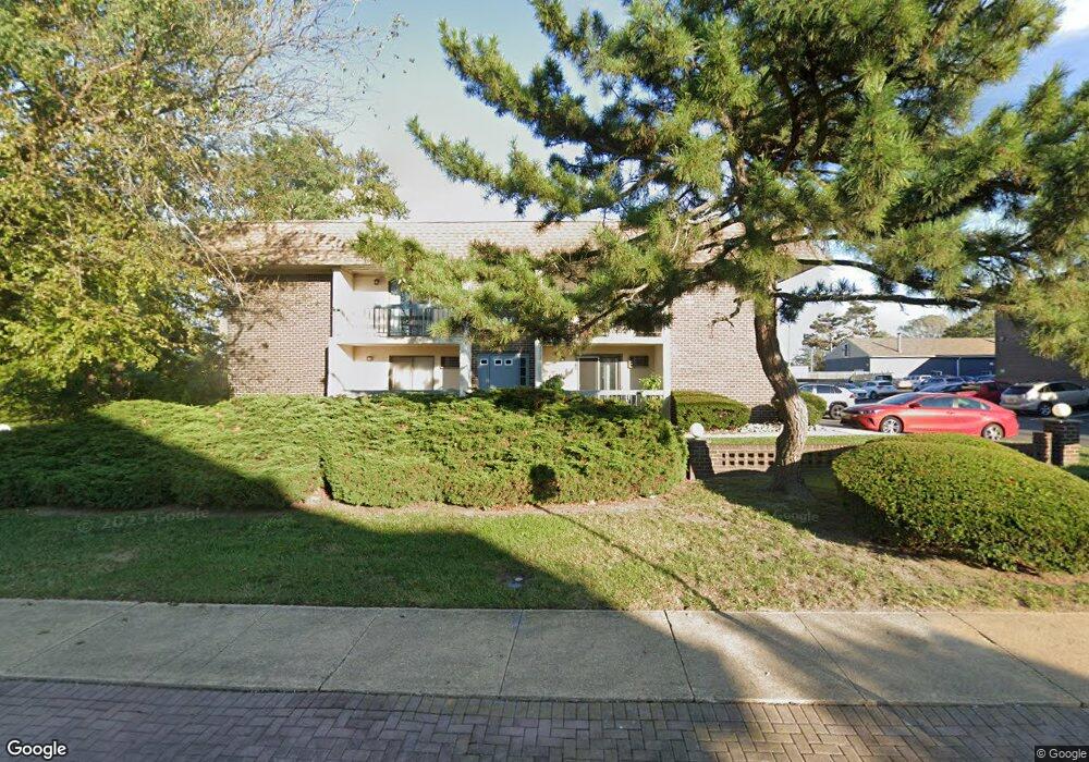
1320 State Route 71, Unit 110 Belmar, NJ 07719
Estimated Value: $272,000 - $344,000
1
Bed
1
Bath
780
Sq Ft
$414/Sq Ft
Est. Value
About This Home
This home is located at 1320 State Route 71 Unit 110, Belmar, NJ 07719 and is currently estimated at $322,677, approximately $413 per square foot. 1320 State Route 71 Unit 110 is a home located in Monmouth County with nearby schools including Belmar Elementary School, St. Rose Grammar School, and St Rose High School.
Ownership History
Date
Name
Owned For
Owner Type
Purchase Details
Closed on
May 7, 2011
Sold by
Federal National Mortgage Association
Bought by
Matthews Philip T
Current Estimated Value
Home Financials for this Owner
Home Financials are based on the most recent Mortgage that was taken out on this home.
Original Mortgage
$73,237
Outstanding Balance
$4,283
Interest Rate
4.05%
Mortgage Type
New Conventional
Estimated Equity
$318,394
Purchase Details
Closed on
Mar 10, 2010
Sold by
Marinelli Mary R
Bought by
Federal National Mortgage Association
Purchase Details
Closed on
May 21, 1999
Sold by
Giddio Stephen
Bought by
Crowell Garry
Home Financials for this Owner
Home Financials are based on the most recent Mortgage that was taken out on this home.
Original Mortgage
$49,850
Interest Rate
7.09%
Mortgage Type
FHA
Create a Home Valuation Report for This Property
The Home Valuation Report is an in-depth analysis detailing your home's value as well as a comparison with similar homes in the area
Home Values in the Area
Average Home Value in this Area
Purchase History
| Date | Buyer | Sale Price | Title Company |
|---|---|---|---|
| Matthews Philip T | $97,650 | First American Title Ins Co | |
| Federal National Mortgage Association | $151,000 | None Available | |
| Crowell Garry | $51,000 | -- |
Source: Public Records
Mortgage History
| Date | Status | Borrower | Loan Amount |
|---|---|---|---|
| Open | Matthews Philip T | $73,237 | |
| Previous Owner | Crowell Garry | $49,850 |
Source: Public Records
Tax History Compared to Growth
Tax History
| Year | Tax Paid | Tax Assessment Tax Assessment Total Assessment is a certain percentage of the fair market value that is determined by local assessors to be the total taxable value of land and additions on the property. | Land | Improvement |
|---|---|---|---|---|
| 2025 | $2,364 | $162,500 | $105,000 | $57,500 |
| 2024 | $2,285 | $162,500 | $105,000 | $57,500 |
| 2023 | $2,285 | $162,500 | $105,000 | $57,500 |
| 2022 | $2,205 | $162,500 | $105,000 | $57,500 |
| 2021 | $2,186 | $162,500 | $105,000 | $57,500 |
| 2020 | $2,186 | $162,500 | $105,000 | $57,500 |
| 2019 | $2,186 | $162,500 | $105,000 | $57,500 |
| 2018 | $2,007 | $162,500 | $105,000 | $57,500 |
| 2017 | $1,958 | $162,500 | $105,000 | $57,500 |
| 2016 | $1,554 | $81,300 | $29,000 | $52,300 |
| 2015 | $1,579 | $82,300 | $30,000 | $52,300 |
| 2014 | $1,399 | $72,300 | $20,000 | $52,300 |
Source: Public Records
About This Building
Map
Nearby Homes
- 823 13th Ave
- 704 15th Ave
- 1223 Briarwood Rd
- 1602 W Pine Tree Way Unit A
- 725 17th Ave
- 1000 River Rd Unit 4G
- 1208 Pine Tree Way
- 1236 Maplewood Rd
- 615 17th Ave
- 1622 Oakwood Rd
- 516 13th Ave
- 517 14th Ave
- 1630 Oakwood Rd
- 708-710 Main St
- 708 18th Ave
- 620 Redmond Ave
- 1012 Glenn St
- 1024 17th Ave
- 1014 Glenn St
- 1203 D St
- 1320 State Route 71 Unit 217
- 1320 State Route 71 Unit 215
- 1320 State Route 71 Unit 214
- 1320 State Route 71 Unit 212
- 1320 State Route 71 Unit 211
- 1320 State Route 71 Unit 210
- 1320 State Route 71 Unit 208
- 1320 State Route 71 Unit 207
- 1320 State Route 71 Unit 206
- 1320 State Route 71 Unit 205
- 1320 State Route 71 Unit 204
- 1320 State Route 71 Unit 203
- 1320 State Route 71 Unit 201
- 1320 State Route 71 Unit 117
- 1320 State Route 71 Unit 116
- 1320 State Route 71 Unit 115
- 1320 State Route 71 Unit 114
- 1320 State Route 71 Unit 112
- 1320 State Route 71 Unit 111
- 1320 State Route 71 Unit 108