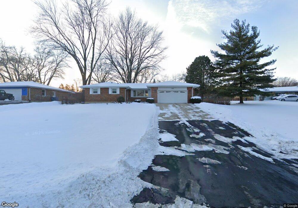
1320 Summit Dr Schaumburg, IL 60193
South Schaumburg NeighborhoodEstimated Value: $521,402 - $568,000
About This Home
This home is located at 1320 Summit Dr, Schaumburg, IL 60193 and is currently estimated at $534,851, approximately $304 per square foot. 1320 Summit Dr is a home located in Cook County with nearby schools including Frederick Nerge Elementary School, Margaret Mead Junior High School, and J B Conant High School.
Ownership History
We collect this data history from publicly available records. To have your information removed, we recommend requesting removal directly through your county’s website.
Purchase Details
Purchase Details
Home Financials for this Owner
Home Financials are based on the most recent Mortgage that was taken out on this home.Home Values in the Area
Average Home Value in this Area
Purchase History
We collect this data history from publicly available records. To have your information removed, we recommend requesting removal directly through your county’s website.
| Date | Buyer | Sale Price | Title Company |
|---|---|---|---|
| -- | None Available | ||
| $280,000 | -- |
Mortgage History
We collect this data history from publicly available records. To have your information removed, we recommend requesting removal directly through your county’s website.
| Date | Status | Borrower | Loan Amount |
|---|---|---|---|
| Closed | $115,000 |
Tax History
We collect this data history from publicly available records. To have your information removed, we recommend requesting removal directly through your county’s website.
| Year | Tax Paid | Tax Assessment Tax Assessment Total Assessment is a certain percentage of the fair market value that is determined by local assessors to be the total taxable value of land and additions on the property. | Land | Improvement |
|---|---|---|---|---|
| 2025 | $9,790 | $44,000 | $9,000 | $35,000 |
| 2024 | $9,790 | $36,128 | $8,000 | $28,128 |
| 2023 | $9,466 | $38,000 | $8,000 | $30,000 |
| 2022 | $9,466 | $38,000 | $8,000 | $30,000 |
| 2021 | $6,949 | $26,551 | $22,500 | $4,051 |
| 2020 | $7,790 | $26,551 | $22,500 | $4,051 |
| 2019 | $7,802 | $29,502 | $22,500 | $7,002 |
| 2018 | $7,058 | $24,555 | $19,000 | $5,555 |
| 2017 | $6,953 | $24,555 | $19,000 | $5,555 |
| 2016 | $8,178 | $29,303 | $19,000 | $10,303 |
| 2015 | $7,143 | $23,823 | $16,000 | $7,823 |
| 2014 | $7,082 | $23,823 | $16,000 | $7,823 |
| 2013 | $7,186 | $24,737 | $16,000 | $8,737 |
Map
- 1134 Jamestown Ct
- 1516 Sunset Dr
- 124 E Monterey Ave
- 1439 Blackhawk Dr
- 1067 Glouchester Harbor Unit 2802
- 1070 Glouchester Harbor Unit 2502
- 199 E Nerge Rd
- 310 Jennifer Ln
- 695 E Nerge Rd
- 626 Bryce Trail
- 613 Thames Dr
- 815 Claridge Ct
- 800 Shawnee Trail
- 1400 Marion St
- 113 W Monterey Ave
- 563 N Woodfield Trail Unit 2
- 826 Thornton Ct Unit 2AL
- 1630 Myrtle Park St
- 100 Pratt Blvd
- 842 Cross Creek Dr N Unit A1
- 331 E Niagara Ave
- 313 E Monterey Ave
- 321 E Niagara Ave
- 1300 Summit Dr
- 311 E Monterey Ave
- 326 E Niagara Ave
- 400 E Monterey Ave
- 401 E Niagara Ave
- 309 E Monterey Ave
- 1332 Summit Dr
- 320 E Niagara Ave
- 410 E Monterey Ave
- 411 E Niagara Ave
- 316 E Niagara Ave
- 1230 Summit Dr
- 307 E Monterey Ave
- 309 E Niagara Ave
- 306 E Monterey Ave
- 1335 Summit Dr
- 1233 Summit Dr
Ask me questions while you tour the home.