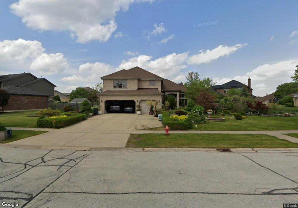
1320 Talcott Rd Woodridge, IL 60517
South Woodridge NeighborhoodEstimated Value: $697,000 - $753,000
--
Bed
--
Bath
3,155
Sq Ft
$230/Sq Ft
Est. Value
About This Home
This home is located at 1320 Talcott Rd, Woodridge, IL 60517 and is currently estimated at $724,950, approximately $229 per square foot. 1320 Talcott Rd is a home located in DuPage County with nearby schools including Oakwood School, River Valley School, and Old Quarry Middle School.
Ownership History
Date
Name
Owned For
Owner Type
Purchase Details
Closed on
Sep 29, 2006
Sold by
Standard Bank & Trust Co
Bought by
Vattappallil Nethaji N and Velayudhan Kunjumol P
Current Estimated Value
Home Financials for this Owner
Home Financials are based on the most recent Mortgage that was taken out on this home.
Original Mortgage
$417,000
Outstanding Balance
$249,382
Interest Rate
6.5%
Mortgage Type
Purchase Money Mortgage
Estimated Equity
$475,568
Create a Home Valuation Report for This Property
The Home Valuation Report is an in-depth analysis detailing your home's value as well as a comparison with similar homes in the area
Home Values in the Area
Average Home Value in this Area
Purchase History
| Date | Buyer | Sale Price | Title Company |
|---|---|---|---|
| Vattappallil Nethaji N | $518,000 | Ctic Dupage |
Source: Public Records
Mortgage History
| Date | Status | Borrower | Loan Amount |
|---|---|---|---|
| Open | Vattappallil Nethaji N | $417,000 |
Source: Public Records
Tax History Compared to Growth
Tax History
| Year | Tax Paid | Tax Assessment Tax Assessment Total Assessment is a certain percentage of the fair market value that is determined by local assessors to be the total taxable value of land and additions on the property. | Land | Improvement |
|---|---|---|---|---|
| 2024 | $10,988 | $230,439 | $89,754 | $140,685 |
| 2023 | $13,565 | $211,840 | $82,510 | $129,330 |
| 2022 | $13,464 | $209,540 | $81,620 | $127,920 |
| 2021 | $11,648 | $207,070 | $80,690 | $126,380 |
| 2020 | $12,891 | $202,970 | $79,090 | $123,880 |
| 2019 | $12,353 | $194,750 | $75,890 | $118,860 |
| 2018 | $10,908 | $195,770 | $75,400 | $120,370 |
| 2017 | $12,292 | $188,390 | $72,560 | $115,830 |
| 2016 | $12,424 | $179,800 | $69,250 | $110,550 |
| 2015 | $11,690 | $169,160 | $65,150 | $104,010 |
| 2014 | $11,978 | $164,470 | $63,340 | $101,130 |
| 2013 | $11,465 | $163,700 | $63,040 | $100,660 |
Source: Public Records
Map
Nearby Homes
- 20W260 Meadow Ln
- Fremont Plan at Farmingdale Village
- Eden Plan at Farmingdale Village
- Danbury Plan at Farmingdale Village
- Calysta Plan at Farmingdale Village
- Briarcliffe Plan at Farmingdale Village
- Amberwood Plan at Farmingdale Village
- 12193 Curragh Meadow Way
- 20W227 Pleasantdale Dr
- 20W270 Pleasantdale Dr
- 9014 Gloucester Rd
- 11S100 Carpenter St
- 9005 Gloucester Rd
- 9032 Lemont Rd
- 312 Homestead Dr
- 11S105 Carpenter St
- 10S241 Wallace Dr
- 8843 Oxford St
- 564 White Oak Rd
- 235 Capitol Dr
- 1420 Talcott Rd
- 9360 Keswick Dr
- 9340 Keswick Dr
- 9330 Keswick Dr
- 1307 Keswick Rd
- 1340 Witham Ln
- 1440 Talcott Rd
- 9320 Keswick Dr
- 1421 Talcott Rd
- 1520 Talcott Rd
- 1341 Witham Ln
- 1440 Witham Ln
- 1441 Talcott Rd
- 9260 Keswick Dr
- 1361 Witham Ln
- 9341 Keswick Dr
- 9321 Keswick Dr
- 1540 Talcott Rd
- 9361 Keswick Dr
- 1520 Witham Ln