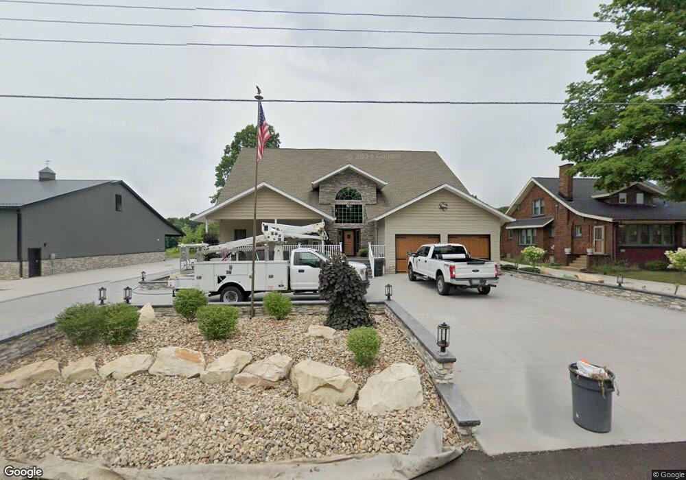
13203 Beeson St NE Alliance, OH 44601
Estimated Value: $354,000 - $580,000
2
Beds
3
Baths
4,085
Sq Ft
$118/Sq Ft
Est. Value
About This Home
This home is located at 13203 Beeson St NE, Alliance, OH 44601 and is currently estimated at $480,480, approximately $117 per square foot. 13203 Beeson St NE is a home located in Stark County with nearby schools including Marlington High School and Regina Coeli/St Joseph School.
Ownership History
Date
Name
Owned For
Owner Type
Purchase Details
Closed on
Nov 10, 2011
Sold by
Arbaugh Candy
Bought by
Kirkpatick Christopher T
Current Estimated Value
Purchase Details
Closed on
May 1, 2000
Sold by
Adams Cathryn V
Bought by
Kirkpatrick Christopher T and Arbaugh Candy
Home Financials for this Owner
Home Financials are based on the most recent Mortgage that was taken out on this home.
Original Mortgage
$54,000
Outstanding Balance
$18,790
Interest Rate
8.24%
Mortgage Type
Purchase Money Mortgage
Estimated Equity
$461,690
Create a Home Valuation Report for This Property
The Home Valuation Report is an in-depth analysis detailing your home's value as well as a comparison with similar homes in the area
Home Values in the Area
Average Home Value in this Area
Purchase History
| Date | Buyer | Sale Price | Title Company |
|---|---|---|---|
| Kirkpatick Christopher T | -- | Attorney | |
| Kirkpatrick Christopher T | $59,000 | Mk Title Agency Of Stark Cou |
Source: Public Records
Mortgage History
| Date | Status | Borrower | Loan Amount |
|---|---|---|---|
| Open | Kirkpatrick Christopher T | $54,000 |
Source: Public Records
Tax History Compared to Growth
Tax History
| Year | Tax Paid | Tax Assessment Tax Assessment Total Assessment is a certain percentage of the fair market value that is determined by local assessors to be the total taxable value of land and additions on the property. | Land | Improvement |
|---|---|---|---|---|
| 2025 | -- | $165,100 | $20,410 | $144,690 |
| 2024 | -- | $165,100 | $20,410 | $144,690 |
| 2023 | $4,409 | $125,200 | $10,820 | $114,380 |
| 2022 | $2,212 | $125,200 | $10,820 | $114,380 |
| 2021 | $4,439 | $125,200 | $10,820 | $114,380 |
| 2020 | $4,215 | $105,920 | $9,350 | $96,570 |
| 2019 | $4,185 | $105,920 | $9,350 | $96,570 |
| 2018 | $4,191 | $105,920 | $9,350 | $96,570 |
| 2017 | $4,190 | $99,120 | $8,890 | $90,230 |
| 2016 | $4,191 | $99,120 | $8,890 | $90,230 |
| 2015 | $917 | $22,790 | $8,890 | $13,900 |
| 2014 | $836 | $18,970 | $7,420 | $11,550 |
| 2013 | $416 | $18,970 | $7,420 | $11,550 |
Source: Public Records
Map
Nearby Homes
- 13061 Beeson St NE
- 13334 Cindy St NE
- 0 Meadow St NE
- 10666 Wilma Ave NE
- 0 W Main St Unit 5090123
- 11480 Aebi Ave NE
- 1430 Westwood Ave
- 000 Klinger Ave
- 2081 Marwood Cir
- 432 Johnson Ave
- 11940 Freshley Ave NE
- 0 Klinger Ave NE
- 11960 Freshley Ave NE
- 13109 Edison St NE
- 1201 Overlook Dr
- 0 Johnson Ave NE Unit 5142926
- 565 W Broadway St
- 0 Meadowbrook Ave
- 1038 Fairview Place
- 2377 Ansley St Unit 2377
- 13223 Beeson St NE
- 13231 Beeson St NE
- 13271 Beeson St NE
- 10586 Julie St NE
- 13161 Beeson St NE
- 13285 Beeson St NE
- 10608 Julie St NE
- 13295 Beeson St NE
- 10630 Julie St NE
- 10663 Julie St NE
- 13321 Beeson St NE
- 13091 Beeson St NE
- 13094 Beeson St NE
- 10654 Julie St NE
- 13331 Beeson St NE
- 13072 Beeson St NE
- 10670 Julie St NE
- 10692 Julie St NE
- 13060 Beeson St NE
- 13363 Beeson St NE