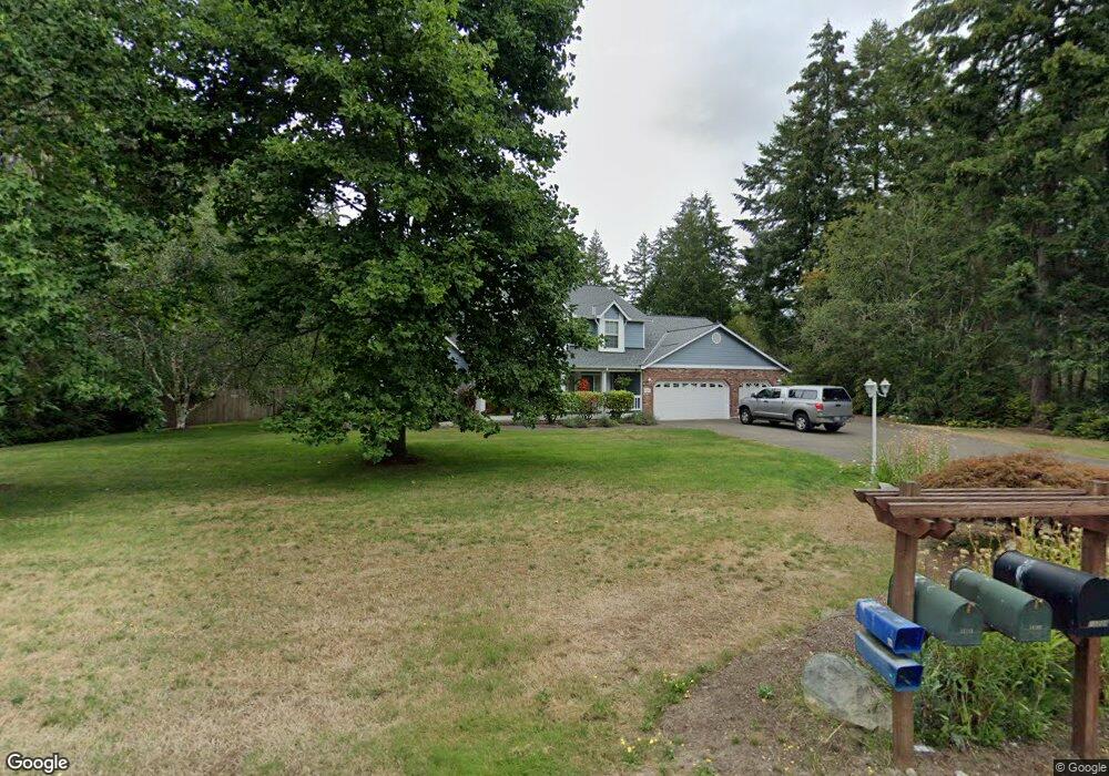
13207 130th Street Kp N Gig Harbor, WA 98329
Estimated Value: $842,000 - $1,069,291
3
Beds
3
Baths
2,525
Sq Ft
$382/Sq Ft
Est. Value
About This Home
This home is located at 13207 130th Street Kp N, Gig Harbor, WA 98329 and is currently estimated at $963,323, approximately $381 per square foot. 13207 130th Street Kp N is a home located in Pierce County with nearby schools including Vaughn Elementary School, Key Peninsula Middle School, and Peninsula High School.
Ownership History
Date
Name
Owned For
Owner Type
Purchase Details
Closed on
Feb 23, 2024
Sold by
Trowbridge Meredith and Trowbridge Tyler L
Bought by
Trowbridge Tyler L
Current Estimated Value
Home Financials for this Owner
Home Financials are based on the most recent Mortgage that was taken out on this home.
Original Mortgage
$861,350
Outstanding Balance
$846,270
Interest Rate
6.66%
Mortgage Type
VA
Estimated Equity
$117,053
Purchase Details
Closed on
Feb 22, 2024
Sold by
Lasalle Anita Marie and Whisenand Rachel
Bought by
Trowbridge Tyler L and Trowbridge Robert
Home Financials for this Owner
Home Financials are based on the most recent Mortgage that was taken out on this home.
Original Mortgage
$861,350
Outstanding Balance
$846,270
Interest Rate
6.66%
Mortgage Type
VA
Estimated Equity
$117,053
Purchase Details
Closed on
Feb 4, 2021
Sold by
Magee Richard Dean and Hasenpflug Tamara Anne
Bought by
Lasalle Anita Marie and Whisenand Rachel
Purchase Details
Closed on
Jan 29, 2021
Sold by
Whisenand Daniel and Whisenand Rachel
Bought by
Whisenand Rachel
Purchase Details
Closed on
Oct 22, 2010
Sold by
Wescott Mary T and Wescott Michael J
Bought by
Magee Richard Dean and Magee Tamara A
Home Financials for this Owner
Home Financials are based on the most recent Mortgage that was taken out on this home.
Original Mortgage
$408,600
Interest Rate
4.33%
Mortgage Type
VA
Purchase Details
Closed on
Aug 26, 2004
Sold by
Wescott Michael J
Bought by
Wescott Mary T
Home Financials for this Owner
Home Financials are based on the most recent Mortgage that was taken out on this home.
Original Mortgage
$296,000
Interest Rate
7.2%
Mortgage Type
Purchase Money Mortgage
Purchase Details
Closed on
Jul 26, 1999
Sold by
Bryant John C
Bought by
Laherty Thomas J and Laherty Elizabeth S
Home Financials for this Owner
Home Financials are based on the most recent Mortgage that was taken out on this home.
Original Mortgage
$223,600
Interest Rate
7.64%
Create a Home Valuation Report for This Property
The Home Valuation Report is an in-depth analysis detailing your home's value as well as a comparison with similar homes in the area
Home Values in the Area
Average Home Value in this Area
Purchase History
| Date | Buyer | Sale Price | Title Company |
|---|---|---|---|
| Trowbridge Tyler L | -- | Aegis Land Title | |
| Trowbridge Tyler L | $1,058,000 | Aegis Land Title | |
| Lasalle Anita Marie | $750,000 | New Title Company Name | |
| Whisenand Rachel | -- | Aegis Land Title Group | |
| Magee Richard Dean | $400,000 | Ticor | |
| Wescott Mary T | -- | Transnation Title | |
| Wescott Mary T | $370,000 | Transnation Title | |
| Laherty Thomas J | $279,500 | -- |
Source: Public Records
Mortgage History
| Date | Status | Borrower | Loan Amount |
|---|---|---|---|
| Open | Trowbridge Tyler L | $861,350 | |
| Previous Owner | Magee Richard Dean | $408,600 | |
| Previous Owner | Wescott Mary T | $296,000 | |
| Previous Owner | Laherty Thomas J | $223,600 | |
| Closed | Wescott Mary T | $74,000 |
Source: Public Records
Tax History Compared to Growth
Tax History
| Year | Tax Paid | Tax Assessment Tax Assessment Total Assessment is a certain percentage of the fair market value that is determined by local assessors to be the total taxable value of land and additions on the property. | Land | Improvement |
|---|---|---|---|---|
| 2025 | $7,524 | $972,100 | $271,100 | $701,000 |
| 2024 | $7,524 | $865,300 | $278,400 | $586,900 |
| 2023 | $7,524 | $837,300 | $304,800 | $532,500 |
| 2022 | $7,412 | $844,800 | $285,800 | $559,000 |
| 2021 | $6,785 | $631,400 | $161,200 | $470,200 |
| 2019 | $6,177 | $623,600 | $122,800 | $500,800 |
| 2018 | $6,308 | $584,200 | $107,300 | $476,900 |
| 2017 | $5,907 | $535,400 | $93,000 | $442,400 |
| 2016 | $5,299 | $453,800 | $80,600 | $373,200 |
| 2014 | $5,000 | $424,800 | $76,800 | $348,000 |
| 2013 | $5,000 | $403,500 | $72,000 | $331,500 |
Source: Public Records
Map
Nearby Homes
- 12718 131st St NW
- 13721 137th St NW
- 13112 Grouse Hollow Dr NW
- 14014 131st St NW
- 12901 122nd Ave NW
- 13202 142nd Ave NW
- 13619 Sandy Point East NW
- 12711 144th Ave NW
- 14413 134th St NW
- 13510 145th Ave NW
- 13257 118th Ave NW
- 13617 144th St NW
- 18703 Washington 302
- 5301 Washington 302
- 3151 Washington 302
- 14720 Parkdale Dr NW
- 11019 136th St NW
- 0 154th Ave NW Unit NWM2322039
- 0 X 154th Ave NW
- 12211 110th St NW
- 13207 130th Street Kp N Unit KN
- 13207 130th St NW
- 13217 130th Street Kp N Unit KN
- 13201 130th Street Kp N Unit KN
- 13208 130th Street Kp N Unit KN
- 13315 131st St NW
- 13315 131st St NW Unit KN
- 13214 130th Street Kp N Unit KN
- 13214 130th St NW
- 12925 132nd Ave NW Unit KN
- 13221 130th Street Kp N Unit KN
- 12917 133rd Avenue Kp N
- 12917 133rd Avenue Kp N Unit KN
- 12915 132nd Avenue Kp N
- 12915 132nd Avenue Kp N Unit KN
- 12917 133rd Ave NW
- 12911 132nd Ave NW
- 13214
- 12911 132nd Avenue Kp N
- 12911 132nd Avenue Kp N Unit KN