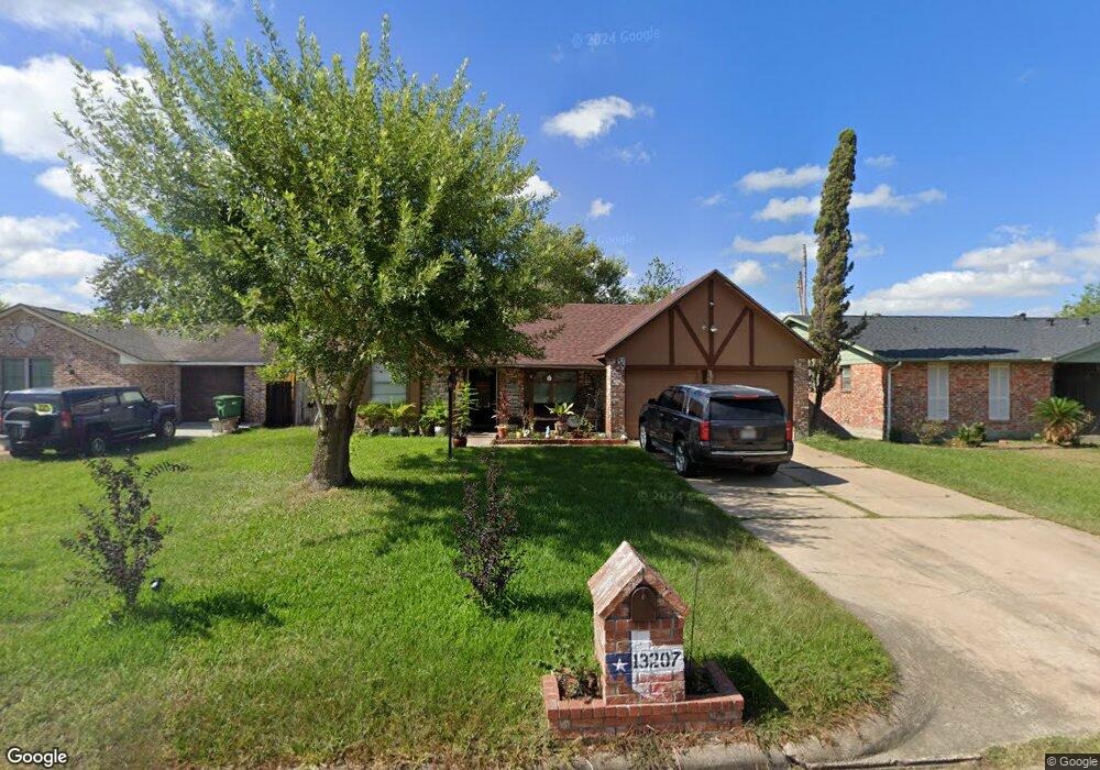
13207 Woodsdale Ct Houston, TX 77038
North Houston NeighborhoodEstimated Value: $214,255 - $244,000
3
Beds
2
Baths
1,518
Sq Ft
$151/Sq Ft
Est. Value
About This Home
This home is located at 13207 Woodsdale Ct, Houston, TX 77038 and is currently estimated at $229,064, approximately $150 per square foot. 13207 Woodsdale Ct is a home located in Harris County with nearby schools including Gloria B. Sammons Elementary School, Stovall School, and Dr. Viola K. Garcia Middle School.
Ownership History
Date
Name
Owned For
Owner Type
Purchase Details
Closed on
Jun 3, 2002
Sold by
Partida Maria E and Perez Joel G
Bought by
Lopez Mario and Lopez Narcedalia
Current Estimated Value
Home Financials for this Owner
Home Financials are based on the most recent Mortgage that was taken out on this home.
Original Mortgage
$76,500
Outstanding Balance
$38,116
Interest Rate
9.39%
Estimated Equity
$190,948
Purchase Details
Closed on
Jul 9, 2001
Sold by
Wells Fargo Bank Of Minnesota Natl Assn
Bought by
Partida Maria E
Home Financials for this Owner
Home Financials are based on the most recent Mortgage that was taken out on this home.
Original Mortgage
$54,000
Interest Rate
7.2%
Mortgage Type
Purchase Money Mortgage
Purchase Details
Closed on
Aug 10, 2000
Sold by
Grp Financial Services
Bought by
Grp Realty Corp
Purchase Details
Closed on
Aug 1, 2000
Sold by
Westmorland Helena Teresa
Bought by
Grp Financial Services
Create a Home Valuation Report for This Property
The Home Valuation Report is an in-depth analysis detailing your home's value as well as a comparison with similar homes in the area
Home Values in the Area
Average Home Value in this Area
Purchase History
| Date | Buyer | Sale Price | Title Company |
|---|---|---|---|
| Lopez Mario | -- | Chicago Title | |
| Partida Maria E | -- | First American Title | |
| Wells Fargo Bank Of Minnesota Natl Assn | -- | First American Title | |
| Grp Realty Corp | -- | -- | |
| Grp Financial Services | $52,255 | -- |
Source: Public Records
Mortgage History
| Date | Status | Borrower | Loan Amount |
|---|---|---|---|
| Open | Lopez Mario | $76,500 | |
| Previous Owner | Partida Maria E | $54,000 | |
| Closed | Lopez Mario | $3,000 |
Source: Public Records
Tax History Compared to Growth
Tax History
| Year | Tax Paid | Tax Assessment Tax Assessment Total Assessment is a certain percentage of the fair market value that is determined by local assessors to be the total taxable value of land and additions on the property. | Land | Improvement |
|---|---|---|---|---|
| 2025 | $3,123 | $188,860 | $35,650 | $153,210 |
| 2024 | $3,123 | $187,290 | $35,650 | $151,640 |
| 2023 | $3,123 | $187,290 | $35,650 | $151,640 |
| 2022 | $3,781 | $167,176 | $35,650 | $131,526 |
| 2021 | $3,561 | $144,359 | $21,390 | $122,969 |
| 2020 | $3,432 | $144,359 | $21,390 | $122,969 |
| 2019 | $3,236 | $124,370 | $21,390 | $102,980 |
| 2018 | $989 | $119,132 | $21,390 | $97,742 |
| 2017 | $2,625 | $119,132 | $21,390 | $97,742 |
| 2016 | $2,387 | $96,713 | $21,390 | $75,323 |
| 2015 | $1,753 | $98,187 | $21,390 | $76,797 |
| 2014 | $1,753 | $64,120 | $14,260 | $49,860 |
Source: Public Records
Map
Nearby Homes
- 2614 Lemonwood Ln
- 2530 Woodtown Dr
- 2719 Magnolia Hill Trail
- 2203 Chalet Rd
- 2811 Oakland Brook St
- 2115 Havencrest Dr
- 2831 Oakland Brook St
- 00 Fallbrook Dr
- 2835 Oakland Brook St
- 0 W Mt Houston Rd Unit 90464120
- 2838 Packard Elm St
- 1327 Fallbrook Dr
- 12718 Sai Baba Dr
- 10519 Pleasanton Dr
- 12611 Landon Light Ln
- 1219 Pilot Point Dr
- 10558 Pleasanton Dr
- 2919 Sunwood Dr
- 1506 Wilshire Park Dr
- 3127 Frick Rd
- 13211 Woodsdale Ct
- 13203 Woodsdale Ct
- 13206 Winding Wood Dr
- 13215 Woodsdale Ct
- 13210 Winding Wood Dr
- 13202 Winding Wood Dr
- 13214 Winding Wood Dr
- 13206 Woodsdale Ct
- 13210 Woodsdale Ct
- 13202 Woodsdale Ct
- 13115 Woodsdale Ct
- 13219 Woodsdale Ct
- 13214 Woodsdale Ct
- 13218 Winding Wood Dr
- 13154 Winding Wood Dr
- 13223 Woodsdale Ct
- 13114 Woodsdale Ct
- 2402 Woodsdale Blvd
- 2403 Woodwild Dr
- 13218 Woodsdale Ct