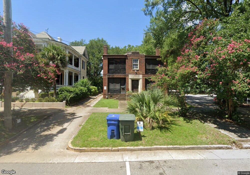
1321 Blanding St Columbia, SC 29201
Arsenal Hill NeighborhoodEstimated Value: $261,000 - $687,088
4
Beds
4
Baths
4,620
Sq Ft
$101/Sq Ft
Est. Value
About This Home
This home is located at 1321 Blanding St, Columbia, SC 29201 and is currently estimated at $466,772, approximately $101 per square foot. 1321 Blanding St is a home located in Richland County with nearby schools including Carver-Lyon Elementary School, W. A. Perry Middle School, and C. A. Johnson High School.
Ownership History
Date
Name
Owned For
Owner Type
Purchase Details
Closed on
Mar 13, 2019
Sold by
Mason Fordyce H
Bought by
Blanding I Llc
Current Estimated Value
Purchase Details
Closed on
Mar 5, 2019
Sold by
Mason Martha D
Bought by
Mason Fordyce H
Purchase Details
Closed on
Aug 18, 2005
Sold by
Fulda Barbara Anders and Land Amy Anders
Bought by
Anders Jason S
Home Financials for this Owner
Home Financials are based on the most recent Mortgage that was taken out on this home.
Original Mortgage
$270,000
Interest Rate
5.61%
Mortgage Type
Unknown
Create a Home Valuation Report for This Property
The Home Valuation Report is an in-depth analysis detailing your home's value as well as a comparison with similar homes in the area
Home Values in the Area
Average Home Value in this Area
Purchase History
| Date | Buyer | Sale Price | Title Company |
|---|---|---|---|
| Blanding I Llc | -- | None Available | |
| Mason Fordyce H | -- | None Available | |
| Anders Jason S | $355,794 | -- |
Source: Public Records
Mortgage History
| Date | Status | Borrower | Loan Amount |
|---|---|---|---|
| Previous Owner | Anders Jason S | $270,000 |
Source: Public Records
Tax History Compared to Growth
Tax History
| Year | Tax Paid | Tax Assessment Tax Assessment Total Assessment is a certain percentage of the fair market value that is determined by local assessors to be the total taxable value of land and additions on the property. | Land | Improvement |
|---|---|---|---|---|
| 2024 | $8,804 | $295,700 | $0 | $0 |
| 2023 | $8,636 | $0 | $0 | $0 |
| 2022 | $7,911 | $257,100 | $134,000 | $123,100 |
| 2021 | $7,971 | $15,430 | $0 | $0 |
| 2020 | $8,077 | $15,430 | $0 | $0 |
| 2019 | $8,098 | $15,430 | $0 | $0 |
| 2018 | $8,440 | $15,900 | $0 | $0 |
| 2017 | $8,222 | $15,900 | $0 | $0 |
| 2016 | $8,009 | $15,900 | $0 | $0 |
| 2015 | $7,964 | $15,900 | $0 | $0 |
| 2014 | $7,897 | $265,000 | $0 | $0 |
| 2013 | -- | $15,900 | $0 | $0 |
Source: Public Records
Map
Nearby Homes
- 800 Laurel St
- 2721 Park St
- 8 Townpark Cir
- 1728 Hampton St
- 824 Laurel St
- 36 Townpark Cir
- 1117 Kinard Ct
- 2233 Marion St
- 1722 Wayne St
- 2212 Park St
- 2212 Clark St
- 2230 Rembert St
- 2210 Lincoln St
- 1520 Senate St Unit 116
- 1520 Senate St Unit 195
- 1520 Senate St Unit 49
- 1520 Senate St Unit 204
- 1520 Senate St Unit 197
- 1520 Senate St Unit 71
- 128 Taylors Hill Dr
- 1321 Blanding St Unit 3
- 1321 Blanding St Unit 2
- 1321 Blanding St Unit 1
- 1321 Blanding St Unit 4
- 1317Bla Blanding St
- 1319 Blanding St
- 1317 Blanding St
- 1327 Blanding St
- 1315 Blanding St
- 1329 Blanding St
- 1418 Laurel St
- 1410 Blanding St
- 1813 Marion St
- 1209 Blanding St
- 1817 Marion St
- 1817 Marion St Unit 5
- 1817 Marion St Unit 1
- 1817 Marion St Unit 2
- 1817 Marion St Unit 3
- 1817 Marion St Unit 6