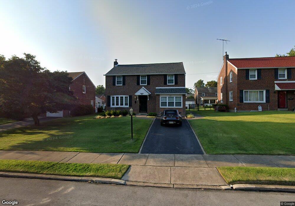
1321 Dermond Rd Drexel Hill, PA 19026
Estimated Value: $453,000 - $518,000
4
Beds
2
Baths
1,572
Sq Ft
$309/Sq Ft
Est. Value
About This Home
This home is located at 1321 Dermond Rd, Drexel Hill, PA 19026 and is currently estimated at $486,192, approximately $309 per square foot. 1321 Dermond Rd is a home located in Delaware County with nearby schools including Manoa Elementary School, Haverford Middle School, and Haverford Senior High School.
Ownership History
Date
Name
Owned For
Owner Type
Purchase Details
Closed on
Apr 25, 2011
Sold by
Kurtz Jacquelyn Powers and Powers Jacquelyn T
Bought by
Powers Jacquelyn T
Current Estimated Value
Home Financials for this Owner
Home Financials are based on the most recent Mortgage that was taken out on this home.
Original Mortgage
$237,350
Interest Rate
4.5%
Mortgage Type
FHA
Purchase Details
Closed on
May 24, 1996
Sold by
Kurtz Stephen W and Kurtz Jacquelyn Powers
Bought by
Kurtz Jacquelyn Powers and Powers Jacquelyn T
Create a Home Valuation Report for This Property
The Home Valuation Report is an in-depth analysis detailing your home's value as well as a comparison with similar homes in the area
Home Values in the Area
Average Home Value in this Area
Purchase History
| Date | Buyer | Sale Price | Title Company |
|---|---|---|---|
| Powers Jacquelyn T | -- | None Available | |
| Kurtz Jacquelyn Powers | -- | -- |
Source: Public Records
Mortgage History
| Date | Status | Borrower | Loan Amount |
|---|---|---|---|
| Closed | Powers Jacquelyn T | $237,350 |
Source: Public Records
Tax History Compared to Growth
Tax History
| Year | Tax Paid | Tax Assessment Tax Assessment Total Assessment is a certain percentage of the fair market value that is determined by local assessors to be the total taxable value of land and additions on the property. | Land | Improvement |
|---|---|---|---|---|
| 2025 | $7,411 | $288,220 | $95,190 | $193,030 |
| 2024 | $7,411 | $288,220 | $95,190 | $193,030 |
| 2023 | $7,200 | $288,220 | $95,190 | $193,030 |
| 2022 | $7,032 | $288,220 | $95,190 | $193,030 |
| 2021 | $11,456 | $288,220 | $95,190 | $193,030 |
| 2020 | $6,368 | $137,010 | $51,440 | $85,570 |
| 2019 | $6,251 | $137,010 | $51,440 | $85,570 |
| 2018 | $6,143 | $137,010 | $0 | $0 |
| 2017 | $6,013 | $137,010 | $0 | $0 |
| 2016 | $752 | $137,010 | $0 | $0 |
| 2015 | $752 | $137,010 | $0 | $0 |
| 2014 | $752 | $137,010 | $0 | $0 |
Source: Public Records
Map
Nearby Homes
- 2223 Steele Rd
- 181 Friendship Rd
- 736 Timber Trail Ln
- 104 Treaty Rd
- 505 Glendale Rd
- 5042 Sylvia Rd
- 5233 Arrowhead Ln
- 921 Addingham Ave
- 414 Stanfield Rd
- 4938 State Rd
- 412 N Rolling Rd
- 530 Hempstead Rd
- 1042 Blythe Ave
- 920 Alexander Ave
- 1029 Belfield Ave
- 833 Anderson Ave
- 333 Sussex Blvd
- 837 Alexander Ave
- 429 Portland Dr
- 1102 Childs Ave
- 1317 Dermond Rd
- 1325 Dermond Rd
- 216 Signal Rd
- 1333 Dermond Rd
- 1313 Dermond Rd
- 220 Signal Rd
- 212 Signal Rd
- 224 Signal Rd
- 1316 Dermond Rd
- 1320 Dermond Rd
- 208 Signal Rd
- 1329 Dermond Rd
- 1309 Dermond Rd
- 1312 Dermond Rd
- 1324 Dermond Rd
- 228 Signal Rd
- 1308 Dermond Rd
- 204 Signal Rd
- 1328 Dermond Rd
- 1305 Dermond Rd