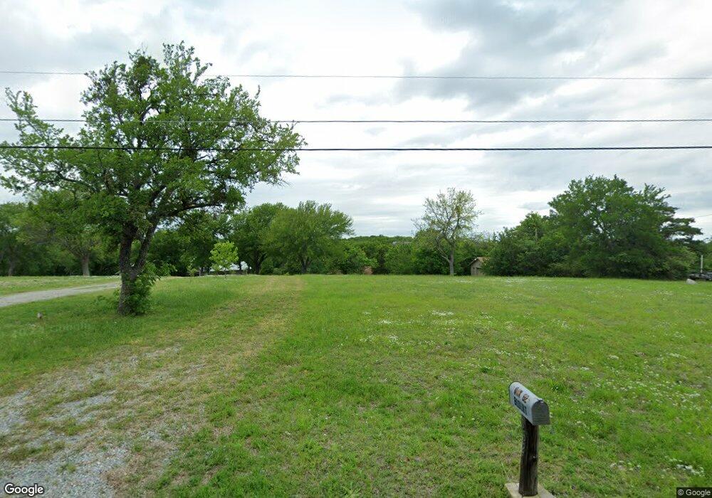
1321 Elm Ridge Rd Denison, TX 75020
Estimated Value: $508,000 - $728,000
--
Bed
--
Bath
888
Sq Ft
$673/Sq Ft
Est. Value
About This Home
This home is located at 1321 Elm Ridge Rd, Denison, TX 75020 and is currently estimated at $597,223, approximately $672 per square foot. 1321 Elm Ridge Rd is a home with nearby schools including Mayes Elementary School, Scott Middle School, and Denison High School.
Ownership History
Date
Name
Owned For
Owner Type
Purchase Details
Closed on
Apr 1, 2024
Sold by
Walker Maureen Blount and Kirby Land
Bought by
Ray Wesley and Ray Toni
Current Estimated Value
Purchase Details
Closed on
Jul 9, 2021
Sold by
Blount Michael Eugene
Bought by
Walker Maureen Blount and Walker Kirby Land
Purchase Details
Closed on
Feb 26, 2014
Sold by
Blount Easter Lue
Bought by
Walker Maureen Blount and Blount Michael Eugene
Create a Home Valuation Report for This Property
The Home Valuation Report is an in-depth analysis detailing your home's value as well as a comparison with similar homes in the area
Home Values in the Area
Average Home Value in this Area
Purchase History
| Date | Buyer | Sale Price | Title Company |
|---|---|---|---|
| Ray Wesley | -- | Independence Title | |
| Walker Maureen Blount | -- | None Available | |
| Walker Maureen Blount | -- | Independence Title Co |
Source: Public Records
Tax History Compared to Growth
Tax History
| Year | Tax Paid | Tax Assessment Tax Assessment Total Assessment is a certain percentage of the fair market value that is determined by local assessors to be the total taxable value of land and additions on the property. | Land | Improvement |
|---|---|---|---|---|
| 2025 | $10,208 | $630,688 | $531,101 | $99,587 |
| 2024 | $10,208 | $633,543 | $531,101 | $102,442 |
| 2023 | $9,626 | $596,559 | $491,924 | $104,635 |
| 2022 | $7,824 | $453,863 | $355,363 | $98,500 |
| 2021 | $6,509 | $348,064 | $274,995 | $73,069 |
| 2020 | $6,944 | $349,691 | $274,995 | $74,696 |
| 2019 | $7,434 | $350,923 | $274,995 | $75,928 |
| 2018 | $7,400 | $345,672 | $274,995 | $70,677 |
| 2017 | $5,780 | $268,330 | $198,350 | $69,980 |
| 2016 | $5,601 | $259,993 | $198,350 | $61,643 |
| 2015 | $0 | $232,316 | $198,350 | $33,966 |
| 2014 | -- | $218,276 | $198,350 | $19,926 |
Source: Public Records
Map
Nearby Homes
- Lot 80 Rocky Point E Bois d Arc Rd
- 37 Hanna Cove Dr
- 82 Sweet Gum St
- 2 Harbor View Cir
- Lot 4 Mariner Cay ES Hanna Dr
- Lot 5 Mariner Cay ES Hanna Dr
- 920 Hanna Dr
- 190 Neva Ln
- Lot 1A-1 Thompson Heights Dr
- Lot 2A-1 Thompson Heights Dr
- Lot 1A-2 Thompson Heights Dr
- 5.63 acres Thompson Heights Dr
- 000 Eisenhower Rd
- 193 Eisenhower Rd
- Lot 2 Lakeview Dr
- 594 Lukehaven Dr
- 221 Clayton Dr
- 287 Pecan Dr
- 192 Ila Dr
- TBD Clayton Dr
- 1317 Elm Ridge Rd
- 1361 Elmridge Rd
- 1297 Elm Ridge
- 1297 Elm Ridge Rd
- 1427 Elmridge Rd
- 1282 Elm Ridge Rd
- 1282 Elmridge Rd
- 1269 Elmridge Rd
- 1354 Elmridge Rd
- 1253 Elmridge Rd
- 1429 Elmridge Rd
- 1260 Elmridge Rd
- 1388 Elmridge Rd
- 1215 Elmridge Rd
- 1224 Elmridge Rd
- 1485 Elmridge Rd
- 1183 Elmridge Rd
- 1214 Elmridge Rd
- 1157 Elmridge Rd
- Lot 61 Elm Ridge Rd
