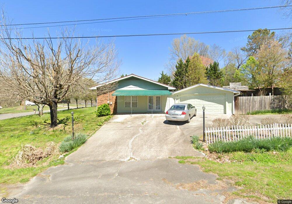
1321 N Michael Dr Tunnel Hill, GA 30755
Estimated Value: $216,000 - $375,000
--
Bed
2
Baths
1,943
Sq Ft
$139/Sq Ft
Est. Value
About This Home
This home is located at 1321 N Michael Dr, Tunnel Hill, GA 30755 and is currently estimated at $269,853, approximately $138 per square foot. 1321 N Michael Dr is a home located in Whitfield County with nearby schools including Westside Elementary School, Westside Middle School, and Northwest Whitfield County High School.
Ownership History
Date
Name
Owned For
Owner Type
Purchase Details
Closed on
Jun 5, 2020
Sold by
Selby Connie
Bought by
Hill Scott and Bell Sheri
Current Estimated Value
Home Financials for this Owner
Home Financials are based on the most recent Mortgage that was taken out on this home.
Original Mortgage
$50,000
Outstanding Balance
$44,321
Interest Rate
3.2%
Mortgage Type
Commercial
Estimated Equity
$225,532
Purchase Details
Closed on
Apr 14, 2004
Sold by
Selby David B
Bought by
Selby Connie
Create a Home Valuation Report for This Property
The Home Valuation Report is an in-depth analysis detailing your home's value as well as a comparison with similar homes in the area
Home Values in the Area
Average Home Value in this Area
Purchase History
| Date | Buyer | Sale Price | Title Company |
|---|---|---|---|
| Hill Scott | $50,000 | -- | |
| Selby Connie | -- | -- |
Source: Public Records
Mortgage History
| Date | Status | Borrower | Loan Amount |
|---|---|---|---|
| Open | Hill Scott | $50,000 |
Source: Public Records
Tax History Compared to Growth
Tax History
| Year | Tax Paid | Tax Assessment Tax Assessment Total Assessment is a certain percentage of the fair market value that is determined by local assessors to be the total taxable value of land and additions on the property. | Land | Improvement |
|---|---|---|---|---|
| 2024 | $1,945 | $94,866 | $8,400 | $86,466 |
| 2023 | $1,911 | $64,778 | $5,250 | $59,528 |
| 2022 | $1,405 | $47,627 | $5,250 | $42,377 |
| 2021 | $590 | $49,229 | $5,250 | $43,979 |
| 2020 | $343 | $49,229 | $5,250 | $43,979 |
| 2019 | $321 | $46,201 | $5,250 | $40,951 |
| 2018 | $334 | $46,201 | $5,250 | $40,951 |
| 2017 | $334 | $46,201 | $5,250 | $40,951 |
| 2016 | $407 | $42,706 | $5,250 | $37,456 |
| 2014 | $328 | $42,706 | $5,250 | $37,456 |
| 2013 | -- | $42,705 | $5,250 | $37,455 |
Source: Public Records
Map
Nearby Homes
- 321 Whitmire Cir
- 130 Jocelyn Way
- 200 England Dr
- 1105 Mcclure Dr
- 1127 Mount Vernon Rd
- 140 Ault Dr
- 674 Shadow Leaf Ln
- 3038 Chattanooga Rd
- 1113 Mount Vernon Rd
- 359 Lafayette Rd
- 638 Pine Oaks Dr
- 1098 Mount Vernon Rd
- Lot 2 Hillside Dr
- 616 Pine Oaks Dr
- 250 Pinnacle Pointe Dr Unit 22
- 4579 Dogwood Valley Rd
- 00 Chattanooga Rd
- 191 Mayfield Dr
- 946 Old Cottonwood Mill Rd
- 0 Chattanooga Rd
- 638 Carol Dr
- 1315 N Michael Dr
- 1331 N Michael Dr
- 1322 N Michael Dr
- 639 Louise Dr
- 632 Carol Dr
- 1314 N Michael Dr
- 1330 N Michael Dr
- 1330 N Michael Dr
- 635 Louise Dr
- 1337 N Michael Dr
- 633 Carol Dr
- 646 Louise Dr
- 1395 David Cir
- 1391 David Cir
- 1308 N Michael Dr
- 640 Louise Dr
- 1427 David Cir
- 631 Louise Dr
- 634 Louise Dr