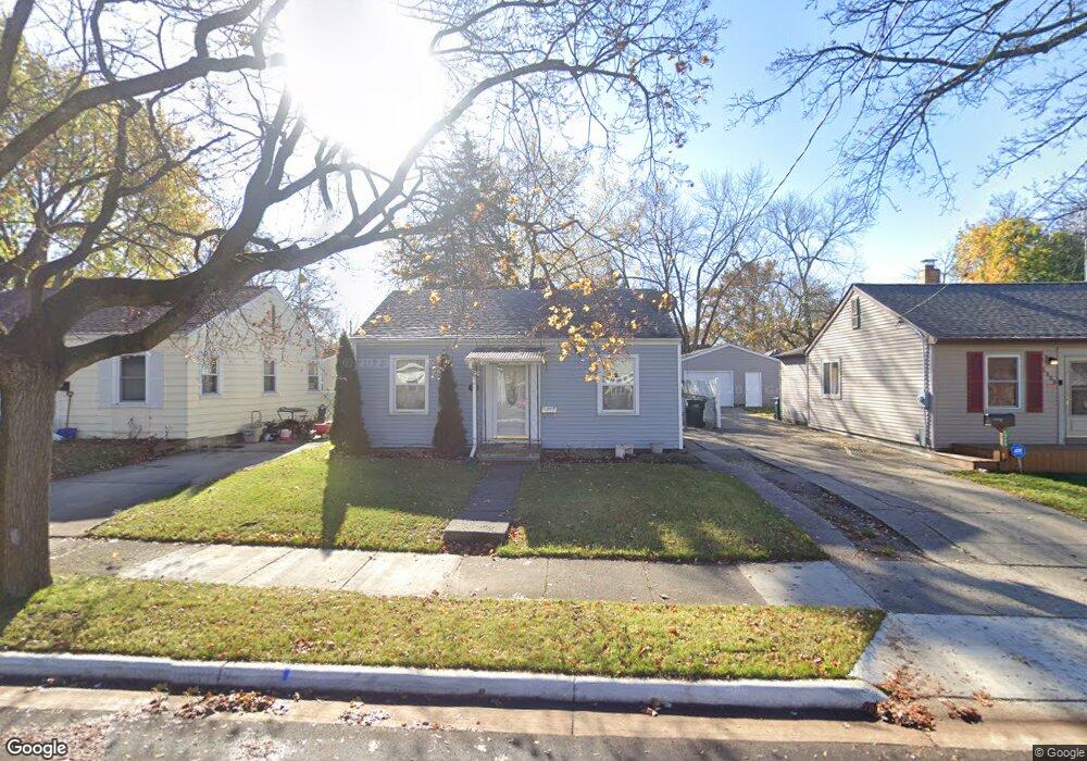
1321 Woodbine Ave Lansing, MI 48910
Colonial Village NeighborhoodEstimated Value: $103,489 - $137,000
2
Beds
1
Bath
1,364
Sq Ft
$87/Sq Ft
Est. Value
About This Home
This home is located at 1321 Woodbine Ave, Lansing, MI 48910 and is currently estimated at $119,122, approximately $87 per square foot. 1321 Woodbine Ave is a home located in Ingham County with nearby schools including Averill Elementary School, Attwood School, and J.W. Sexton High School.
Ownership History
Date
Name
Owned For
Owner Type
Purchase Details
Closed on
Oct 18, 2023
Sold by
Hackworth Joan
Bought by
Tenhove Gregory
Current Estimated Value
Purchase Details
Closed on
Dec 18, 2014
Sold by
Hackworth Ray and Hackworth Joan
Bought by
Lira Beverly S
Purchase Details
Closed on
Mar 24, 2010
Sold by
Taylor Gloria Anne and Nichols Vedetta M
Bought by
Hackworth Ray and Hackworth Joan
Create a Home Valuation Report for This Property
The Home Valuation Report is an in-depth analysis detailing your home's value as well as a comparison with similar homes in the area
Home Values in the Area
Average Home Value in this Area
Purchase History
| Date | Buyer | Sale Price | Title Company |
|---|---|---|---|
| Tenhove Gregory | $73,500 | Ata National Title | |
| Lira Beverly S | -- | None Available | |
| Hackworth Ray | $19,500 | Midstate |
Source: Public Records
Tax History Compared to Growth
Tax History
| Year | Tax Paid | Tax Assessment Tax Assessment Total Assessment is a certain percentage of the fair market value that is determined by local assessors to be the total taxable value of land and additions on the property. | Land | Improvement |
|---|---|---|---|---|
| 2025 | $3,561 | $44,800 | $7,400 | $37,400 |
| 2024 | $30 | $42,500 | $7,400 | $35,100 |
| 2023 | $2,495 | $39,100 | $7,400 | $31,700 |
| 2022 | $2,279 | $35,300 | $7,400 | $27,900 |
| 2021 | $2,226 | $33,000 | $7,100 | $25,900 |
| 2020 | $2,211 | $31,100 | $7,100 | $24,000 |
| 2019 | $2,135 | $29,400 | $7,100 | $22,300 |
| 2018 | $2,025 | $26,300 | $7,100 | $19,200 |
| 2017 | $1,949 | $26,300 | $7,100 | $19,200 |
| 2016 | $1,871 | $25,900 | $7,100 | $18,800 |
| 2015 | $1,871 | $25,200 | $14,129 | $11,071 |
| 2014 | $1,871 | $24,700 | $15,815 | $8,885 |
Source: Public Records
Map
Nearby Homes
- 1404 Kelsey Ave
- 2118 Marion Ave
- 1420 Poxson Ave
- 1120 Kelsey Ave
- 1618 Loraine Ave
- 1032 Kelsey Ave
- 2515 S Martin Luther King Junior Blvd
- 2310 Stirling Ave
- 1312 W Mount Hope Ave
- 2112 Stirling Ave
- 1315 Goodrich St
- 2421 Stirling Ave
- 1114 Goodrich St
- 1607 Holly Way
- 815 Woodbine Ave
- 1913 Stirling Ave
- 907 Lenore Ave
- 1116 George St
- 2313 S Rundle Ave
- 1721 Fletcher St
- 1325 Woodbine Ave
- 1317 Woodbine Ave
- 1315 Woodbine Ave
- 1403 Woodbine Ave
- 1320 Kelsey Ave
- 1316 Kelsey Ave
- 1407 Woodbine Ave
- 1400 Kelsey Ave
- 1309 Woodbine Ave
- 1314 Kelsey Ave
- 1316 Woodbine Ave
- 1322 Woodbine Ave
- 1413 Woodbine Ave
- 1400 Woodbine Ave
- 1312 Woodbine Ave
- 2412 Marion Ave
- 1408 Kelsey Ave
- 2402 Marion Ave
- 1404 Woodbine Ave
- 1300 Woodbine Ave