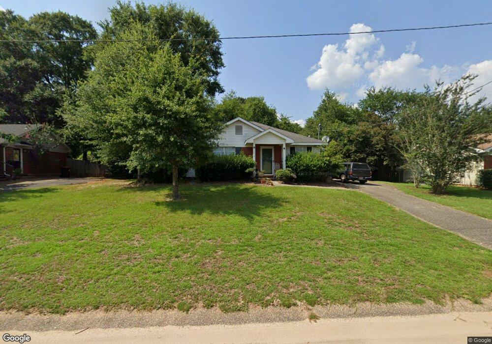
13210 Buckthorn Ct Mobile, AL 36608
Outer West Mobile NeighborhoodEstimated Value: $177,356 - $205,000
3
Beds
2
Baths
1,203
Sq Ft
$157/Sq Ft
Est. Value
About This Home
This home is located at 13210 Buckthorn Ct, Mobile, AL 36608 and is currently estimated at $189,089, approximately $157 per square foot. 13210 Buckthorn Ct is a home located in Mobile County with nearby schools including Hutchens Elementary School, Dawes Intermediate School, and Bernice J Causey Middle School.
Ownership History
Date
Name
Owned For
Owner Type
Purchase Details
Closed on
Aug 18, 2009
Sold by
James Robert D and James June M
Bought by
Smith Michael J
Current Estimated Value
Home Financials for this Owner
Home Financials are based on the most recent Mortgage that was taken out on this home.
Original Mortgage
$115,020
Outstanding Balance
$74,917
Interest Rate
5.19%
Mortgage Type
VA
Estimated Equity
$114,172
Purchase Details
Closed on
Nov 26, 1997
Sold by
Rlb Inc
Bought by
Turner Steven Todd and Norwood Amy Xarisse
Home Financials for this Owner
Home Financials are based on the most recent Mortgage that was taken out on this home.
Original Mortgage
$54,300
Interest Rate
7.35%
Create a Home Valuation Report for This Property
The Home Valuation Report is an in-depth analysis detailing your home's value as well as a comparison with similar homes in the area
Home Values in the Area
Average Home Value in this Area
Purchase History
| Date | Buyer | Sale Price | Title Company |
|---|---|---|---|
| Smith Michael J | -- | Slt | |
| Turner Steven Todd | -- | -- |
Source: Public Records
Mortgage History
| Date | Status | Borrower | Loan Amount |
|---|---|---|---|
| Open | Smith Michael J | $115,020 | |
| Previous Owner | Turner Steven Todd | $54,300 |
Source: Public Records
Tax History Compared to Growth
Tax History
| Year | Tax Paid | Tax Assessment Tax Assessment Total Assessment is a certain percentage of the fair market value that is determined by local assessors to be the total taxable value of land and additions on the property. | Land | Improvement |
|---|---|---|---|---|
| 2024 | $743 | $14,620 | $3,600 | $11,020 |
| 2023 | $712 | $12,280 | $3,600 | $8,680 |
| 2022 | $461 | $10,870 | $3,000 | $7,870 |
| 2021 | $418 | $9,980 | $3,000 | $6,980 |
| 2020 | $423 | $10,080 | $3,000 | $7,080 |
| 2019 | $413 | $9,900 | $0 | $0 |
| 2018 | $417 | $9,980 | $0 | $0 |
| 2017 | $492 | $10,080 | $0 | $0 |
| 2016 | $421 | $10,060 | $0 | $0 |
| 2013 | $457 | $9,960 | $0 | $0 |
Source: Public Records
Map
Nearby Homes
- 13190 Hackberry Dr
- 2865 Barlett Dr
- #77 Deer Crest Dr
- 0 Deer Crest Ln Unit 7676050
- 00 Deer Crest Ln
- 2760 Wildflower Dr W
- 0 Newman Rd Unit 7559706
- 0 Newman Rd Unit 22348691
- 0 Newman Rd Unit 7559703
- 0 Newman Rd Unit 7559705
- 0 Newman Rd Unit 25399577
- 0 Newman Rd Unit 7559708
- 0 Newman Rd Unit 7559711
- 0 Newman Rd Unit 7493775
- 0 Newman Rd Unit 7670125
- 0 Newman Rd Unit 22348697
- 0 Newman Rd Unit 7652668
- 0 Newman Rd Unit 7499863
- 14201 Airport Blvd
- 12171 Yancey Glen Dr
- 13190 Buckthorn Ct
- 13220 Buckthorn Ct
- 13230 Buckthorn Ct
- 13205 Hackberry Dr
- 13225 Buckthorn Ct
- 13215 Hackberry Dr
- 13170 Buckthorn Ct
- 13240 Buckthorn Ct
- 13225 Hackberry Dr
- 13195 Hackberry Dr
- 13250 Buckthorn Ct
- 2956 Bear Oak Ct
- 13235 Hackberry Dr
- 2957 Bear Oak Ct
- 13160 Buckthorn Ct
- 13260 Buckthorn Ct
- 2966 Bear Oak Ct
- 13245 Buckthorn Ct
- 13245 Hackberry Dr
- 13173 Buckthorn Ct