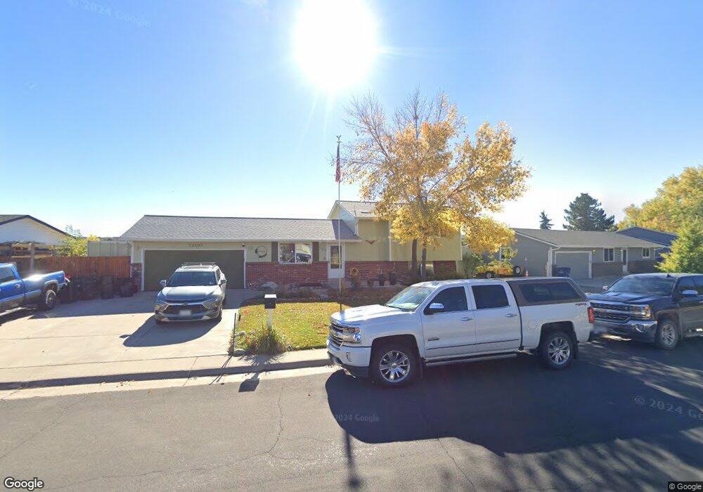
13210 Mercury Dr Lone Tree, CO 80124
Estimated Value: $561,607 - $575,000
3
Beds
2
Baths
1,955
Sq Ft
$291/Sq Ft
Est. Value
About This Home
This home is located at 13210 Mercury Dr, Lone Tree, CO 80124 and is currently estimated at $568,304, approximately $290 per square foot. 13210 Mercury Dr is a home located in Douglas County with nearby schools including Acres Green Elementary School, Cresthill Middle School, and Highlands Ranch High School.
Ownership History
Date
Name
Owned For
Owner Type
Purchase Details
Closed on
Oct 24, 2012
Sold by
Mcgruder Robert W
Bought by
Mcgruder Robert W and Mcgruder Ingrid A
Current Estimated Value
Home Financials for this Owner
Home Financials are based on the most recent Mortgage that was taken out on this home.
Original Mortgage
$182,000
Outstanding Balance
$126,503
Interest Rate
3.59%
Mortgage Type
New Conventional
Estimated Equity
$441,801
Purchase Details
Closed on
May 7, 2010
Sold by
Mcgruder William R and Mcgruder Judith E
Bought by
Mcgruder Robert W
Home Financials for this Owner
Home Financials are based on the most recent Mortgage that was taken out on this home.
Original Mortgage
$154,941
Interest Rate
5.5%
Mortgage Type
FHA
Purchase Details
Closed on
Mar 4, 2009
Sold by
Deutsche Bank National Trust Company
Bought by
Mcgruder William R and Mcgruder Judith E
Home Financials for this Owner
Home Financials are based on the most recent Mortgage that was taken out on this home.
Original Mortgage
$132,000
Interest Rate
5.14%
Mortgage Type
Unknown
Purchase Details
Closed on
Sep 19, 2008
Sold by
Ulrickson Amy M and Ulrickson William A
Bought by
Deutsche Bank National Trust Co
Purchase Details
Closed on
Jul 14, 2008
Sold by
Ulrickson William A and Ulrickson Amy M
Bought by
13210 Mercury Drive Family Trust
Purchase Details
Closed on
Feb 28, 2006
Sold by
Osborn Patricia Mayer
Bought by
Ulrickson William A and Ulrickson Amy M
Home Financials for this Owner
Home Financials are based on the most recent Mortgage that was taken out on this home.
Original Mortgage
$208,250
Interest Rate
7.99%
Mortgage Type
Unknown
Purchase Details
Closed on
Sep 24, 1997
Sold by
Gerding David D and Medina Laura T
Bought by
Osborn Patricia Mayer
Home Financials for this Owner
Home Financials are based on the most recent Mortgage that was taken out on this home.
Original Mortgage
$130,235
Interest Rate
7.49%
Purchase Details
Closed on
May 21, 1992
Sold by
Linden Glenda M
Bought by
Gerding David D and Medina Laura T
Purchase Details
Closed on
Dec 8, 1987
Sold by
Linden Frank R
Bought by
Linden Glenda M
Purchase Details
Closed on
Apr 13, 1979
Sold by
Unavailable
Bought by
Unavailable
Create a Home Valuation Report for This Property
The Home Valuation Report is an in-depth analysis detailing your home's value as well as a comparison with similar homes in the area
Home Values in the Area
Average Home Value in this Area
Purchase History
| Date | Buyer | Sale Price | Title Company |
|---|---|---|---|
| Mcgruder Robert W | -- | None Available | |
| Mcgruder Robert W | $157,800 | Heritage Title | |
| Mcgruder William R | $165,000 | None Available | |
| Deutsche Bank National Trust Co | -- | None Available | |
| 13210 Mercury Drive Family Trust | -- | None Available | |
| Ulrickson William A | $245,000 | Fahtco | |
| Osborn Patricia Mayer | $137,090 | -- | |
| Gerding David D | $99,000 | -- | |
| Linden Glenda M | -- | -- | |
| Unavailable | $53,600 | -- |
Source: Public Records
Mortgage History
| Date | Status | Borrower | Loan Amount |
|---|---|---|---|
| Open | Mcgruder Robert W | $182,000 | |
| Closed | Mcgruder Robert W | $154,941 | |
| Previous Owner | Mcgruder William R | $132,000 | |
| Previous Owner | Ulrickson William A | $208,250 | |
| Previous Owner | Osborn Patricia Mayer | $130,235 |
Source: Public Records
Tax History Compared to Growth
Tax History
| Year | Tax Paid | Tax Assessment Tax Assessment Total Assessment is a certain percentage of the fair market value that is determined by local assessors to be the total taxable value of land and additions on the property. | Land | Improvement |
|---|---|---|---|---|
| 2024 | $3,474 | $41,540 | $8,480 | $33,060 |
| 2023 | $3,509 | $41,540 | $8,480 | $33,060 |
| 2022 | $2,592 | $29,110 | $7,200 | $21,910 |
| 2021 | $2,696 | $29,110 | $7,200 | $21,910 |
| 2020 | $2,557 | $28,290 | $7,300 | $20,990 |
| 2019 | $2,566 | $28,290 | $7,300 | $20,990 |
| 2018 | $1,918 | $22,650 | $6,360 | $16,290 |
| 2017 | $1,949 | $22,650 | $6,360 | $16,290 |
| 2016 | $1,856 | $21,120 | $4,470 | $16,650 |
| 2015 | $1,898 | $21,120 | $4,470 | $16,650 |
| 2014 | $1,637 | $17,060 | $4,580 | $12,480 |
Source: Public Records
Map
Nearby Homes
- 13134 Deneb Dr
- 13117 Deneb Dr
- 181 Dianna Dr
- 130 Dianna Dr
- 13483 Achilles Dr
- 13542 Achilles Dr
- 8159 Lodgepole Trail
- 108 Olympus Cir
- 789 Hamal Dr
- 8860 Kachina Way
- 8822 Fiesta Terrace
- 802 Altair Dr
- 9308 Miles Dr Unit 5
- 9493 Southern Hills Cir Unit A25
- 9275 Erminedale Dr
- 9412 La Quinta Way
- 9445 Aspen Hill Cir
- 7057 Chestnut Hill St
- 8733 Fairview Oaks Ln
- 7041 Chestnut Hill Trail
- 13216 Mercury Dr
- 13198 Mercury Dr
- 13205 Mercury Dr
- 13222 Mercury Dr
- 13192 Mercury Dr
- 13211 Mercury Dr
- 13199 Mercury Dr
- 13217 Mercury Dr
- 13193 Mercury Dr
- 13186 Mercury Dr
- 13246 Saturn Dr
- 13226 Saturn Dr
- 13256 Saturn Dr
- 13223 Mercury Dr
- 13187 Mercury Dr
- 13194 Saturn Dr
- 13266 Saturn Dr
- 13229 Mercury Dr
- 13174 Saturn Dr
- 13240 Mercury Dr