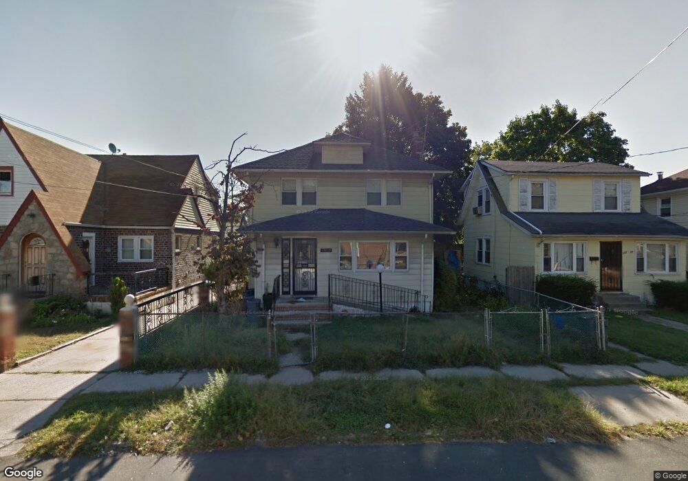
13213 220th St Springfield Gardens, NY 11413
Laurelton NeighborhoodEstimated Value: $567,000 - $700,798
--
Bed
--
Bath
1,182
Sq Ft
$542/Sq Ft
Est. Value
About This Home
This home is located at 13213 220th St, Springfield Gardens, NY 11413 and is currently estimated at $640,700, approximately $542 per square foot. 13213 220th St is a home located in Queens County with nearby schools including P.S. 132 - Ralph Bunche, Is 59 Springfield Gardens, and Merrick Academy Charter School.
Ownership History
Date
Name
Owned For
Owner Type
Purchase Details
Closed on
Feb 5, 2015
Sold by
Melk Holding Llc
Bought by
Doris Audrey and Sosanya Natallie
Current Estimated Value
Home Financials for this Owner
Home Financials are based on the most recent Mortgage that was taken out on this home.
Original Mortgage
$565,475
Outstanding Balance
$432,791
Interest Rate
3.74%
Mortgage Type
Commercial
Estimated Equity
$207,909
Purchase Details
Closed on
Jun 17, 2014
Sold by
Daryl Spencer As Administrator
Bought by
Melk Holding Llc
Create a Home Valuation Report for This Property
The Home Valuation Report is an in-depth analysis detailing your home's value as well as a comparison with similar homes in the area
Home Values in the Area
Average Home Value in this Area
Purchase History
| Date | Buyer | Sale Price | Title Company |
|---|---|---|---|
| Doris Audrey | $585,000 | -- | |
| Melk Holding Llc | $220,000 | -- |
Source: Public Records
Mortgage History
| Date | Status | Borrower | Loan Amount |
|---|---|---|---|
| Open | Doris Audrey | $565,475 |
Source: Public Records
Tax History Compared to Growth
Tax History
| Year | Tax Paid | Tax Assessment Tax Assessment Total Assessment is a certain percentage of the fair market value that is determined by local assessors to be the total taxable value of land and additions on the property. | Land | Improvement |
|---|---|---|---|---|
| 2025 | $5,757 | $28,663 | $7,297 | $21,366 |
| 2024 | $5,757 | $28,663 | $8,742 | $19,921 |
| 2023 | $5,713 | $28,445 | $9,605 | $18,840 |
| 2022 | $5,357 | $37,740 | $12,480 | $25,260 |
| 2021 | $5,328 | $35,340 | $12,480 | $22,860 |
| 2020 | $5,056 | $31,680 | $12,480 | $19,200 |
| 2019 | $4,997 | $29,760 | $12,480 | $17,280 |
| 2018 | $4,832 | $23,704 | $9,097 | $14,607 |
| 2017 | $4,559 | $22,364 | $9,050 | $13,314 |
| 2016 | $4,218 | $22,364 | $9,050 | $13,314 |
| 2015 | $2,325 | $19,905 | $9,846 | $10,059 |
| 2014 | $2,325 | $19,905 | $11,495 | $8,410 |
Source: Public Records
Map
Nearby Homes
- 21931 133rd Ave
- 21917 132nd Rd
- 133-15 220th St
- 218-36 133rd Rd
- 131-35 222nd St
- 21924 130th Dr
- 130-45 220th St
- 134-16 221st St
- 134-15 221st St
- 22310 131st Ave
- 13049 217th St
- 220-27 134th Rd
- 131-20 224th St
- 130-55 222nd St
- 220-24 134th Rd
- 21608 Merrick Blvd
- 130-25 217th St
- 22014 130th Ave
- 22014 130th Ave
- 22126 134th Rd
- 13217 220th St
- 13211 220th St
- 13207 220th St
- 13221 220th St
- 13138 221st St
- 13142 221st St
- 13203 220th St
- 13134 221st St
- 13227 220th St
- 13148 221st St
- 21937 132nd Rd
- 13125 220th St
- 13130 221st St
- 21931 132nd Rd
- 13208 220th St
- 13154 221st St
- 13121 220th St
- 13126 221st St
- 13121 220th St
- 131-62 221st St