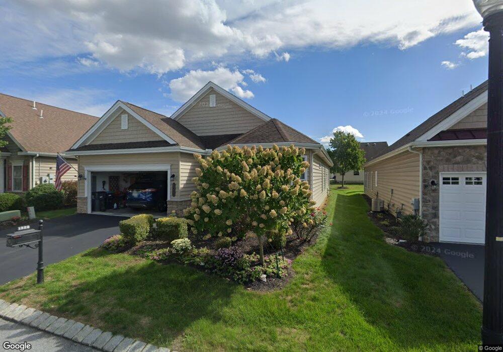
1322 Emerson Dr Mount Joy, PA 17552
Estimated Value: $416,623 - $488,000
2
Beds
3
Baths
1,800
Sq Ft
$257/Sq Ft
Est. Value
About This Home
This home is located at 1322 Emerson Dr, Mount Joy, PA 17552 and is currently estimated at $462,406, approximately $256 per square foot. 1322 Emerson Dr is a home located in Lancaster County with nearby schools including Manheim Central Senior High School and Sporting Hill Christian School.
Ownership History
Date
Name
Owned For
Owner Type
Purchase Details
Closed on
Oct 31, 2014
Sold by
Toa Pa Xiii Lp
Bought by
Lowell Donald E and Lowell Linda
Current Estimated Value
Home Financials for this Owner
Home Financials are based on the most recent Mortgage that was taken out on this home.
Original Mortgage
$466,902
Outstanding Balance
$360,413
Interest Rate
4.21%
Mortgage Type
Reverse Mortgage Home Equity Conversion Mortgage
Estimated Equity
$101,993
Purchase Details
Closed on
Feb 13, 2013
Sold by
Elm Tree Properties Llc
Bought by
Toa Pa Xiii Lp
Home Financials for this Owner
Home Financials are based on the most recent Mortgage that was taken out on this home.
Original Mortgage
$50,000
Interest Rate
3.44%
Mortgage Type
Future Advance Clause Open End Mortgage
Create a Home Valuation Report for This Property
The Home Valuation Report is an in-depth analysis detailing your home's value as well as a comparison with similar homes in the area
Home Values in the Area
Average Home Value in this Area
Purchase History
| Date | Buyer | Sale Price | Title Company |
|---|---|---|---|
| Lowell Donald E | $311,268 | None Available | |
| Toa Pa Xiii Lp | $860,000 | None Available |
Source: Public Records
Mortgage History
| Date | Status | Borrower | Loan Amount |
|---|---|---|---|
| Open | Lowell Donald E | $466,902 | |
| Previous Owner | Toa Pa Xiii Lp | $50,000 |
Source: Public Records
Tax History
| Year | Tax Paid | Tax Assessment Tax Assessment Total Assessment is a certain percentage of the fair market value that is determined by local assessors to be the total taxable value of land and additions on the property. | Land | Improvement |
|---|---|---|---|---|
| 2025 | $5,539 | $267,500 | -- | $267,500 |
| 2024 | $5,539 | $267,500 | -- | $267,500 |
| 2023 | $5,424 | $267,500 | $0 | $267,500 |
| 2022 | $5,219 | $267,500 | $0 | $267,500 |
| 2021 | $5,067 | $267,500 | $0 | $267,500 |
| 2020 | $5,067 | $267,500 | $0 | $267,500 |
| 2019 | $4,979 | $267,500 | $0 | $267,500 |
| 2018 | $3,834 | $267,500 | $0 | $267,500 |
| 2017 | $5,835 | $250,900 | $0 | $250,900 |
| 2016 | $5,835 | $250,900 | $0 | $250,900 |
| 2015 | $1,376 | $250,900 | $0 | $250,900 |
| 2014 | $86 | $5,000 | $0 | $5,000 |
Source: Public Records
Map
Nearby Homes
- 1337 Heatherwood Dr
- 1392 Fieldstone Dr
- 3435 Green Leaf Dr
- 2182 Weeping Willow Ln
- 5315 Oak Leaf Dr
- 5307 Oak Leaf Dr
- 5253 Summerfield Dr
- 5123 Summerfield Dr
- 4036 Green Park Dr
- 546 Creekside Ln
- 0 N Strickler Rd Unit PALA2071458
- 0 N Strickler Rd Unit PALA2071460
- 400 E Main St
- 133 Ridgewood Manor
- 128 S Barbara St
- 101 & 103 W Main St
- 65 W Donegal St
- 10 Gantz Meadows
- 333 Marietta Ave
- 0 Back Run Rd
- 1322 Emerson Dr Unit 4
- 1328 Emerson Dr Unit 5
- 1318 Emerson Dr Unit 3
- 1318 Emerson Dr
- 1332 Emerson Dr Unit 145
- 1314 Emerson Dr Unit 2
- 1314 Emerson Dr
- 1313 Heatherwood Dr
- 1311 Heatherwood Dr
- 1315 Heatherwood Dr
- 1315 Heatherwood Dr Unit 7
- 1338 Emerson Dr Unit 7
- 1309 Heatherwood Dr
- 1308 Emerson Dr Unit 1
- 1308 Emerson Dr
- 1325 Emerson Dr Unit 87
- 1325 Emerson Dr
- 1319 Emerson Dr Unit 88
- 1319 Emerson Dr
- 1317 Heatherwood Dr