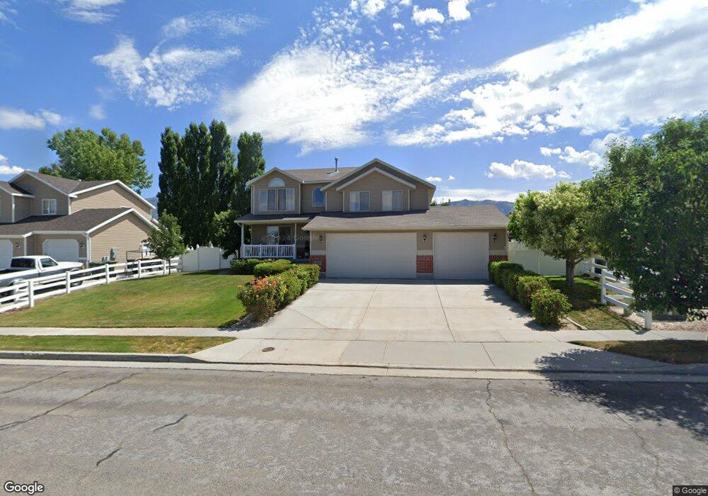
1322 N 590 E Tooele, UT 84074
Estimated Value: $483,000 - $545,000
4
Beds
3
Baths
2,700
Sq Ft
$186/Sq Ft
Est. Value
About This Home
This home is located at 1322 N 590 E, Tooele, UT 84074 and is currently estimated at $501,314, approximately $185 per square foot. 1322 N 590 E is a home located in Tooele County with nearby schools including Copper Canyon Elementary School, Clarke N. Johnsen Junior High School, and Stansbury High School.
Ownership History
Date
Name
Owned For
Owner Type
Purchase Details
Closed on
Feb 17, 2005
Sold by
Maple Holls 3 Develoments Co Llc
Bought by
Dale Arnold Ernest and Dale Janet Faye
Current Estimated Value
Home Financials for this Owner
Home Financials are based on the most recent Mortgage that was taken out on this home.
Original Mortgage
$84,500
Outstanding Balance
$43,063
Interest Rate
5.79%
Mortgage Type
Purchase Money Mortgage
Estimated Equity
$458,251
Create a Home Valuation Report for This Property
The Home Valuation Report is an in-depth analysis detailing your home's value as well as a comparison with similar homes in the area
Home Values in the Area
Average Home Value in this Area
Purchase History
| Date | Buyer | Sale Price | Title Company |
|---|---|---|---|
| Dale Arnold Ernest | -- | Merrill Title Company |
Source: Public Records
Mortgage History
| Date | Status | Borrower | Loan Amount |
|---|---|---|---|
| Open | Dale Arnold Ernest | $84,500 |
Source: Public Records
Tax History Compared to Growth
Tax History
| Year | Tax Paid | Tax Assessment Tax Assessment Total Assessment is a certain percentage of the fair market value that is determined by local assessors to be the total taxable value of land and additions on the property. | Land | Improvement |
|---|---|---|---|---|
| 2025 | $3,369 | $510,953 | $112,500 | $398,453 |
| 2024 | $3,685 | $281,279 | $61,875 | $219,404 |
| 2023 | $3,685 | $267,771 | $58,915 | $208,856 |
| 2022 | $3,159 | $271,827 | $59,641 | $212,186 |
| 2021 | $2,600 | $187,076 | $23,856 | $163,220 |
| 2020 | $2,470 | $308,343 | $43,375 | $264,968 |
| 2019 | $2,408 | $295,725 | $43,375 | $252,350 |
| 2018 | $2,223 | $258,856 | $45,000 | $213,856 |
| 2017 | $2,006 | $277,201 | $30,000 | $247,201 |
| 2016 | $1,621 | $134,726 | $16,500 | $118,226 |
| 2015 | $1,621 | $117,913 | $0 | $0 |
| 2014 | -- | $117,913 | $0 | $0 |
Source: Public Records
Map
Nearby Homes
- 475 E 1310 N
- 1169 N 490 E
- 405 E 1310 N
- 1451 N 380 E
- 455 Lindy Way
- 802 E 1120 N
- 647 E 980 N
- 876 N Fox Run Dr
- 180 1000 N
- 1046 Cedarwood Rd
- 1182 N Berra Blvd
- 865 E 980 N
- 579 E Kings Landing
- 1737 N Broadway Ave
- 348 1770 N
- 1834 N 370 E
- 1545 N 210 E
- 779 N 560 E
- 1598 N 210 E Unit 107
- 1721 Copper Canyon Dr Unit 1282