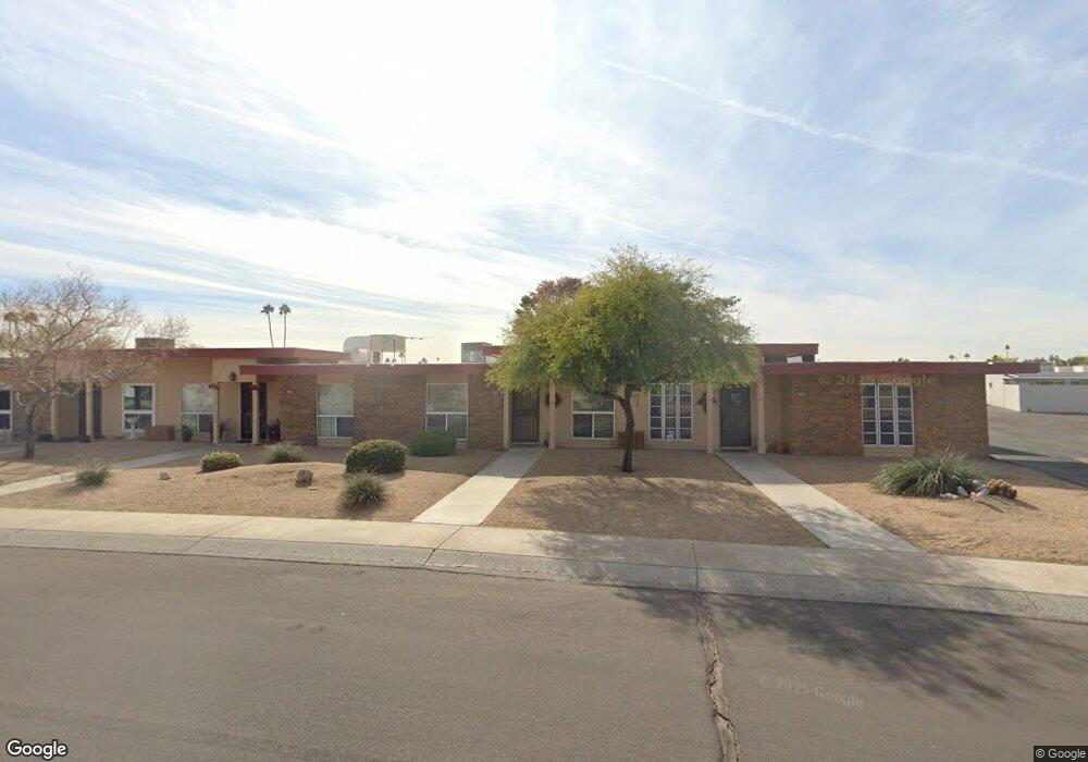
13220 N Cedar Dr Sun City, AZ 85351
Estimated Value: $170,000 - $196,000
1
Bed
1
Bath
1,019
Sq Ft
$182/Sq Ft
Est. Value
About This Home
This home is located at 13220 N Cedar Dr, Sun City, AZ 85351 and is currently estimated at $185,201, approximately $181 per square foot. 13220 N Cedar Dr is a home located in Maricopa County with nearby schools including Desert Mirage Elementary School, Ombudsman - Northwest Charter, and Peoria Accelerated High School.
Ownership History
Date
Name
Owned For
Owner Type
Purchase Details
Closed on
Jul 13, 2004
Sold by
Altic Deborah L
Bought by
Lane Deborah Lee and Altic Deborah L
Current Estimated Value
Purchase Details
Closed on
Mar 25, 2004
Sold by
Altic James E
Bought by
Altic Deborah L
Home Financials for this Owner
Home Financials are based on the most recent Mortgage that was taken out on this home.
Original Mortgage
$57,000
Outstanding Balance
$25,839
Interest Rate
5.35%
Mortgage Type
Purchase Money Mortgage
Estimated Equity
$159,362
Purchase Details
Closed on
May 1, 2001
Sold by
Kohout Jean E
Bought by
Valenzuela Connie
Home Financials for this Owner
Home Financials are based on the most recent Mortgage that was taken out on this home.
Original Mortgage
$60,000
Interest Rate
7.03%
Mortgage Type
New Conventional
Create a Home Valuation Report for This Property
The Home Valuation Report is an in-depth analysis detailing your home's value as well as a comparison with similar homes in the area
Home Values in the Area
Average Home Value in this Area
Purchase History
| Date | Buyer | Sale Price | Title Company |
|---|---|---|---|
| Lane Deborah Lee | -- | First American Title Ins Co | |
| Altic Deborah L | -- | First American Title Ins Co | |
| Altic Deborah L | $72,000 | First American Title Ins Co | |
| Valenzuela Connie | $60,000 | First American Title |
Source: Public Records
Mortgage History
| Date | Status | Borrower | Loan Amount |
|---|---|---|---|
| Open | Altic Deborah L | $57,000 | |
| Closed | Altic Deborah L | $57,000 | |
| Previous Owner | Valenzuela Connie | $60,000 |
Source: Public Records
Tax History Compared to Growth
Tax History
| Year | Tax Paid | Tax Assessment Tax Assessment Total Assessment is a certain percentage of the fair market value that is determined by local assessors to be the total taxable value of land and additions on the property. | Land | Improvement |
|---|---|---|---|---|
| 2025 | $266 | $3,350 | -- | -- |
| 2024 | $263 | $3,350 | -- | -- |
| 2023 | $263 | $3,350 | $670 | $2,680 |
| 2022 | $262 | $3,350 | $670 | $2,680 |
| 2021 | $283 | $9,720 | $1,940 | $7,780 |
| 2020 | $289 | $8,460 | $1,690 | $6,770 |
| 2019 | $300 | $7,120 | $1,420 | $5,700 |
| 2018 | $305 | $3,350 | $670 | $2,680 |
| 2017 | $307 | $3,350 | $670 | $2,680 |
| 2016 | $173 | $3,350 | $670 | $2,680 |
| 2015 | $303 | $3,350 | $670 | $2,680 |
Source: Public Records
Map
Nearby Homes
- 10040 W Royal Oak Rd Unit B
- 10040 W Royal Oak Rd Unit H
- 10030 W Royal Oak Rd Unit C
- 13067 N 100th Dr
- 13039 N 100th Dr
- 13071 N 100th Dr
- 10020 W Royal Oak Rd Unit E
- 13050 N 100th Ave
- 10225 W Thunderbird Blvd
- 13054 N 100th Ave
- 13072 N 100th Ave
- 13442 N Emberwood Dr
- 13410 N Cedar Dr Unit 20
- 13058 N 100th Ave Unit 24A
- 10114 W Candlewood Dr
- 13420 N Emberwood Dr
- 10114 W Royal Oak Rd Unit 20
- 10112 W Forrester Dr
- 10127 W Forrester Dr
- 13433 N Emberwood Dr
- 13218 N Cedar Dr Unit 24
- 13222 N Cedar Dr Unit 24
- 13216 N Cedar Dr Unit 24
- 10040 W Royal Oak Rd Unit A
- 10040 W Royal Oak Rd Unit F
- 10040 W Royal Oak Rd Unit C
- 10040 W Royal Oak Rd
- 10040 W Royal Oak Rd
- 10040 W Royal Oak Rd
- 10040 W Royal Oak Rd
- 10040 W Royal Oak Rd
- 10040 W Royal Oak Rd Unit 24
- 10040 W Royal Oak Rd
- 10040 W Royal Oak Rd
- 10040 W Royal Oak Rd
- 10040 W Royal Oak Rd
- 10040 W Royal Oak Rd
- 10040 W Royal Oak Rd
- 10040 W Royal Oak Rd
- 10040 W Royal Oak Rd