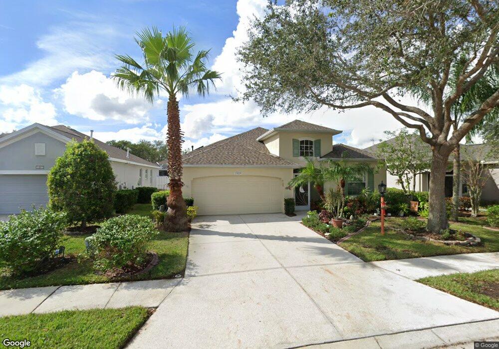
1323 Millbrook Cir Bradenton, FL 34212
Estimated Value: $368,521 - $393,000
2
Beds
2
Baths
1,782
Sq Ft
$216/Sq Ft
Est. Value
About This Home
This home is located at 1323 Millbrook Cir, Bradenton, FL 34212 and is currently estimated at $385,630, approximately $216 per square foot. 1323 Millbrook Cir is a home located in Manatee County with nearby schools including Freedom Elementary School, Carlos E. Haile Middle School, and Parrish Community High School.
Ownership History
Date
Name
Owned For
Owner Type
Purchase Details
Closed on
May 17, 2019
Sold by
Harwood Robert W and Harwood Shirley A
Bought by
Harwood Robert W and The Robert W Harwood Revocable
Current Estimated Value
Purchase Details
Closed on
Sep 17, 2002
Sold by
B W Gneral Contractors Inc
Bought by
Harwood Robert W and Harwood Shirley A
Home Financials for this Owner
Home Financials are based on the most recent Mortgage that was taken out on this home.
Original Mortgage
$100,000
Outstanding Balance
$41,956
Interest Rate
6.3%
Estimated Equity
$343,674
Create a Home Valuation Report for This Property
The Home Valuation Report is an in-depth analysis detailing your home's value as well as a comparison with similar homes in the area
Purchase History
| Date | Buyer | Sale Price | Title Company |
|---|---|---|---|
| Harwood Robert W | -- | Attorney | |
| Harwood Robert W | $175,700 | -- |
Source: Public Records
Mortgage History
| Date | Status | Borrower | Loan Amount |
|---|---|---|---|
| Open | Harwood Robert W | $100,000 |
Source: Public Records
Tax History
| Year | Tax Paid | Tax Assessment Tax Assessment Total Assessment is a certain percentage of the fair market value that is determined by local assessors to be the total taxable value of land and additions on the property. | Land | Improvement |
|---|---|---|---|---|
| 2025 | $1,796 | $159,378 | -- | -- |
| 2023 | $1,796 | $150,375 | $0 | $0 |
| 2022 | $1,742 | $145,995 | $0 | $0 |
| 2021 | $1,668 | $141,743 | $0 | $0 |
| 2020 | $1,721 | $139,786 | $0 | $0 |
| 2019 | $1,692 | $136,643 | $0 | $0 |
| 2018 | $1,675 | $134,095 | $0 | $0 |
| 2017 | $1,554 | $131,337 | $0 | $0 |
| 2016 | $1,548 | $128,636 | $0 | $0 |
Source: Public Records
Map
Nearby Homes
- 1135 Millbrook Cir
- 1494 Millbrook Cir
- 834 Springwood Cir
- 920 Springwood Cir
- 718 Planters Manor Way
- 531 Hunter Ln
- 535 Planters Manor Way
- 8844 Stone Harbour Loop
- 9605 Bladesmith Ln
- 566 Planters Manor Way
- 8772 Stone Harbour Loop
- 574 Planters Manor Way
- 8746 Stone Harbour Loop
- 8725 Stone Harbour Loop
- 710 Acacia Ct
- 706 Acacia Ct
- 8997 Stone Harbour Loop
- 1003 Fairwaycove Ln Unit 205
- 923 Fairwaycove Ln Unit 103
- 915 Fairwaycove Ln Unit 204
- 1319 Millbrook Cir
- 1327 Millbrook Cir
- 1169 Cane Mill Ln
- 1315 Millbrook Cir
- 1173 Cane Mill Ln
- 1165 Cane Mill Ln
- 1326 Millbrook Cir
- 1311 Millbrook Cir
- 1318 Millbrook Cir
- 1161 Cane Mill Ln
- 1330 Millbrook Cir
- 1314 Millbrook Cir
- 1334 Millbrook Cir
- 1346 Millbrook Cir
- 1338 Millbrook Cir
- 1350 Millbrook Cir
- 1342 Millbrook Cir
- 1307 Millbrook Cir
- 1157 Cane Mill Ln
- 1402 Millbrook Cir
Your Personal Tour Guide
Ask me questions while you tour the home.