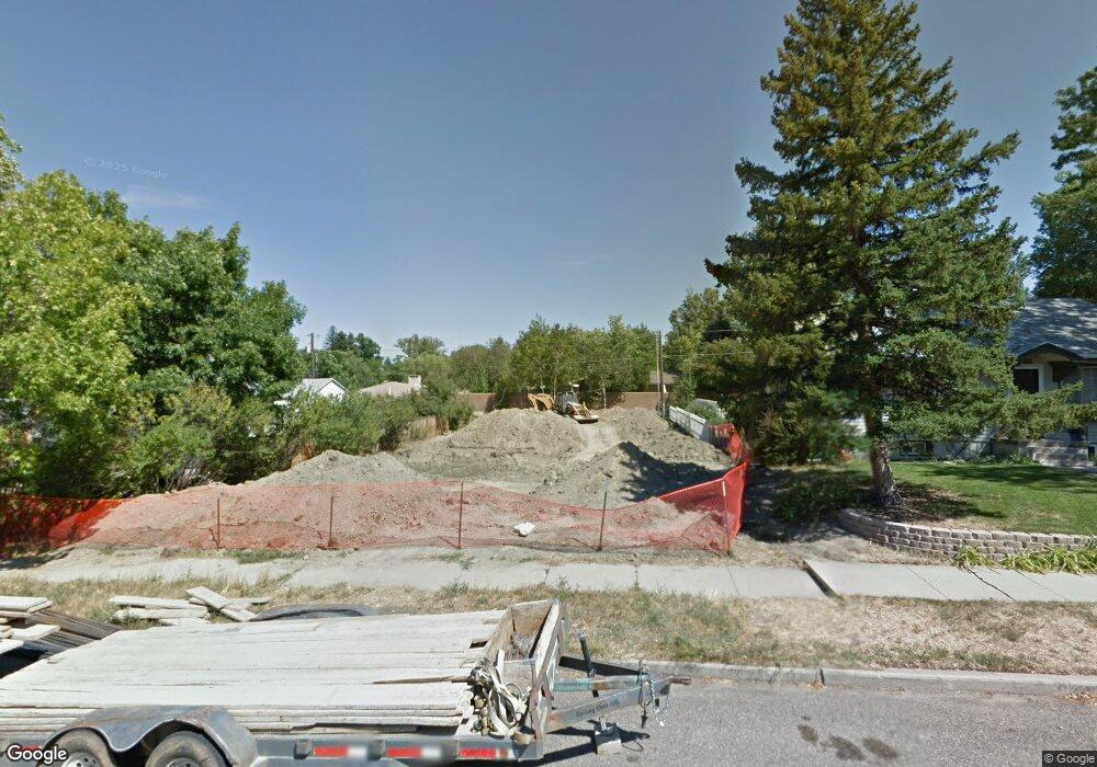
1323 S David St Unit 13th Casper, WY 82601
Central Casper NeighborhoodEstimated Value: $773,000 - $859,000
4
Beds
4
Baths
4,116
Sq Ft
$197/Sq Ft
Est. Value
About This Home
This home is located at 1323 S David St Unit 13th, Casper, WY 82601 and is currently estimated at $812,202, approximately $197 per square foot. 1323 S David St Unit 13th is a home located in Natrona County with nearby schools including St. Anthony Tri-Parish Catholic School and Mountain Road Christian Academy.
Ownership History
Date
Name
Owned For
Owner Type
Purchase Details
Closed on
Mar 26, 2021
Sold by
Bullard David S and Bullard Ronda D
Bought by
Mcjunkin Patrick J and Mcjunkin Kimberly
Current Estimated Value
Home Financials for this Owner
Home Financials are based on the most recent Mortgage that was taken out on this home.
Original Mortgage
$405,000
Outstanding Balance
$364,480
Interest Rate
2.8%
Mortgage Type
New Conventional
Estimated Equity
$447,722
Purchase Details
Closed on
Nov 4, 2016
Sold by
Cabriales Ramon and Cabrialesq Maria
Bought by
Bullard David S and Bullard Ronda D
Create a Home Valuation Report for This Property
The Home Valuation Report is an in-depth analysis detailing your home's value as well as a comparison with similar homes in the area
Home Values in the Area
Average Home Value in this Area
Purchase History
| Date | Buyer | Sale Price | Title Company |
|---|---|---|---|
| Mcjunkin Patrick J | -- | Rocky Mountain Title | |
| Bullard David S | -- | Rocky Mountain Title |
Source: Public Records
Mortgage History
| Date | Status | Borrower | Loan Amount |
|---|---|---|---|
| Open | Mcjunkin Patrick J | $405,000 |
Source: Public Records
Tax History Compared to Growth
Tax History
| Year | Tax Paid | Tax Assessment Tax Assessment Total Assessment is a certain percentage of the fair market value that is determined by local assessors to be the total taxable value of land and additions on the property. | Land | Improvement |
|---|---|---|---|---|
| 2025 | $3,785 | $52,706 | $3,212 | $49,494 |
| 2024 | $4,957 | $69,024 | $5,570 | $63,454 |
| 2023 | $4,824 | $66,176 | $5,163 | $61,013 |
| 2022 | $4,829 | $66,248 | $4,357 | $61,891 |
| 2021 | $3,955 | $57,259 | $4,501 | $52,758 |
| 2020 | $3,878 | $53,202 | $7,182 | $46,020 |
| 2019 | $3,849 | $52,808 | $4,788 | $48,020 |
| 2018 | $3,745 | $51,373 | $4,788 | $46,585 |
| 2017 | $3,335 | $51,748 | $4,788 | $46,960 |
| 2015 | $4,654 | $63,853 | $4,788 | $59,065 |
| 2014 | $4,111 | $56,405 | $4,788 | $51,617 |
Source: Public Records
Map
Nearby Homes
- 1227 S Center St
- 203 W 15th St
- 1244 S Durbin St
- 1242 S Elm St
- 0 Casper Mountain Rd Unit 20256509
- 1007 S Wolcott St
- 428 W 12th St
- 1010 S Durbin St
- 1606 S Oak St
- 1117 S Lincoln St
- 835 S Ash St
- 603 E 13th St
- 205 E 8th St
- 0 15th St Unit 20251555
- 1152 S Walnut St
- 637 E 13th St
- 737 W 12th St
- 1236 S Chestnut St
- 46000 U S Highway 20
- 833 W 13th St
- 1323 S David St
- 1335 S David St
- 1317 S David St
- 1317 S David St Unit 13TH
- 131 W 13th St
- 134 W 14th St
- 1345 S David St
- 1345 S David St Unit 14th Street
- 143 W 13th St
- 143 W 13th St Unit David Street
- 1320 S Center St
- 110 W 14th St
- 110 W 14th St Unit Center
- 1320 S David St
- 1314 S David St
- 1334 S David St
- 205 W 13th St
- 210 W 14th St
- 1300 S Center St
- 1300 S Center St Unit 13th
