Estimated Value: $238,294 - $466,000
3
Beds
1
Bath
1,538
Sq Ft
$205/Sq Ft
Est. Value
About This Home
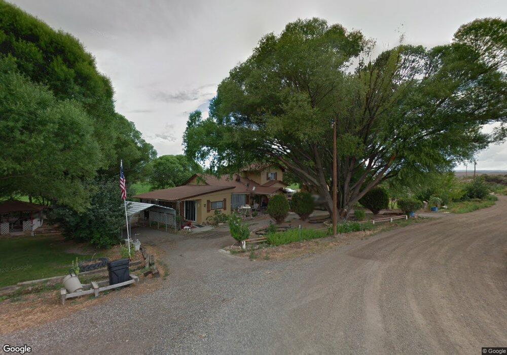
This home is located at 1324 H25 Rd, Delta, CO 81416 and is currently estimated at $315,074, approximately $204 per square foot. 1324 H25 Rd is a home located in Delta County with nearby schools including Garnet Mesa Elementary School, Lincoln Elementary School, and Delta Middle School.
Ownership History
Date
Name
Owned For
Owner Type
Purchase Details
Closed on
Jun 24, 2022
Sold by
Lupe Abeyta
Bought by
Abeyta Ernest
Current Estimated Value
Home Financials for this Owner
Home Financials are based on the most recent Mortgage that was taken out on this home.
Original Mortgage
$202,800
Outstanding Balance
$192,677
Interest Rate
5.1%
Mortgage Type
New Conventional
Estimated Equity
$122,397
Purchase Details
Closed on
Jun 20, 2008
Sold by
Abeyta Lupe and Abeyta Margie
Bought by
Abeyta Lupe
Purchase Details
Closed on
Jun 15, 1987
Sold by
Simmons Judy M
Bought by
Abeyta Lupe and Abeyta Lupe
Create a Home Valuation Report for This Property
The Home Valuation Report is an in-depth analysis detailing your home's value as well as a comparison with similar homes in the area
Purchase History
| Date | Buyer | Sale Price | Title Company |
|---|---|---|---|
| Abeyta Ernest | -- | None Listed On Document | |
| Abeyta Ernest F | -- | None Listed On Document | |
| Abeyta Lupe | -- | None Available | |
| Abeyta Lupe | $15,000 | -- |
Source: Public Records
Mortgage History
| Date | Status | Borrower | Loan Amount |
|---|---|---|---|
| Open | Abeyta Ernest F | $202,800 | |
| Closed | Abeyta Ernest | $202,800 |
Source: Public Records
Tax History
| Year | Tax Paid | Tax Assessment Tax Assessment Total Assessment is a certain percentage of the fair market value that is determined by local assessors to be the total taxable value of land and additions on the property. | Land | Improvement |
|---|---|---|---|---|
| 2024 | $529 | $7,992 | $2,293 | $5,699 |
| 2023 | $529 | $7,992 | $2,293 | $5,699 |
| 2022 | $310 | $9,600 | $3,823 | $5,777 |
| 2021 | $313 | $9,877 | $3,933 | $5,944 |
| 2020 | $241 | $7,500 | $2,860 | $4,640 |
| 2019 | $238 | $7,500 | $2,860 | $4,640 |
| 2018 | $282 | $8,539 | $3,564 | $4,975 |
| 2017 | $274 | $8,539 | $3,564 | $4,975 |
| 2016 | $242 | $8,255 | $3,940 | $4,315 |
| 2014 | -- | $6,028 | $3,582 | $2,446 |
Source: Public Records
Map
Nearby Homes
- 1312 & 1304 Granite Way
- TBD 1375 Rd
- 1249 Buckskin St
- 1241 Buckskin St
- 1397 Highway 50
- 1205 Highway 50 Unit 24
- 6038 Townsend Rd
- 863 1400 Ln
- 1491 Highway 50 Unit 64
- TBD 1500 Ct
- 6154 Graff Rd
- 791 Albany St
- 15083 Silver Belle St
- 14885 G Rd
- 10.5 ac. LOT 1B 1525 Rd
- TBD B Rd
- 1532 U S 50
- 783 1550 Rd
- 777 1550 Rd
- 167 Gunnison River Dr