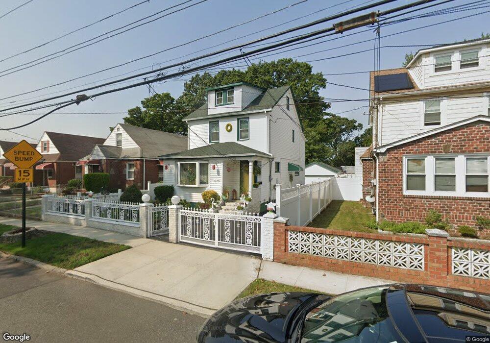
13240 220th St Springfield Gardens, NY 11413
Laurelton NeighborhoodEstimated Value: $666,732 - $757,000
--
Bed
--
Bath
1,580
Sq Ft
$444/Sq Ft
Est. Value
About This Home
This home is located at 13240 220th St, Springfield Gardens, NY 11413 and is currently estimated at $702,183, approximately $444 per square foot. 13240 220th St is a home located in Queens County with nearby schools including P.S. 132 - Ralph Bunche, Is 59 Springfield Gardens, and Success Academy Springfield Gardens.
Ownership History
Date
Name
Owned For
Owner Type
Purchase Details
Closed on
Feb 26, 1998
Sold by
Holm Elaine
Bought by
Williamson Sophia
Current Estimated Value
Home Financials for this Owner
Home Financials are based on the most recent Mortgage that was taken out on this home.
Original Mortgage
$147,200
Interest Rate
7.11%
Mortgage Type
FHA
Purchase Details
Closed on
Mar 19, 1996
Sold by
Holm Gertrude and Holm Elaine
Bought by
Holm Elaine
Create a Home Valuation Report for This Property
The Home Valuation Report is an in-depth analysis detailing your home's value as well as a comparison with similar homes in the area
Home Values in the Area
Average Home Value in this Area
Purchase History
| Date | Buyer | Sale Price | Title Company |
|---|---|---|---|
| Williamson Sophia | $160,000 | Commonwealth Land Title Ins | |
| Williamson Sophia | $160,000 | Commonwealth Land Title Ins | |
| Holm Elaine | -- | Commonwealth Land Title Ins | |
| Holm Elaine | -- | Commonwealth Land Title Ins |
Source: Public Records
Mortgage History
| Date | Status | Borrower | Loan Amount |
|---|---|---|---|
| Previous Owner | Williamson Sophia | $147,200 |
Source: Public Records
Tax History Compared to Growth
Tax History
| Year | Tax Paid | Tax Assessment Tax Assessment Total Assessment is a certain percentage of the fair market value that is determined by local assessors to be the total taxable value of land and additions on the property. | Land | Improvement |
|---|---|---|---|---|
| 2025 | $5,764 | $31,888 | $8,867 | $23,021 |
| 2024 | $5,776 | $30,097 | $8,533 | $21,564 |
| 2023 | $5,636 | $29,459 | $7,447 | $22,012 |
| 2022 | $4,476 | $40,140 | $12,180 | $27,960 |
| 2021 | $4,436 | $38,100 | $12,180 | $25,920 |
| 2020 | $4,424 | $32,760 | $12,180 | $20,580 |
| 2019 | $4,049 | $33,600 | $12,180 | $21,420 |
| 2018 | $4,707 | $24,549 | $10,694 | $13,855 |
| 2017 | $4,523 | $23,659 | $9,923 | $13,736 |
| 2016 | $4,152 | $23,659 | $9,923 | $13,736 |
| 2015 | $2,472 | $22,144 | $11,668 | $10,476 |
| 2014 | $2,472 | $20,901 | $11,387 | $9,514 |
Source: Public Records
Map
Nearby Homes
- 21931 133rd Ave
- 21917 132nd Rd
- 133-15 220th St
- 218-36 133rd Rd
- 131-35 222nd St
- 21924 130th Dr
- 130-45 220th St
- 134-16 221st St
- 134-15 221st St
- 22310 131st Ave
- 13049 217th St
- 220-27 134th Rd
- 131-20 224th St
- 130-55 222nd St
- 220-24 134th Rd
- 21608 Merrick Blvd
- 130-25 217th St
- 22014 130th Ave
- 22014 130th Ave
- 22126 134th Rd
- 13236 220th St
- 13244 220th St
- 13248 220th St
- 13232 220th St
- 21930 132nd Rd
- 13252 220th St
- 13228 220th St
- 21924 132nd Rd
- 219-31 133rd Ave
- 21925 133rd Ave
- 21931 133rd Ave
- 13241 220th St
- 13256 220th St
- 21922 132nd Rd
- 13231 220th St
- 13245 220th St
- 219-22 132nd Rd
- 220-03 133rd Ave
- 220-07 133rd Ave
- 22003 133rd Ave