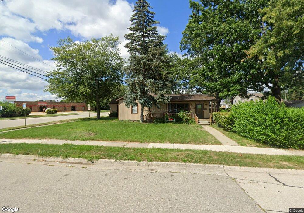
13246 Pearl St Southgate, MI 48195
Estimated Value: $214,000 - $276,000
3
Beds
2
Baths
1,884
Sq Ft
$132/Sq Ft
Est. Value
About This Home
This home is located at 13246 Pearl St, Southgate, MI 48195 and is currently estimated at $248,773, approximately $132 per square foot. 13246 Pearl St is a home located in Wayne County with nearby schools including Fordline Elementary School, Davidson Middle School, and Southgate Anderson High School.
Ownership History
Date
Name
Owned For
Owner Type
Purchase Details
Closed on
Apr 28, 2011
Sold by
White John G
Bought by
White John G and White John W
Current Estimated Value
Purchase Details
Closed on
Apr 11, 2011
Sold by
Secretary Of Housing & Urban Development
Bought by
White John G
Purchase Details
Closed on
Jun 17, 2010
Sold by
Citimortgage Inc
Bought by
Secretary Of Housing & Urban Development
Purchase Details
Closed on
Mar 26, 2009
Sold by
Swiney Kevan G and Swiney Desiree C
Bought by
Citimortgage Inc
Purchase Details
Closed on
Jan 9, 2004
Sold by
Maxfield Thelma and Maxfield Jewell Hayden
Bought by
Swiney Kevan G
Purchase Details
Closed on
May 7, 2002
Sold by
Maxfield Thelma
Bought by
Maxfield Thelma
Create a Home Valuation Report for This Property
The Home Valuation Report is an in-depth analysis detailing your home's value as well as a comparison with similar homes in the area
Home Values in the Area
Average Home Value in this Area
Purchase History
| Date | Buyer | Sale Price | Title Company |
|---|---|---|---|
| White John G | -- | None Available | |
| White John G | $39,031 | None Available | |
| Secretary Of Housing & Urban Development | -- | None Available | |
| Citimortgage Inc | $168,529 | None Available | |
| Swiney Kevan G | $161,900 | Multiple | |
| Maxfield Thelma | -- | -- |
Source: Public Records
Tax History Compared to Growth
Tax History
| Year | Tax Paid | Tax Assessment Tax Assessment Total Assessment is a certain percentage of the fair market value that is determined by local assessors to be the total taxable value of land and additions on the property. | Land | Improvement |
|---|---|---|---|---|
| 2025 | $4,679 | $139,100 | $0 | $0 |
| 2024 | $4,679 | $128,700 | $0 | $0 |
| 2023 | $4,456 | $117,500 | $0 | $0 |
| 2022 | $4,903 | $106,000 | $0 | $0 |
| 2021 | $4,767 | $96,500 | $0 | $0 |
| 2020 | $4,692 | $88,300 | $0 | $0 |
| 2019 | $6,067 | $81,500 | $0 | $0 |
| 2018 | $4,356 | $69,000 | $0 | $0 |
| 2017 | $1,577 | $65,000 | $0 | $0 |
| 2016 | $4,484 | $61,800 | $0 | $0 |
| 2015 | $5,595 | $60,100 | $0 | $0 |
| 2013 | $5,420 | $56,500 | $0 | $0 |
| 2012 | $2,413 | $53,400 | $14,400 | $39,000 |
Source: Public Records
Map
Nearby Homes
- 13367 Fordline St
- 13632 Pearl St
- 13546 Trenton Rd
- 13543 Poplar St
- 13728 Agnes St
- 13787 Irene St
- 12750 Longtin St
- 13847 Helen St
- 12685 Fordline St
- 13550 Karl St
- 0 Poplar St
- 13650 Jobin St
- 12792 Elaine Dr
- 12720 Elaine Dr Unit 31
- 13497 Mark St
- 13395 Pullman St
- 13459 Jobin St
- 14268 Trenton Rd
- 14370 Pearl St
- 13335 Pullman St
- 13210 Pearl St
- 13243 Irene St
- 13231 Irene St
- 13344 Dix Toledo Rd
- 13198 Pearl St
- 13211 Irene St
- 13186 Pearl St
- 13187 Irene St
- 13174 Pearl St
- 13275 Dix Toledo Rd
- 13354 Dix Toledo Rd
- 13175 Irene St
- 13162 Pearl St
- 13246 Irene St Unit Bldg-Unit
- 13246 Irene St
- 13234 Irene St
- 13222 Irene St
- 13163 Irene St
- 13210 Irene St
- 13150 Pearl St