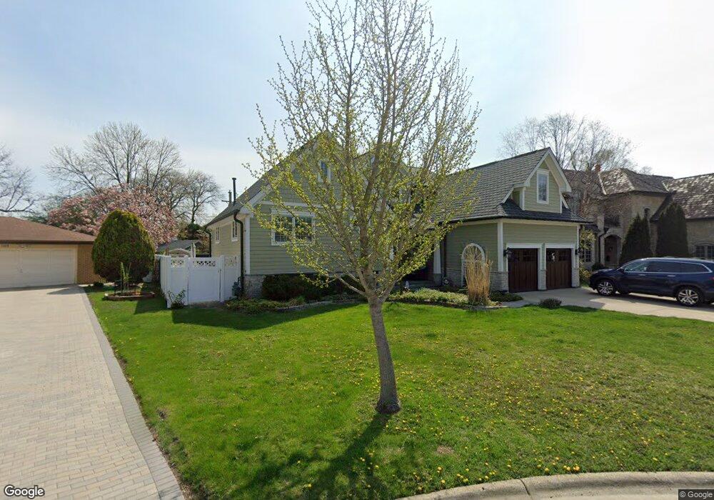
1325 Brook Ln Unit 2 Glenview, IL 60025
Estimated Value: $817,000 - $1,225,000
4
Beds
3
Baths
3,219
Sq Ft
$319/Sq Ft
Est. Value
About This Home
This home is located at 1325 Brook Ln Unit 2, Glenview, IL 60025 and is currently estimated at $1,027,977, approximately $319 per square foot. 1325 Brook Ln Unit 2 is a home located in Cook County with nearby schools including Marie Murphy School, Avoca West Elementary School, and New Trier Township High School - Northfield.
Ownership History
Date
Name
Owned For
Owner Type
Purchase Details
Closed on
May 18, 1998
Sold by
The First National Bank Of Chicago
Bought by
Quezada Alexander and Quezada Karen
Current Estimated Value
Home Financials for this Owner
Home Financials are based on the most recent Mortgage that was taken out on this home.
Original Mortgage
$180,000
Outstanding Balance
$32,404
Interest Rate
7.19%
Estimated Equity
$995,573
Purchase Details
Closed on
Oct 16, 1997
Sold by
The First National Bank Of Chicago
Bought by
The First National Bank Of Chicago
Create a Home Valuation Report for This Property
The Home Valuation Report is an in-depth analysis detailing your home's value as well as a comparison with similar homes in the area
Home Values in the Area
Average Home Value in this Area
Purchase History
| Date | Buyer | Sale Price | Title Company |
|---|---|---|---|
| Quezada Alexander | $225,000 | Centennial Title Incorporate | |
| The First National Bank Of Chicago | -- | -- |
Source: Public Records
Mortgage History
| Date | Status | Borrower | Loan Amount |
|---|---|---|---|
| Open | Quezada Alexander | $180,000 |
Source: Public Records
Tax History
| Year | Tax Paid | Tax Assessment Tax Assessment Total Assessment is a certain percentage of the fair market value that is determined by local assessors to be the total taxable value of land and additions on the property. | Land | Improvement |
|---|---|---|---|---|
| 2025 | $14,174 | $103,000 | $13,917 | $89,083 |
| 2024 | $14,174 | $68,000 | $13,917 | $54,083 |
| 2023 | $13,555 | $68,000 | $13,917 | $54,083 |
| 2022 | $13,555 | $68,000 | $13,917 | $54,083 |
| 2021 | $7,462 | $34,054 | $10,002 | $24,052 |
| 2020 | $7,328 | $34,054 | $10,002 | $24,052 |
| 2019 | $7,158 | $37,423 | $10,002 | $27,421 |
| 2018 | $6,680 | $33,254 | $8,263 | $24,991 |
| 2017 | $6,499 | $33,254 | $8,263 | $24,991 |
| 2016 | $6,323 | $33,254 | $8,263 | $24,991 |
| 2015 | $5,995 | $28,783 | $6,740 | $22,043 |
| 2014 | $5,881 | $28,783 | $6,740 | $22,043 |
| 2013 | $5,612 | $28,783 | $6,740 | $22,043 |
Source: Public Records
Map
Nearby Homes
- 718 Lawler Ave
- 711 Becker Rd
- 808 Indian Rd
- 33 Longmeadow Rd
- 3226 Sprucewood Rd
- 700 Lamon Ave
- 846 Wagner Rd
- 639 Harms Rd
- 1050 Burton Terrace
- 408 Lavergne Ave
- 1431 Meadow Ln
- 6040 Arbor Ln Unit 302
- 623 Echo Ln
- 3031 Indianwood Rd
- 1245 Canterbury Ln
- 1443 Hawthorne Ln
- 809 Lenox Rd
- 2033 Winnetka Rd
- 2938 Indianwood Rd
- 1437 Sunset Ridge Rd
- 1319 Brook Ln
- 1329 Brook Ln
- 1322 Heatherfield Ln
- 1316 Heatherfield Ln
- 1313 Brook Ln
- 408 Brook Ln
- 1324 Heatherfield Ln
- 414 Brook Ln
- 1312 Heatherfield Ln
- 1307 Brook Ln
- 1322 Brook Ln
- 1326 Heatherfield Ln
- 401 E Lake Ave
- 403 E Lake Ave
- 1314 Brook Ln
- 347 E Lake Ave
- 1304 Heatherfield Ln
- 411 E Lake Ave
- 420 Brook Ln
- 343 E Lake Ave
Your Personal Tour Guide
Ask me questions while you tour the home.