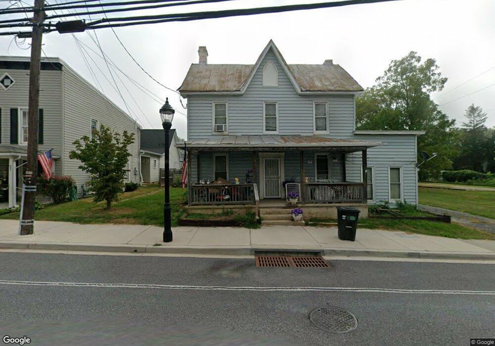
1325 Main St Hampstead, MD 21074
Estimated Value: $263,887
3
Beds
2
Baths
1,444
Sq Ft
$183/Sq Ft
Est. Value
About This Home
This home is located at 1325 Main St, Hampstead, MD 21074 and is currently estimated at $263,887, approximately $182 per square foot. 1325 Main St is a home located in Carroll County with nearby schools including Spring Garden Elementary School, Shiloh Middle School, and Manchester Valley High School.
Ownership History
Date
Name
Owned For
Owner Type
Purchase Details
Closed on
Sep 20, 2018
Sold by
County Commissioners Of Carroll County
Bought by
Hampstead Vilunteer Fire And Hose Co No
Current Estimated Value
Purchase Details
Closed on
Oct 24, 2011
Sold by
Ryan Madeleine A
Bought by
Hamstead Volunteer Fire & Hose Company #
Purchase Details
Closed on
Jun 4, 2004
Sold by
Roe Madeleine R
Bought by
Ryan Madeleine A
Purchase Details
Closed on
Jan 4, 2002
Sold by
Roe Edmund L
Bought by
Roe Madeleine R
Purchase Details
Closed on
Jun 21, 1994
Sold by
Vanscoy Ellen
Bought by
Roe Edmund L
Home Financials for this Owner
Home Financials are based on the most recent Mortgage that was taken out on this home.
Original Mortgage
$88,000
Interest Rate
8.5%
Purchase Details
Closed on
Dec 22, 1993
Sold by
Knoerlein Krista K
Bought by
Vanscoy Ellen
Create a Home Valuation Report for This Property
The Home Valuation Report is an in-depth analysis detailing your home's value as well as a comparison with similar homes in the area
Home Values in the Area
Average Home Value in this Area
Purchase History
| Date | Buyer | Sale Price | Title Company |
|---|---|---|---|
| Hampstead Vilunteer Fire And Hose Co No | -- | None Available | |
| Hamstead Volunteer Fire & Hose Company # | $140,000 | None Available | |
| Hampstead Volunteer Fire And Hose | $140,000 | -- | |
| Ryan Madeleine A | -- | -- | |
| Roe Madeleine R | -- | -- | |
| Roe Edmund L | $88,000 | -- | |
| Vanscoy Ellen | $98,000 | -- |
Source: Public Records
Mortgage History
| Date | Status | Borrower | Loan Amount |
|---|---|---|---|
| Previous Owner | Vanscoy Ellen | $88,000 |
Source: Public Records
Tax History
| Year | Tax Paid | Tax Assessment Tax Assessment Total Assessment is a certain percentage of the fair market value that is determined by local assessors to be the total taxable value of land and additions on the property. | Land | Improvement |
|---|---|---|---|---|
| 2025 | $45 | $107,000 | $107,000 | $0 |
| 2024 | $45 | $107,000 | $107,000 | $0 |
| 2023 | $45 | $107,000 | $107,000 | $0 |
| 2022 | $45 | $107,000 | $107,000 | $0 |
| 2021 | $41 | $106,600 | $0 | $0 |
| 2020 | $41 | $106,200 | $0 | $0 |
| 2019 | $41 | $105,800 | $105,800 | $0 |
| 2018 | $41 | $103,633 | $0 | $0 |
| 2017 | $41 | $101,467 | $0 | $0 |
| 2016 | -- | $99,300 | $0 | $0 |
| 2015 | -- | $99,300 | $0 | $0 |
| 2014 | -- | $99,300 | $0 | $0 |
Source: Public Records
Map
Nearby Homes
- 4138 Hillcrest Ave
- 0 Hanover Pike Unit MDCR2024542
- 4112 Creswell Terrace
- 1421 N Main St
- 3815 Sunnyfield Ct Unit 2C
- 3815 Sunnyfield Ct Unit 3D
- 4210 Upper Beckleysville Rd
- 1151 Caton Rd
- 1148 Gypsum Dr
- 3992 Terrace Dr
- TBD Sommerfield Dr
- TBD Sommerfield Dr Unit (5 ACRES)
- 3830 Normandy Dr Unit 3A
- 3870 Normandy Dr Unit 1D
- 3840 Normandy Dr Unit 2A
- 3820 Normandy Dr Unit 2A
- 3850 Normandy Dr Unit 2B
- 4211 S Hunter Rd
- 920 N Houcksville Rd
- 4233 Tumbrell Dr
Your Personal Tour Guide
Ask me questions while you tour the home.