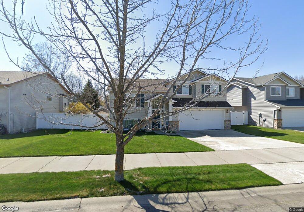
1325 N Simpson Rd Liberty Lake, WA 99019
MeadowWood NeighborhoodEstimated Value: $517,782 - $574,000
3
Beds
2
Baths
1,961
Sq Ft
$279/Sq Ft
Est. Value
About This Home
This home is located at 1325 N Simpson Rd, Liberty Lake, WA 99019 and is currently estimated at $546,946, approximately $278 per square foot. 1325 N Simpson Rd is a home located in Spokane County with nearby schools including Liberty Lake Elementary School, Greenacres Middle School, and Central Valley High School.
Ownership History
Date
Name
Owned For
Owner Type
Purchase Details
Closed on
Feb 26, 2003
Sold by
Greenstone Construction Llc
Bought by
Johnson Timothy J and Wadsen Johnson Lisa D
Current Estimated Value
Home Financials for this Owner
Home Financials are based on the most recent Mortgage that was taken out on this home.
Original Mortgage
$148,700
Outstanding Balance
$64,159
Interest Rate
5.93%
Mortgage Type
Purchase Money Mortgage
Estimated Equity
$482,787
Purchase Details
Closed on
Jul 31, 2002
Sold by
Greenstone Corp
Bought by
Greenstone Construction Llc
Create a Home Valuation Report for This Property
The Home Valuation Report is an in-depth analysis detailing your home's value as well as a comparison with similar homes in the area
Home Values in the Area
Average Home Value in this Area
Purchase History
| Date | Buyer | Sale Price | Title Company |
|---|---|---|---|
| Johnson Timothy J | $150,314 | First American Title Ins | |
| Greenstone Construction Llc | $644,000 | First American Title Ins |
Source: Public Records
Mortgage History
| Date | Status | Borrower | Loan Amount |
|---|---|---|---|
| Open | Johnson Timothy J | $148,700 |
Source: Public Records
Tax History Compared to Growth
Tax History
| Year | Tax Paid | Tax Assessment Tax Assessment Total Assessment is a certain percentage of the fair market value that is determined by local assessors to be the total taxable value of land and additions on the property. | Land | Improvement |
|---|---|---|---|---|
| 2025 | $4,980 | $481,600 | $135,000 | $346,600 |
| 2024 | $4,980 | $484,700 | $125,000 | $359,700 |
| 2023 | $4,153 | $480,700 | $115,000 | $365,700 |
| 2022 | $4,112 | $450,700 | $100,000 | $350,700 |
| 2021 | $3,795 | $311,000 | $70,000 | $241,000 |
| 2020 | $3,371 | $281,400 | $70,000 | $211,400 |
| 2019 | $3,028 | $263,000 | $55,000 | $208,000 |
| 2018 | $3,266 | $235,700 | $50,000 | $185,700 |
| 2017 | $3,029 | $222,400 | $50,000 | $172,400 |
| 2016 | $2,926 | $208,800 | $50,000 | $158,800 |
| 2015 | $2,848 | $199,600 | $50,000 | $149,600 |
| 2014 | -- | $188,800 | $50,000 | $138,800 |
| 2013 | -- | $0 | $0 | $0 |
Source: Public Records
Map
Nearby Homes
- 24838 E Coopers Hawk Ln
- 24845 E Spotted Owl Ln
- 24853 Spotted Owl Ln
- 24853 E Spotted Owl Ln
- 24861 Spotted Owl Ln
- 24861 E Spotted Owl Ln
- 24869 Spotted Owl Ln
- 24869 E Spotted Owl Ln
- 1124 N Malvern Rd
- 24380 E Thorton Ave
- 24604 E Maxwell Ln
- 24222 E Pinehurst Ln
- 1790 N Winchester St
- 2111 N Wolfe Penn St
- 23413 E Boone Ave
- 1305 N King James Ln
- 520 N Village Ln
- 2221 N Wilmington St
- 512 N Village Ln
- 24910 E Stonecrest Ave
- 1323 N Simpson Rd
- 1405 N Simpson Rd
- 1409 N Simpson Rd
- 1320 N Samantha Rd
- 1324 N Samantha Rd
- 1319 N Simpson Rd
- 1316 N Samantha Rd
- 1404 N Samantha Rd
- 1402 N Simpson Rd
- 1324 N Simpson Rd
- 1413 N Simpson Rd
- 1315 N Simpson Rd
- 1406 N Simpson Rd
- 1322 N Simpson Rd
- 1314 N Samantha Rd
- 1406 N Samantha Rd
- 1412 N Simpson Rd
- 1318 N Simpson Rd
- 1311 N Simpson Rd
- 1417 N Simpson Rd