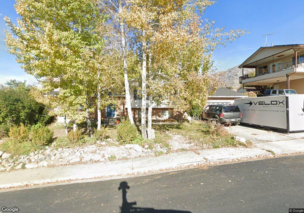
1325 Navajo Dr Pleasant Grove, UT 84062
Estimated Value: $509,000 - $576,411
3
Beds
4
Baths
1,310
Sq Ft
$419/Sq Ft
Est. Value
About This Home
This home is located at 1325 Navajo Dr, Pleasant Grove, UT 84062 and is currently estimated at $548,853, approximately $418 per square foot. 1325 Navajo Dr is a home located in Utah County with nearby schools including Valley View Elementary, Central Elementary School, and Oak Canyon Junior High School.
Ownership History
Date
Name
Owned For
Owner Type
Purchase Details
Closed on
Jun 18, 2019
Sold by
Curtis Dylan K
Bought by
Curtis Dylan K and Curtis Melanie
Current Estimated Value
Home Financials for this Owner
Home Financials are based on the most recent Mortgage that was taken out on this home.
Original Mortgage
$320,100
Outstanding Balance
$281,446
Interest Rate
4.1%
Mortgage Type
New Conventional
Estimated Equity
$267,407
Purchase Details
Closed on
Feb 15, 2005
Sold by
Robb Jody F
Bought by
Butterworth Andrew and Butterworth Samantha C
Purchase Details
Closed on
Aug 21, 1998
Sold by
Robb Jeffery T and Robb Jody F
Bought by
Robb Jody F
Home Financials for this Owner
Home Financials are based on the most recent Mortgage that was taken out on this home.
Original Mortgage
$116,800
Interest Rate
6.91%
Create a Home Valuation Report for This Property
The Home Valuation Report is an in-depth analysis detailing your home's value as well as a comparison with similar homes in the area
Home Values in the Area
Average Home Value in this Area
Purchase History
| Date | Buyer | Sale Price | Title Company |
|---|---|---|---|
| Curtis Dylan K | -- | Provo Land Title Co | |
| Curtis Dylan K | -- | Provo Land Title Co | |
| Butterworth Andrew | -- | Utah Standard Title | |
| Robb Jody F | -- | -- |
Source: Public Records
Mortgage History
| Date | Status | Borrower | Loan Amount |
|---|---|---|---|
| Open | Curtis Dylan K | $320,100 | |
| Previous Owner | Robb Jody F | $116,800 |
Source: Public Records
Tax History Compared to Growth
Tax History
| Year | Tax Paid | Tax Assessment Tax Assessment Total Assessment is a certain percentage of the fair market value that is determined by local assessors to be the total taxable value of land and additions on the property. | Land | Improvement |
|---|---|---|---|---|
| 2025 | $2,128 | $281,600 | $209,500 | $302,500 |
| 2024 | $2,128 | $253,825 | $0 | $0 |
| 2023 | $2,029 | $247,940 | $0 | $0 |
| 2022 | $2,247 | $273,130 | $0 | $0 |
| 2021 | $1,941 | $359,200 | $150,300 | $208,900 |
| 2020 | $1,786 | $324,100 | $134,200 | $189,900 |
| 2019 | $1,537 | $288,400 | $123,300 | $165,100 |
| 2018 | $1,545 | $274,100 | $119,700 | $154,400 |
| 2017 | $1,412 | $133,430 | $0 | $0 |
| 2016 | $1,306 | $119,130 | $0 | $0 |
| 2015 | $1,254 | $108,295 | $0 | $0 |
| 2014 | $1,261 | $107,910 | $0 | $0 |
Source: Public Records
Map
Nearby Homes
- 1172 E Murdock Dr
- 1515 E 720 S
- 745 S 1500 St E
- 650 S 1600 E
- 935 S 1500 E
- 778 S 1100 E
- 521 S 1660 E
- 286 S 1150 E
- 177 S 1150 E
- 630 S Loader Dr
- Prelude Plan at Blossom Hill
- Treble Plan at Blossom Hill
- Browning Plan at Blossom Hill
- Cantata Plan at Blossom Hill
- 176 S 1150 E
- Accord Plan at Blossom Hill
- Canon Plan at Blossom Hill
- Trio Plan at Blossom Hill
- Harrison Plan at Blossom Hill
- Adagio Plan at Blossom Hill
- 1345 Navajo Dr
- 1315 Navajo Dr
- 1270 Mohican Cir
- 1278 Mohican Cir
- 1264 Mohican Cir
- 1330 Navajo Dr
- 1264 Mohican Cir S Unit 14
- 1355 Navajo Dr
- 1280 Mohican Cir
- 1340 Navajo Dr
- 1320 E Navajo Dr
- 1320 Navajo Dr
- 635 Mohican Ln
- 640 Mohawk Ave
- 640 E 1200 N
- 1265 Mohican Cir
- 685 Mohican Ln
- 1365 Navajo Dr
- 1305 Navajo Dr
- 689 Mohican Ln