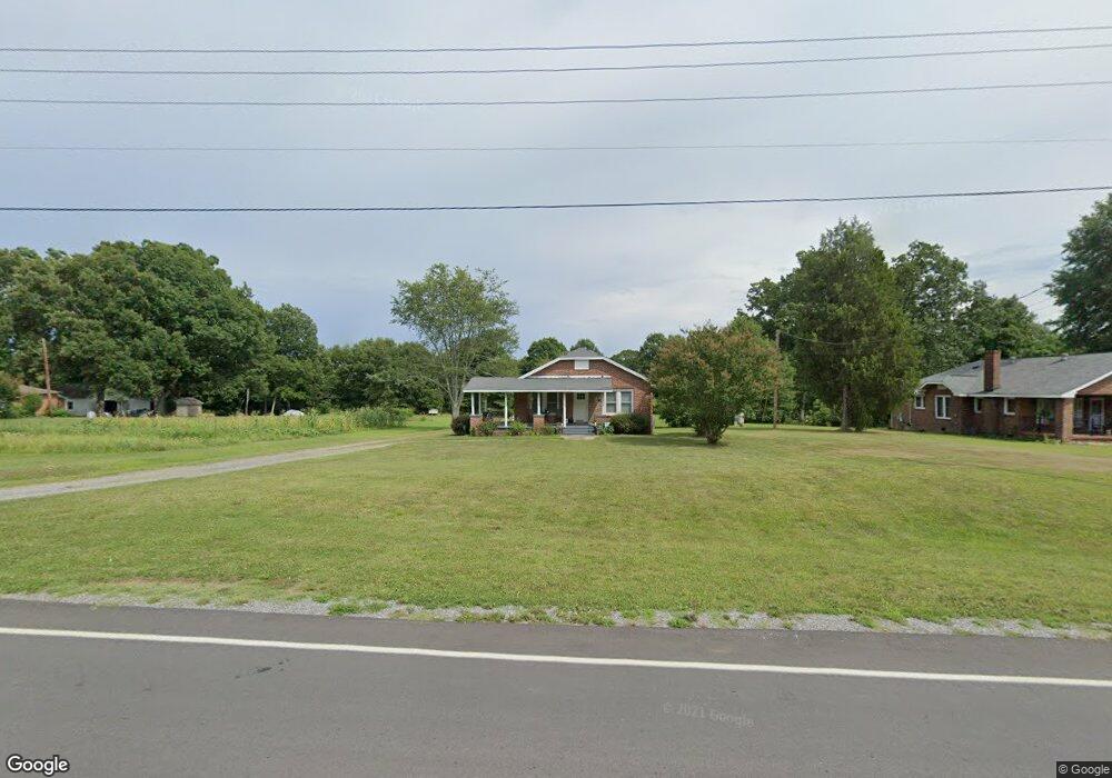
1325 S Battleground Ave Kings Mountain, NC 28086
Estimated Value: $125,736 - $195,000
--
Bed
--
Bath
936
Sq Ft
$168/Sq Ft
Est. Value
About This Home
This home is located at 1325 S Battleground Ave, Kings Mountain, NC 28086 and is currently estimated at $157,684, approximately $168 per square foot. 1325 S Battleground Ave is a home located in Cleveland County with nearby schools including Grover Elementary School, Kings Mountain Middle, and Kings Mountain Intermediate School.
Ownership History
Date
Name
Owned For
Owner Type
Purchase Details
Closed on
Sep 26, 2017
Sold by
Smith Sherry A and Smith Allen G
Bought by
Johnson Michael Scott
Current Estimated Value
Home Financials for this Owner
Home Financials are based on the most recent Mortgage that was taken out on this home.
Original Mortgage
$39,425
Outstanding Balance
$32,931
Interest Rate
3.82%
Mortgage Type
New Conventional
Estimated Equity
$124,753
Create a Home Valuation Report for This Property
The Home Valuation Report is an in-depth analysis detailing your home's value as well as a comparison with similar homes in the area
Home Values in the Area
Average Home Value in this Area
Purchase History
| Date | Buyer | Sale Price | Title Company |
|---|---|---|---|
| Johnson Michael Scott | $41,500 | None Available |
Source: Public Records
Mortgage History
| Date | Status | Borrower | Loan Amount |
|---|---|---|---|
| Open | Johnson Michael Scott | $39,425 |
Source: Public Records
Tax History Compared to Growth
Tax History
| Year | Tax Paid | Tax Assessment Tax Assessment Total Assessment is a certain percentage of the fair market value that is determined by local assessors to be the total taxable value of land and additions on the property. | Land | Improvement |
|---|---|---|---|---|
| 2025 | $842 | $136,844 | $28,233 | $108,611 |
| 2024 | $442 | $46,642 | $14,116 | $32,526 |
| 2023 | $440 | $46,642 | $14,116 | $32,526 |
| 2022 | $440 | $46,642 | $14,116 | $32,526 |
| 2021 | $440 | $46,642 | $14,116 | $32,526 |
| 2020 | $392 | $39,479 | $12,422 | $27,057 |
| 2019 | $392 | $39,479 | $12,422 | $27,057 |
| 2018 | $388 | $39,479 | $12,422 | $27,057 |
| 2017 | $386 | $39,479 | $12,422 | $27,057 |
| 2016 | $366 | $39,479 | $12,422 | $27,057 |
| 2015 | $404 | $44,396 | $11,293 | $33,103 |
| 2014 | $404 | $44,396 | $11,293 | $33,103 |
Source: Public Records
Map
Nearby Homes
- 610 Margrace Rd
- 419 Brinkley Dr
- 412 Brinkley Dr
- 106 Raintree Dr
- 143 Parker Claire Ln
- 137 Parker Claire Ln
- 157 Parker Claire Ln
- 104 Parker Claire Ln
- 207 Parker Claire Ln
- 149 Parker Claire Ln
- 209 Fairdale St
- 219 Parker Claire Ln
- 123 Parker Claire Ln
- 163 Kipling Ln
- 231 Brinkley Dr
- 180 Rosedale St
- Belhaven Plan at Brinkley Ridge
- Freeport Plan at Brinkley Ridge
- Robie Plan at Brinkley Ridge
- Penwell Plan at Brinkley Ridge
- 1327 S Battleground Ave
- 1321 S Battleground Ave
- 1329 S Battleground Ave
- 615 Margrace Rd
- 1319 S Battleground Ave
- 717 Hannis Ln
- 1335 S Battleground Ave
- 1317 S Battleground Ave
- 608 Margrace Rd
- 606 Margrace Rd
- 101 Bain Rd
- 1315 S Battleground Ave
- 604 Margrace Rd
- 612 Margrace Rd
- 614 Margrace Rd
- 103 Bain Rd
- 1343 S Battleground Ave
- 618 Margrace Rd
- 1311 S Battleground Ave
- 100 Keith Ave