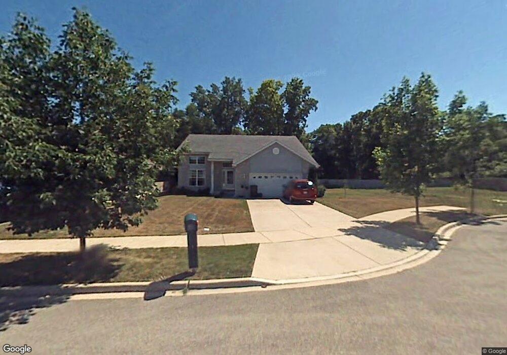
1326 Anthony Ct Waukegan, IL 60087
Estimated Value: $318,000 - $367,236
3
Beds
3
Baths
2,156
Sq Ft
$161/Sq Ft
Est. Value
About This Home
This home is located at 1326 Anthony Ct, Waukegan, IL 60087 and is currently estimated at $347,559, approximately $161 per square foot. 1326 Anthony Ct is a home located in Lake County with nearby schools including Oak Crest School, Beach Park Middle School, and Zion-Benton Township High School.
Ownership History
Date
Name
Owned For
Owner Type
Purchase Details
Closed on
Jan 13, 2024
Sold by
Pickens Jane M
Bought by
Declaration Of Trust and Pickens
Current Estimated Value
Purchase Details
Closed on
Jun 17, 2023
Sold by
Declaration Of Trust Of Charles L Picken and Declaration Of Trust Of Jane M Pickens
Bought by
Pickens Jane M
Purchase Details
Closed on
Jun 6, 2019
Sold by
Pickens Jane M and Pickens Charles L
Bought by
Picknes Charles L and Pickens Jane M
Purchase Details
Closed on
Aug 7, 2001
Sold by
Bank Of Waukegan
Bought by
Pickens Jane M
Home Financials for this Owner
Home Financials are based on the most recent Mortgage that was taken out on this home.
Original Mortgage
$180,000
Interest Rate
7.03%
Create a Home Valuation Report for This Property
The Home Valuation Report is an in-depth analysis detailing your home's value as well as a comparison with similar homes in the area
Home Values in the Area
Average Home Value in this Area
Purchase History
| Date | Buyer | Sale Price | Title Company |
|---|---|---|---|
| Declaration Of Trust | -- | None Listed On Document | |
| Pickens Jane M | -- | None Listed On Document | |
| Picknes Charles L | -- | None Available | |
| Pickens Jane M | $225,000 | -- |
Source: Public Records
Mortgage History
| Date | Status | Borrower | Loan Amount |
|---|---|---|---|
| Previous Owner | Pickens Jane M | $180,000 |
Source: Public Records
Tax History Compared to Growth
Tax History
| Year | Tax Paid | Tax Assessment Tax Assessment Total Assessment is a certain percentage of the fair market value that is determined by local assessors to be the total taxable value of land and additions on the property. | Land | Improvement |
|---|---|---|---|---|
| 2024 | $10,078 | $100,813 | $6,059 | $94,754 |
| 2023 | $10,159 | $88,383 | $5,849 | $82,534 |
| 2022 | $10,159 | $85,363 | $5,714 | $79,649 |
| 2021 | $10,485 | $83,192 | $5,569 | $77,623 |
| 2020 | $10,303 | $79,389 | $5,314 | $74,075 |
| 2019 | $10,287 | $75,322 | $5,042 | $70,280 |
| 2018 | $9,469 | $67,731 | $6,009 | $61,722 |
| 2017 | $9,363 | $63,717 | $5,653 | $58,064 |
| 2016 | $9,149 | $60,660 | $5,382 | $55,278 |
| 2015 | $8,314 | $55,631 | $4,936 | $50,695 |
| 2014 | $7,605 | $53,661 | $12,824 | $40,837 |
| 2012 | $7,650 | $55,763 | $13,326 | $42,437 |
Source: Public Records
Map
Nearby Homes
- 1342 Anthony Ct
- 3810 Cedar Ave
- 1113 Tewes Ln
- 38169 N North Shore Ave
- 10867 W Beach Rd
- 38362 N Manor Ave
- 38697 N Cedar Ave
- 38119 N Wilson Ave
- 1730 W Beach Rd
- 38383 N Tewes Ct
- 37966 N Cornell Rd
- 37905 N Loyola Ave
- 11471 W Leland Ave
- 11345 W Carnahan Ave
- 11342-11364 W Wadsworth Rd
- 1636 Rice St
- 10038 W Beach Rd
- 10160 W Fairbanks Ave
- 10241 W Bairstow Ave
- 38842-60 Sheridan Rd
- 1330 Anthony Ct
- 1322 Anthony Ct
- 1334 Anthony Ct
- 1318 Anthony Ct
- 3661 N De Woody Rd
- 1327 Anthony Ct
- 1331 Anthony Ct
- 1314 Anthony Ct
- 1338 Anthony Ct
- 1310 Anthony Ct
- 3657 N De Woody Rd
- 1342 Anthony Ct
- 1306 Anthony Ct
- 1375 Anthony Ct
- 1346 Anthony Ct
- 1371 Anthony Ct
- 1350 Anthony Ct
- 3653 N De Woody Rd
- 1302 Anthony Ct
- 1354 Anthony Ct