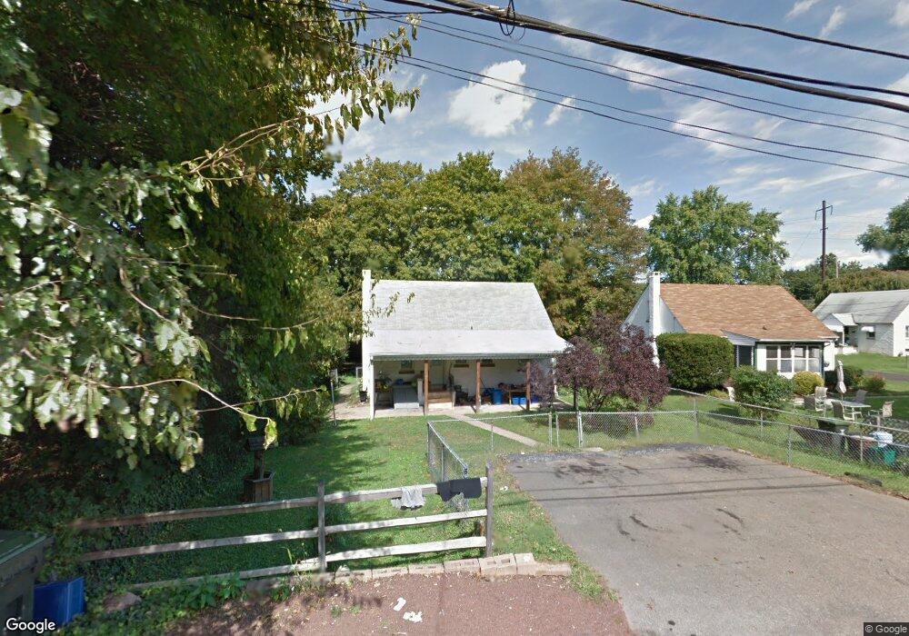
1326 E Harmony St Coatesville, PA 19320
Estimated Value: $258,658 - $304,000
2
Beds
1
Bath
990
Sq Ft
$278/Sq Ft
Est. Value
About This Home
This home is located at 1326 E Harmony St, Coatesville, PA 19320 and is currently estimated at $275,415, approximately $278 per square foot. 1326 E Harmony St is a home located in Chester County with nearby schools including Caln Elementary School, Coatesville Intermediate High School, and Coatesville Area Senior High School.
Ownership History
Date
Name
Owned For
Owner Type
Purchase Details
Closed on
Apr 29, 2005
Sold by
Desantis Philip J and Desantis Patricia
Bought by
Leon Juan and Leon Floripes
Current Estimated Value
Home Financials for this Owner
Home Financials are based on the most recent Mortgage that was taken out on this home.
Original Mortgage
$114,400
Outstanding Balance
$60,452
Interest Rate
6.05%
Mortgage Type
Fannie Mae Freddie Mac
Estimated Equity
$214,963
Purchase Details
Closed on
Apr 21, 2000
Sold by
Hoxter Richard and Hoxter Jean L
Bought by
Desantis Philip J and Desantis Patricia
Home Financials for this Owner
Home Financials are based on the most recent Mortgage that was taken out on this home.
Original Mortgage
$96,300
Interest Rate
8.23%
Purchase Details
Closed on
Mar 5, 1999
Sold by
Woodruff Craig P and Transamerica Consumer Discount
Bought by
Fairbanks Capital Corp
Create a Home Valuation Report for This Property
The Home Valuation Report is an in-depth analysis detailing your home's value as well as a comparison with similar homes in the area
Home Values in the Area
Average Home Value in this Area
Purchase History
| Date | Buyer | Sale Price | Title Company |
|---|---|---|---|
| Leon Juan | $143,000 | -- | |
| Desantis Philip J | $107,000 | Fidelity National Title Ins | |
| Fairbanks Capital Corp | -- | -- |
Source: Public Records
Mortgage History
| Date | Status | Borrower | Loan Amount |
|---|---|---|---|
| Open | Leon Juan | $114,400 | |
| Previous Owner | Desantis Philip J | $96,300 |
Source: Public Records
Tax History Compared to Growth
Tax History
| Year | Tax Paid | Tax Assessment Tax Assessment Total Assessment is a certain percentage of the fair market value that is determined by local assessors to be the total taxable value of land and additions on the property. | Land | Improvement |
|---|---|---|---|---|
| 2025 | $4,017 | $77,280 | $25,860 | $51,420 |
| 2024 | $4,017 | $77,280 | $25,860 | $51,420 |
| 2023 | $3,933 | $77,280 | $25,860 | $51,420 |
| 2022 | $3,735 | $77,280 | $25,860 | $51,420 |
| 2021 | $3,618 | $77,280 | $25,860 | $51,420 |
| 2020 | $3,557 | $77,280 | $25,860 | $51,420 |
| 2019 | $3,492 | $77,280 | $25,860 | $51,420 |
| 2018 | $3,303 | $77,280 | $25,860 | $51,420 |
| 2017 | $3,191 | $77,280 | $25,860 | $51,420 |
| 2016 | $2,337 | $77,280 | $25,860 | $51,420 |
| 2015 | $2,337 | $77,280 | $25,860 | $51,420 |
| 2014 | $2,337 | $77,280 | $25,860 | $51,420 |
Source: Public Records
Map
Nearby Homes
- 1263 E Diamond St
- 901 Merchant St Unit 60
- 826 Stirling St
- 824 Stirling St
- 1050 Wayne Ave
- 214 Andrew Rd
- 420 Glendale Ave
- 69 Palmer Ave
- 499 Prospect Ave
- 298 N Chester Ave
- 124 Chester Ave
- 209 Kendig Ln
- 440 Oak St
- 131 Pennsylvania Ave
- 622 Walnut St
- 215 Kennedy Dr
- 213 Kennedy Dr
- 65 Lukens Mill Dr Unit 154
- 111 Lukens Mill Dr Unit 50
- 284 Derby Dr
- 1328 E Harmony St
- 1322 E Lincoln Hwy
- 3 S 14th Ave
- 1 S 14th Ave
- 1399 Olive St
- 1339 Olive St
- 1320 E Lincoln Hwy
- 1337 Olive St
- 1404 Harmony St
- 1333 Olive St
- 1404 Harmony St
- 1401 Olive St
- 1406 Harmony St
- 1329 Olive St
- 1403 Olive St
- 1316 E Lincoln Hwy
- 1408 Harmony St
- 1405 Olive St
- 1315 E Lincoln Hwy
- 1321 Olive St