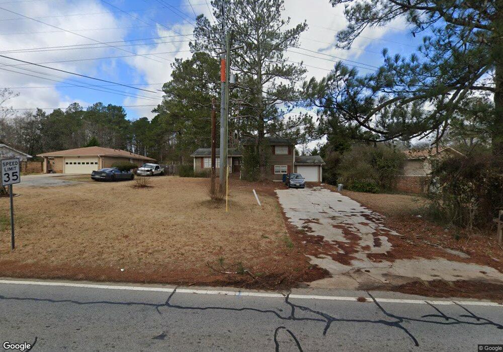
1326 Milstead Ave NE Conyers, AZ 30012
Estimated Value: $258,431 - $288,000
3
Beds
3
Baths
1,910
Sq Ft
$144/Sq Ft
Est. Value
About This Home
This home is located at 1326 Milstead Ave NE, Conyers, AZ 30012 and is currently estimated at $274,358, approximately $143 per square foot. 1326 Milstead Ave NE is a home located in Rockdale County with nearby schools including Pine Street Elementary School, Conyers Middle School, and Rockdale County High School.
Ownership History
Date
Name
Owned For
Owner Type
Purchase Details
Closed on
Jun 2, 2015
Sold by
Freo Georgia Llc
Bought by
Progress Residential 2015 2 Borrower Llc
Current Estimated Value
Purchase Details
Closed on
Dec 20, 2012
Sold by
Bulldog Capital Partners L
Bought by
Freo Georgia Llc
Purchase Details
Closed on
May 1, 2012
Sold by
Eddleman Felice J
Bought by
Bulldog Capital Partners Llc
Purchase Details
Closed on
Dec 30, 1999
Sold by
Eddleman Alan L
Bought by
Eddleman Felice J
Purchase Details
Closed on
May 15, 1998
Sold by
Denny Phillip N and Denny Nancy L
Bought by
Eddleman Alan L and Eddleman Felice J
Home Financials for this Owner
Home Financials are based on the most recent Mortgage that was taken out on this home.
Original Mortgage
$107,362
Interest Rate
7.15%
Mortgage Type
FHA
Create a Home Valuation Report for This Property
The Home Valuation Report is an in-depth analysis detailing your home's value as well as a comparison with similar homes in the area
Home Values in the Area
Average Home Value in this Area
Purchase History
| Date | Buyer | Sale Price | Title Company |
|---|---|---|---|
| Progress Residential 2015 2 Borrower Llc | -- | -- | |
| Freo Georgia Llc | $80,156 | -- | |
| Bulldog Capital Partners Llc | $28,001 | -- | |
| Eddleman Felice J | -- | -- | |
| Eddleman Alan L | $110,000 | -- |
Source: Public Records
Mortgage History
| Date | Status | Borrower | Loan Amount |
|---|---|---|---|
| Previous Owner | Eddleman Alan L | $107,362 |
Source: Public Records
Tax History Compared to Growth
Tax History
| Year | Tax Paid | Tax Assessment Tax Assessment Total Assessment is a certain percentage of the fair market value that is determined by local assessors to be the total taxable value of land and additions on the property. | Land | Improvement |
|---|---|---|---|---|
| 2024 | $3,691 | $92,440 | $37,080 | $55,360 |
| 2023 | $2,811 | $67,960 | $22,600 | $45,360 |
| 2022 | $2,714 | $65,520 | $22,600 | $42,920 |
| 2021 | $2,006 | $48,320 | $13,560 | $34,760 |
| 2020 | $2,059 | $48,320 | $13,560 | $34,760 |
| 2019 | $2,482 | $55,280 | $13,560 | $41,720 |
| 2018 | $1,962 | $43,520 | $10,440 | $33,080 |
| 2017 | $1,786 | $39,240 | $10,440 | $28,800 |
| 2016 | $1,300 | $28,560 | $6,040 | $22,520 |
| 2015 | $1,301 | $28,560 | $6,040 | $22,520 |
| 2014 | $1,227 | $26,640 | $4,120 | $22,520 |
| 2013 | -- | $37,120 | $11,400 | $25,720 |
Source: Public Records
Map
Nearby Homes
- 1312 Milstead Ave NE
- 584 Oak Ct NW
- 1190 Brookside Dr NE
- 1268 Woodland Rd NE
- 1210 Brookside Dr NE
- 121 Wellbrook Ct NE Unit 11
- 126 Wellbrook Ct NE Unit 44
- 00 Hicks Cir N
- 1186 Eastview Rd NE
- 1458 Northside Dr NW
- 1080 Eastview Rd NE
- 1064 Eastview Rd NE
- 0 N Hicks Cir NW Unit 10558065
- 1098 Eastview Cir NE
- 1436 N Hicks Cir NW
- 1349 Springwood Dr NW
- 1421 S Hicks Cir NW
- 1326 Milstead Ave NE
- 1326 Milstead Ave NE
- 1322 Milstead Ave NE
- 1330 Old Milstead Rd NW
- 1358 Latta Dr NW
- 1338 Old Milstead Rd NW
- 1368 Latta Dr NW
- 1325 Milstead Ave NE
- 1378 Latta Dr NW
- 1349 Latta Dr NW
- 1305 Milstead Ave NE Unit B
- 1311 Milstead Ave NE
- 1359 Latta Dr NW
- 1313 Milstead Ave NE
- 1369 Latta Dr NW
- 1315 Milstead Ave NE
- 1394 Latta Dr NW
- 1379 Latta Dr NW
- 1302 Milstead Ave NE
- 0 Old Milstead Rd Unit 7176093