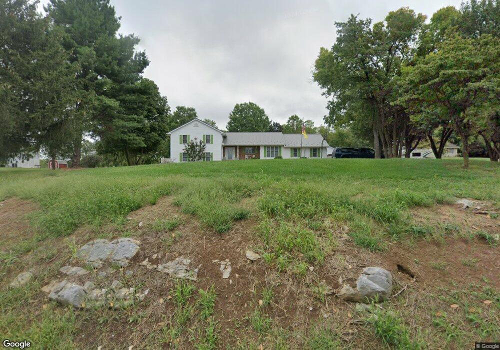
13260 Gearhart Rd Greencastle, PA 17225
Estimated Value: $411,000 - $518,360
--
Bed
1
Bath
2,112
Sq Ft
$215/Sq Ft
Est. Value
About This Home
This home is located at 13260 Gearhart Rd, Greencastle, PA 17225 and is currently estimated at $455,090, approximately $215 per square foot. 13260 Gearhart Rd is a home located in Franklin County with nearby schools including Greencastle-Antrim Primary School, Greencastle-Antrim Elementary School, and Greencastle-Antrim Middle School.
Ownership History
Date
Name
Owned For
Owner Type
Purchase Details
Closed on
Nov 12, 2015
Sold by
Webb Wayne A and Webb Rae A
Bought by
Cline David W and Cline Deborah J
Current Estimated Value
Home Financials for this Owner
Home Financials are based on the most recent Mortgage that was taken out on this home.
Original Mortgage
$221,600
Outstanding Balance
$174,771
Interest Rate
3.87%
Mortgage Type
New Conventional
Estimated Equity
$280,319
Purchase Details
Closed on
Sep 28, 2009
Sold by
Rock Cheryl K and Rock Randal R
Bought by
Webb Wayne A and Webb Rae A
Home Financials for this Owner
Home Financials are based on the most recent Mortgage that was taken out on this home.
Original Mortgage
$381,000
Interest Rate
5.14%
Mortgage Type
Purchase Money Mortgage
Create a Home Valuation Report for This Property
The Home Valuation Report is an in-depth analysis detailing your home's value as well as a comparison with similar homes in the area
Home Values in the Area
Average Home Value in this Area
Purchase History
| Date | Buyer | Sale Price | Title Company |
|---|---|---|---|
| Cline David W | $277,000 | Attorney | |
| Webb Wayne A | $250,000 | None Available |
Source: Public Records
Mortgage History
| Date | Status | Borrower | Loan Amount |
|---|---|---|---|
| Open | Cline David W | $221,600 | |
| Previous Owner | Webb Wayne A | $381,000 |
Source: Public Records
Tax History Compared to Growth
Tax History
| Year | Tax Paid | Tax Assessment Tax Assessment Total Assessment is a certain percentage of the fair market value that is determined by local assessors to be the total taxable value of land and additions on the property. | Land | Improvement |
|---|---|---|---|---|
| 2025 | $4,677 | $27,960 | $1,180 | $26,780 |
| 2024 | $4,243 | $27,960 | $1,180 | $26,780 |
| 2023 | $4,193 | $27,960 | $1,180 | $26,780 |
| 2022 | $4,193 | $27,960 | $1,180 | $26,780 |
| 2021 | $4,112 | $27,960 | $1,180 | $26,780 |
| 2020 | $4,005 | $27,960 | $1,180 | $26,780 |
| 2019 | $3,914 | $27,960 | $1,180 | $26,780 |
| 2018 | $3,872 | $27,960 | $1,180 | $26,780 |
| 2017 | $3,774 | $27,960 | $1,180 | $26,780 |
| 2016 | $801 | $27,960 | $1,180 | $26,780 |
| 2015 | $702 | $26,280 | $1,180 | $25,100 |
| 2014 | $702 | $26,280 | $1,180 | $25,100 |
Source: Public Records
Map
Nearby Homes
- 1631 Buchanan Trail E
- 1033 Dianne Dr
- 1031 Dianne Dr
- 823 Buchanan Trail E
- 15365 Wingerton Rd
- 0 Molly Pitcher Hwy Unit PAFL178468
- 0 Molly Pitcher Hwy Unit PAFL2030380
- 0 Molly Pitcher Hwy Unit PAFL178444
- 1284 State Line Rd
- 431 Leitersburg St
- 674 Lohman Ave
- 775 Lohman Ave
- 14732 Cedarbrook Dr
- 14501 Molly Pitcher Hwy
- 14799 Cedarbrook Dr
- 226 Milnor Rd
- 15621 Oak Rd
- 34.77 Acres Red Oak Estate S
- 602 Brookview Dr
- 271 E Baltimore St
- 13272 Gearhart Rd
- 13246 Gearhart Rd
- 13284 Gearhart Rd
- 13240 Gearhart Rd
- 13296 Gearhart Rd
- 13218 Gearhart Rd
- 13308 Gearhart Rd
- 13204 Gearhart Rd
- 13320 Gearhart Rd
- 13190 Gearhart Rd
- 1697 Mcdowell Rd
- 1665 Mcdowell Rd
- 1655 Mcdowell Rd
- 1739 Mcdowell Rd
- 1819 Mcdowell Rd
- 1786 Mcdowell Rd
- 13162 Gearhart Rd
- 1781 Mcdowell Rd
- 12992 Gearhart Rd
- 1823 Mcdowell Rd