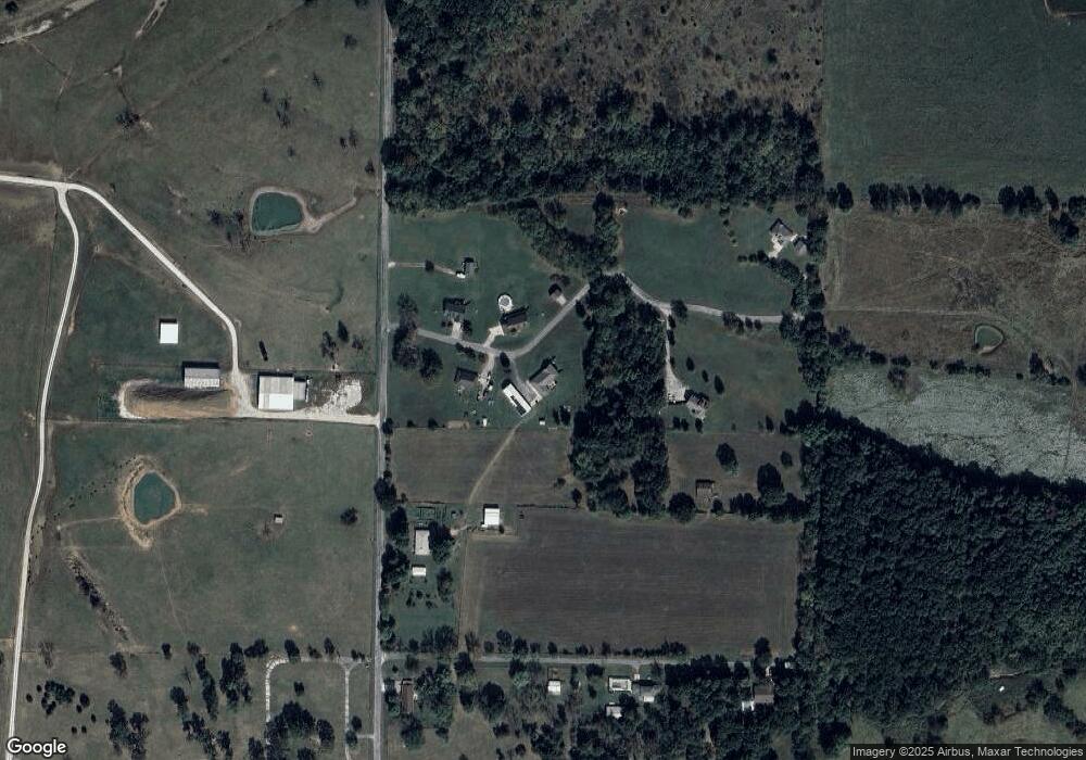
13263 Lawrence 2087 Mount Vernon, MO 65712
Estimated Value: $357,000 - $626,000
5
Beds
4
Baths
3,955
Sq Ft
$119/Sq Ft
Est. Value
About This Home
This home is located at 13263 Lawrence 2087, Mount Vernon, MO 65712 and is currently estimated at $468,675, approximately $118 per square foot. 13263 Lawrence 2087 is a home located in Lawrence County with nearby schools including Mt. Vernon Elementary School, Mt. Vernon Intermediate School, and Mt. Vernon Middle School.
Ownership History
Date
Name
Owned For
Owner Type
Purchase Details
Closed on
Feb 16, 2009
Sold by
Ozark Mountain Petroleum Inc
Bought by
Sullivan James P and Sullivan Jamie L
Current Estimated Value
Home Financials for this Owner
Home Financials are based on the most recent Mortgage that was taken out on this home.
Original Mortgage
$218,000
Interest Rate
4.91%
Purchase Details
Closed on
Feb 12, 2009
Sold by
Korte Michael J and Korte Gari L
Bought by
Sullivan James P and Sullivan Jamie L
Home Financials for this Owner
Home Financials are based on the most recent Mortgage that was taken out on this home.
Original Mortgage
$218,000
Interest Rate
4.91%
Create a Home Valuation Report for This Property
The Home Valuation Report is an in-depth analysis detailing your home's value as well as a comparison with similar homes in the area
Home Values in the Area
Average Home Value in this Area
Purchase History
| Date | Buyer | Sale Price | Title Company |
|---|---|---|---|
| Sullivan James P | $19,700 | -- | |
| Sullivan James P | $19,700 | Ttp | |
| Sullivan James P | -- | -- | |
| Sullivan James P | -- | None Available |
Source: Public Records
Mortgage History
| Date | Status | Borrower | Loan Amount |
|---|---|---|---|
| Closed | Sullivan James P | $218,000 | |
| Closed | Sullivan James P | $218,000 |
Source: Public Records
Tax History Compared to Growth
Tax History
| Year | Tax Paid | Tax Assessment Tax Assessment Total Assessment is a certain percentage of the fair market value that is determined by local assessors to be the total taxable value of land and additions on the property. | Land | Improvement |
|---|---|---|---|---|
| 2025 | $2,221 | $49,360 | $2,510 | $46,850 |
| 2024 | $2,221 | $44,750 | $2,510 | $42,240 |
| 2023 | $2,212 | $44,750 | $2,510 | $42,240 |
| 2022 | $2,060 | $41,670 | $2,510 | $39,160 |
| 2021 | $2,051 | $41,440 | $2,280 | $39,160 |
| 2020 | $2,065 | $41,440 | $2,280 | $39,160 |
| 2019 | $1,892 | $41,440 | $2,280 | $39,160 |
| 2018 | $1,890 | $41,440 | $2,280 | $39,160 |
| 2017 | $1,753 | $41,440 | $2,280 | $39,160 |
| 2016 | -- | $37,600 | $2,280 | $35,320 |
| 2015 | -- | $37,600 | $2,280 | $35,320 |
| 2014 | -- | $37,600 | $2,280 | $35,320 |
Source: Public Records
Map
Nearby Homes
- 14198 Lawrence 2090
- 000 Lawrence 2100
- 9856 Lawrence 1119
- 434 Todd Ln
- 836 Tracy Ln
- 9815 Lawrence 1112
- 610 N Main St
- 10858 Lawrence 1162
- 1352 Deer Ln
- 000 State Highway 39
- 8390 Lawrence 1105
- Lot 6 Fox Haven Dr
- Lot 10 Fox Haven Dr
- Lot 5 Fox Haven Dr
- Lot 7 Fox Haven Dr
- Lot 14 Fox Haven Dr
- Lot 11 Fox Haven Dr
- 423 E Center St
- 300 S Vine St
- 212 W South St
- 13282 Lawrence 2087
- 13247 Lawrence 2087
- 13230 Lawrence 2087
- 13319 Lawrence 2087
- 13326 Lawrence 2087
- 9156 Lawrence 1132
- 9132 Lawrence 1132
- 9135 Lawrence 1132
- 11537 Lawrence 2089
- 11498 Lawrence 2091
- 9407 Lawrence 1132
- 11486 Lawrence 2091
- 0 Rolling Hills Unit 10907634
- 0 Rolling Hills Unit 10907638
- 0 Rolling Hills Unit 11112487
- 0 Rolling Hills Unit 11112486
- L 3 Rolling Hills
- L 2 Rolling Hills
- 11471 Lawrence 2091
- 9417 Lawrence 1132
